OUTLET (POMONA LAKE), KS Campground Reservation, Info, Images, Map, Directions

OUTLET (POMONA LAKE), Kansas Campground Images, Info & Reservations

Directions

From US 75 and K-268 junction, proceed east on K-268 for 7 miles, turn north on Pomona Dam Road and proceed 1/2-mile to 229th Street (just before dam). Turn east and proceed to park entrance.

Phone

785-453-2201

Activities

CAMPING

Keywords

OUT2,LAKE POMONA,OUTLET Pomona Lake,POMONA LAKE

Related Link(s)

Rec Area Info & Images

Kansas State Tourism

Kansas State Road Conditions

Overview

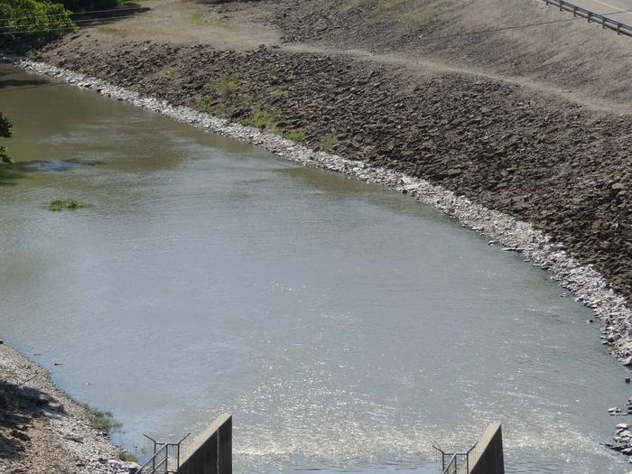
Outlet Campground is located along 110 Mile Creek in eastern Kansas at Pomona Lake. The scenic park appeals to family campers, sportsmen and water sport enthusiasts. The reservoir covers 4,000 acres and offers excellent fishing and boating opportunities.

Recreation

Fishing, boating, picnicking, and hunting are favorite activities on and around Pomona Lake. The lake’s fish and wildlife resources provide ample opportunities for sportsmen and women.

Three nearby trails meander around Pomona Lake, providing visitors with hiking and nature study opportunities. Deer Creek Nature Trail and Witches’ Broom Trail are short trails for hikers. The Black Hawk Trail offers a 33 mile loop with several trailheads and is a popular hiking, horseback riding and mountain biking path.

Facilities

Outlet Campground offers 34 campsites and two group day-use picnic shelters, all of which have electric and water hookups. Other amenities include flush and vault toilets, a shower building, playground, nature trail, dump station, laundry facilities and a boat ramp.

The local sheriff’s department and Corps of Engineers rangers patrol the park during the recreation season.

A visitor center is located a short distance from the park and provides educational displays about the lake and its environment.

Natural Features

Pomona Lake is situated among the rolling hills, mixed grasslands, croplands and forests of eastern Kansas. Wildlife and numerous species of birds can be observed at this secluded, heavily shaded campground. Bald eagles, white-tailed deer, Canada geese, wild turkey, crappie, walleye, channel catfish and other wildlife can be found here.

Nearby Attractions

Numerous parks lie on the banks of Pomona Lake, offering additional boating, fishing, swimming, hunting and hiking opportunities.

The town of Lyndon, Kansas is less than 10 miles away, with limited restaurants and shops. This small town is home to 22 historical sites and the smallest Carnegie library still in use.

Reservation

More from CampingHiking.net:

SOUTHSHORE AT DETROIT LAKE, Oregon Campground Images, Info & Reservations

Directions From Detroit, Oregon, travel east on State Highway 22 for 2.7 miles to Blowout Road/Forest Service Road 10. From Idanha, Oregon, travel west on State Highway 22 for 0.7 miles to Blowout Road/Forest Service Road 10. Proceed on Blowout Road 4.7 miles to Southshore Campground on the right. Phone

PINE CREEK COVE, Oklahoma Campground Images, Info & Reservations

Directions From Valliant, OK, travel Pine Creek Road 7 miles north to the access road. Follow signs into the campground. Phone 580-933-4215 Activities BOATING, CAMPING, FISHING, PICNICKING, DAY USE AREA, SWIMMING SITE, SWIMMING, WATER ACCESS Keywords PICR,PINE CREEK LAKE,PINE CREEK LAKE Related Link(s) Rec Area Info & Images Oklahoma State

DAM WEST SPILLWAY, Illinois Campground Images, Info & Reservations

Directions From I-70, take State Route 127 south to Carlyle and turn east on William Road. Continue for 1/2-mile to Lake Road and turn south, following signs to the park. Phone 618-594-5253 Activities BOATING, CAMPING, FISHING Keywords DAWS,CARLYLE LAKE Related Link(s) Rec Area Info & Images Illinois State Tourism Illinois

LOLETA RECREATION, Pennsylvania Campground Images, Info & Reservations

Directions From the west, take I-80 east to Clarion, Pennsylvania. Turn left onto State Route 66 and continue northeast to Marienville. Turn right on South Forest Street and go south 6 miles to the Loleta Campground entrance sign. From the north, take State Route 66 to Marienville, turn left on

Sand Flats Recreation Area, Utah Campground Images, Info & Reservations

Directions Directions from Your Location: The Entrance Station for the Sand Flats Recreation Area is located around 3000 Sand Flats Rd. We say “around” because there is no actual mailing address for the Entrance Station. Don’t worry though, we have detailed directions. From the South: If heading north on Highway

HOSPITAL FLAT, California Campground Images, Info & Reservations

Directions From Kernville, go 6.5 miles north on Sierra Way (Mountain 99) to the campground. Phone 760-376-1815 Activities BOATING, CAMPING, FISHING, SWIMMING SITE Keywords HOSP,KERN RIVER,UPPER KERN CANYON,SEQUOIA NF – FS Related Link(s) Rec Area Info & Images California State Tourism Forest Service Concessionaire California State Road Conditions Overview Hospital