ROCKY POINT (FT GIBSON), OK Campground Reservation, Info, Images, Map, Directions

ROCKY POINT (FT GIBSON), Oklahoma Campground Images, Info & Reservations

Listen

Directions

From Wagoner, Oklahoma: travel 4.5 miles north on Highway 69. Turn right at stoplight on East 690 Road. Travel 3 miles east. Turn left on South 320 Road and travel north for 3/4 mile to park entrance.

Phone

918-462-2042 OR 918-682-4314

Activities

BOATING, CAMPING, FISHING, HUNTING, SWIMMING SITE

Keywords

ROCY,FORT GIBSON LAKE,ROCKY POINT FT GIBSON,FORT GIBSON LAKE

Related Link(s)

Rec Area Info & Images

Oklahoma State Road Conditions

Oklahoma State Tourism

Overview

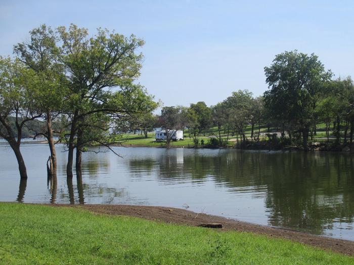
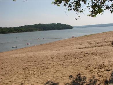
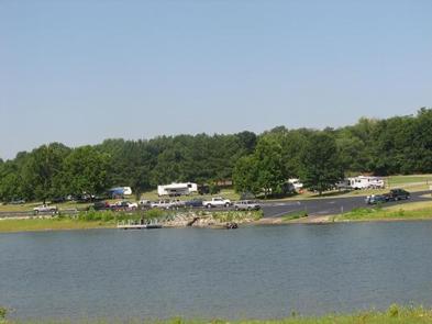
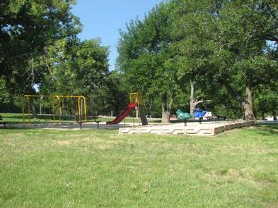
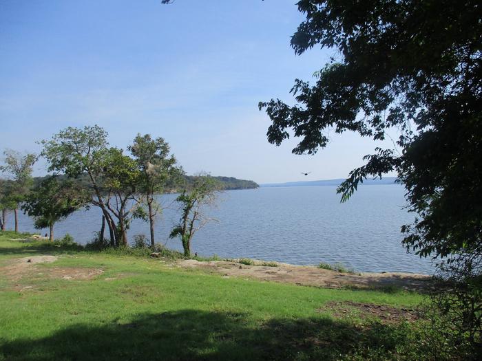
Rocky Point is located on the upper end of Fort Gibson Lake where Flat Rock Creek meets the main channel. This year-round campground offers a sandy swim beach, playground equipment and one of the best boat ramps on Fort Gibson Lake. Rocky Point Store is conveniently located direcly outside the park gates for sandwiches, pizza, ice and fuel. The store also maintains a small inventory of grocery and camping items.

Recreation

The nearly 20,000-acre lake offers excellent boating and swimming opportunities.

Anglers enjoy fishing for black bass, white bass, crappie and several varieties of catfish and panfish.

The lake’s 225 miles of shoreline are home to thousands of acres of public hunting lands, where white-tailed deer, bobwhite quail, mourning dove, duck, geese, cottontail rabbit and squirrel roam.

Facilities

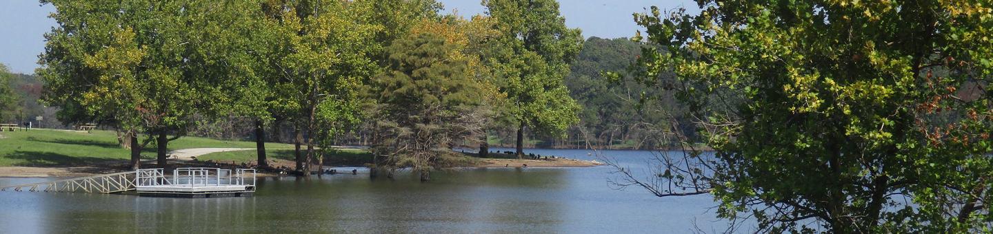
This year-round campground offers 59 campsites and one group day-use picnic shelter, all with electric hookups. An additional 3 campsites with canopies and no hookups are available on a first come – first serve basis. Rocky Point is unique on Fort Gibson Lake by offering a designated swim beach within the park. Additional amenities include drinking water, flush and pit toilets, showers, 2 dump stations, 3 boat ramps and a courtesy dock.

Natural Features

Rocky Point offers steep rocky bluffs on the eastern edge of the park and thick wooded timber of the western edge. A cove between the two sides offers boaters a calm location to moor boats.

Nearby Attractions

Historic Fort Gibson, established in 1824, served as an important military post on the western frontier for close to 70 years. Now a National Historical Landmark, the site is open to the public year round.

Volunteers reenact the lifestyle of the late 1800s during various events held throughout the year. A reconstructed log stockade, and original barracks, hospital, bakehouse and other structures still stand today.

Reservation

More from CampingHiking.net:

CABIN CREEK CABIN, Montana Campground Images, Info & Reservations

Listen Directions Summer access from West Yellowstone: Take U.S. Highway 287 to Forest Service Road 681, Red Canyon Rd, then to the Red Canyon Trailhead. Foloow Trail #205 approximatley 5 miles to Cabin Creek Trail, then 1 mile via hike, horse, mountain bike, or motorcylce to the cabin. Note: ATVs

MOUNT PRINCETON, Colorado Campground Images, Info & Reservations

Listen Directions From Buena Vista, Colorado, take Highway 285 south to Nathrop. Turn west on County Road 162 and travel 7 miles to the campground. Phone CAMPGROUNDS DO NOT HAVE PHONE SERVICE, CALLING TO CHECK AVAILABILITY PRIOR TO ARRIVAL IS NOT POSSIBLE. FOR RESERVATIONS CALL: 1-877-444-6777 Activities HISTORIC & CULTURAL

PEOPLES CREEK, Missouri Campground Images, Info & Reservations

Listen Directions From St. Louis: take I-55 South to Highway 67. Head south to D Highway. Take D Highway South for about 15 miles and look for signs. From Poplar Bluff: Take Hwy 60 East to Highway T. Then take Highway T North and look for signs. Phone 573-222-8234 Activities

TYEE CAMPGROUND (UMPQUA RIVER), Oregon Campground Images, Info & Reservations

Listen Directions From I-5 in Sutherlin, head west 12 miles on Highway 138. Turn left and cross over Bullock Bridge and immediately turn right only Country Road 57 (Bullock Road). Travel .5 miles to the campground. Phone 541-440-4930 Activities CAMPING, FISHING Keywords Related Link(s) Rec Area Info & Images Oregon

WILLIS KNOB HORSE CAMP, Georgia Campground Images, Info & Reservations

Listen Directions From Clayton, Georgia, take Warwoman Road east for about 12 miles. Turn right on Forest Service Road 157 and continue for 2 miles to the campground on the left. Phone 706-754-6221 Activities CAMPING, HORSEBACK RIDING, HUNTING, WILDLIFE VIEWING, HORSE CAMPING Keywords KNOB,CHATTAHOOCHEE-OCONEE NF – FS,HORSE CAMP Related Link(s)

PINE POINT, Oregon Campground Images, Info & Reservations

Listen Directions From Sandy, Oregon, travel east on Highway 26 for approximately 40 miles to Skyline Road/Road 42. Turn right on Skyline Road and continue south for about 9 miles. Turn right on Forest Service Road 57 and travel west for 3 miles, then turn right again at the Pine