EAST TWIN, WI Campground Reservation, Info, Images, Map, Directions

EAST TWIN, Wisconsin Campground Images, Info & Reservations

Directions

Drive 4 miles north from Clam Lake on County Highway GG. Turn right (east) on Forest Road 190 and continue for about one mile to the campground.

Phone

(715) 634-4821 OR (715) 264-2511

Activities

BIKING, BOATING, CAMPING, FISHING, HIKING

Keywords

EATW,CHEQUAMEGON-NICOLET NF – FS

Related Link(s)

Rec Area Info & Images

Overview

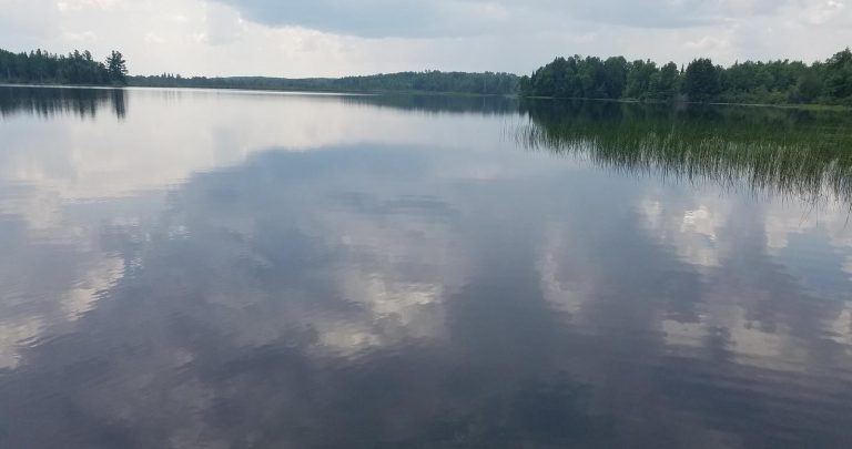
Located on a sparkling 110-acre lake, the East Twin Campground is a known family favorite. The area provides access to a beautiful portion of the Chequamegon National Forest in northwestern Wisconsin.

Recreation

A variety of recreational activities are available, including fishing, boating and swimming on the adjacent lake. A boat ramp is located about a half-mile east of the campground, providing access to East Twin Lake and also features a walk-in portage to West Twin lake which is located just outside the campground. Largemouth bass and pan fish are akin to the body of water, as well as an occasional musky or other freshwater species.

Miles of hiking and mountain bike trails are located nearby and just down the road is an established Blue Heron rookery.

Facilities

The campground offers several single family campsites for tent and RV camping with many located on the lake. East Twin campground offers two tent walk-in sites for those looking for a somewhat more secluded camping experience. Each site is equipped with tables and campfire rings with grills. Accessible vault toilets and drinking water are provided. Trash collection and an aluminum can recycling bin are also available at the campground.

Natural Features

The campground is situated in a maple, birch and hemlock forest, with many sites overlooking the lake. A variety of birds and wildlife, including elk, eagles, loons, blue heron and other species, make their homes near the campground.

Nearby Attractions

The Dead Horse Run trailhead is located just five miles south on County Road GG.

Reservation

More from CampingHiking.net:

Sand Island Group Sites, Utah Campground Images, Info & Reservations

Directions Sand Island Campground is located on the north bank of the San Juan River about 3 miles west of Bluff, Utah, on the south side of Highway 191. Phone 435-587-1500 Activities HISTORIC & CULTURAL SITE, CAMPING, PICNICKING, PHOTOGRAPHY, PADDLING, WATER ACCESS, WHITEWATER RAFTING Keywords None Related Link(s) Rec Area

MATHER CAMPGROUND, Arizona Campground Images, Info & Reservations

Directions Mather Campground is located within the park in Grand Canyon Village on the South Rim. From the south entrance station, proceed for about three miles and turn left on Center Road. Travel 1/4 mile and turn right onto Market Plaza Road. The campground is about one mile down Market

CHEOAH POINT CAMPGROUND, North Carolina Campground Images, Info & Reservations

Directions From Robbinsville, North Carolina, continue on Highway 129 north for approximately 6 miles. Turn left on SR # 1145 – Thunderbird Mountain Road. Continue approximately 1.3 miles on Thunderbird Mountain Road to the Cheoah Point Campground. Phone 828-479-6431 Activities BOATING, CAMPING, FISHING, HIKING, SWIMMING, WATER ACTIVITIES, KAYAKING, CANOEING, NON-MOTORIZED

PHILIPSBURG BAY CAMPGROUND, Montana Campground Images, Info & Reservations

Directions The campground is located in southwestern Montana, about 11 miles south of Philipsburg. Follow U.S. Route 1 south and take a right on Georgetown Lake Road. The campground is on the left adjacent to the lake. Phone 406-210-8199 Activities BIKING, BOATING, CAMPING, FISHING, HIKING, HUNTING, WATER SPORTS, WILDLIFE VIEWING,

MOOSE LAKE CABIN, Montana Campground Images, Info & Reservations

Directions From Philipsburg, travel south on Highway 1 for about 7 miles to the junction with Skalkaho Highway/Highway 38. Turn right onto Highway 38 and continue west for about 9 miles and turn left onto Moose Lake Road/Forest Road 5106. Travel another 9 miles to the cabin. Winter weather conditions