MARSHALL PARK, CO Campground Reservation, Info, Images, Map, Directions

MARSHALL PARK, Colorado Campground Images, Info & Reservations

Listen

Directions

From Creede, Colorado, travel 7 miles west on Colorado Highway 149 to Forest Road 523. Take Forest Road 523 one mile to the campground entrance.

Phone

719-658-0829

Activities

BIKING, CAMPING, FISHING, HIKING

Keywords

MASH,RIO GRANDE NF- FS

Related Link(s)

Rec Area Info & Images

Colorado State Road Conditions

Colorado State Tourism

Overview

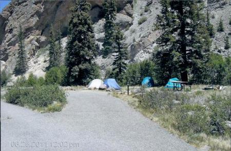
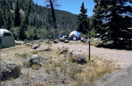
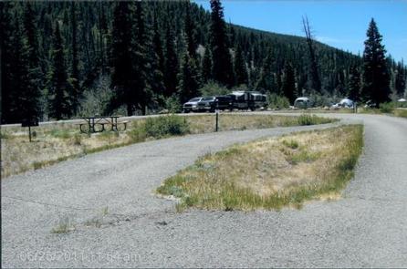
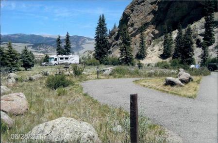
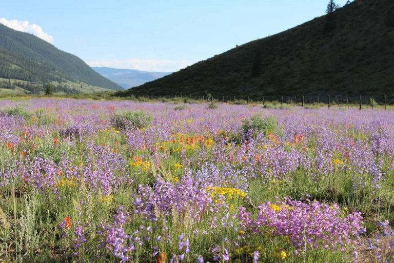
Marshall Park Campground is situated in an open meadow on the Rio Grande River with views of Bristol Head Peak and the La Garita Mountains. Campers enjoy trout fishing, boating and the area’s diverse wildlife. It also makes for a great base camp for hunters in the area.

Recreation

Anglers will find an abundance of rainbow trout in the Rio Grande, which is considered a trophy river. The river also welcomes wading and exploration. Off-road vehicle trails are nearby as well.

Facilities

Amenities include picnic tables and campfire rings. An accessible vault toilet with a night light is provided. Firewood may be purchased from the host. Campfire programs are presented periodically throughout the summer.

No drinking water is available. Campers must bring their own supply.

Natural Features

The campground is located about 7 miles southwest of Creed, Colorado at an elevation of 8,800 feet. Campsites are open with few trees. The sun hits the campground in the late morning, after cool early morning temperatures.

Rio Grande National Forest spans 1.86 million acres in south-central Colorado. The Continental Divide runs for 236 miles along most of the forest’s western border, presenting a myriad of ecosystems from alpine desert to rugged wilderness.

Nearby Attractions

Head east of Creed for off-road vehicle trails like the Lost Trail #821 that runs for 11 miles and offers wonderful views of the surrounding mountains.

Reservation

More from CampingHiking.net:

COLTON GUARD STATION, Utah Campground Images, Info & Reservations

Listen Directions Follow the mileage indications below and look for signs when traveling to Colton Guard Station. Leave with plenty of time to arrive at the guard station before dark. From Vernal, travel north on U.S. Highway 191/Vernal Avenue for approximately 20 miles. Turn left (west) on Forest Road 020.

GOOSEBERRY RESERVOIR, Utah Campground Images, Info & Reservations

Listen Directions From Fairview, Utah, travel north about a mile on Highway 89, to the junction with Highway 31. Travel east on Highway 31 for about nine miles, to the junction with Forest Development Road 124. Go north on Forest Development Raod 124 for three miles, to the campground. Phone

CASTLE BUTTE LOOKOUT, Idaho Campground Images, Info & Reservations

Listen Directions From Missoula, MT: Take US Highway 12 West for about 65 miles. All roads from this point are gravel or dirt and a vehicle with high clearance is suggested. Turn right onto Forest Service Road 108 (Waw’aalamnime Rd), go about .5 miles, turn left onto Forest Service Road

SAGEHEN CREEK, Idaho Campground Images, Info & Reservations

Listen Directions From Horseshoe Bend, Idaho take Highway 52 for 9 miles west to the junction with the Sweet/Ola Highway. Turn north and travel 16 miles to Ola, Idaho. Travel north through Ola and follow FS Rd 618, 18 miles to Sagehen Reservoir (FS Road 626). Turn right and continue

GRANITE BUTTE LOOKOUT, Montana Campground Images, Info & Reservations

Listen Directions The lookout is located approximately 16 miles southeast of Lincoln. It can be reached via Stemple Pass Road #601, which leaves downtown Lincoln at the blinking light and joins Highway 279 north of Helena. Follow Stemple Pass Road for approximately 14 miles to the top of the pass

TIONESTA REC. AREA CAMPGROUND, Pennsylvania Campground Images, Info & Reservations

Listen Directions From Tionesta, PA: Go 0.5 mile south on SR 36 and follow signs into the campground. Phone 814-755-3512 Activities BOATING, CAMPING, FISHING, HIKING, PICNICKING, WILDLIFE VIEWING, WILDERNESS, ENVIRONMENTAL EDUCATION, PHOTOGRAPHY, RANGER STATION, CANOEING, DISC GOLF, RECREATION PROGRAMS, SCENIC DRIVE Keywords TIONESTA DAM,TIONESTA LAKE,OUTFLOW CAMP LEFT BANK,TIONESTA OUTFLOW CAMPGROUND,TIONESTA