COVE LAKE RECREATION AREA, AR Campground Reservation, Info, Images, Map, Directions

COVE LAKE RECREATION AREA, Arkansas Campground Images, Info & Reservations

Listen

Directions

From Paris, take Highway 109 south, then turn southeast on Highway 309 for 9 miles.

Phone

479-963-6421

Activities

BIKING, BOATING, CAMPING, FISHING, HIKING, HUNTING, WATER SPORTS, WILDLIFE VIEWING, DAY USE AREA, SWIMMING SITE, OTHER RECREATION CONCESSION SITE

Keywords

COLA,COVE LAKE,COVE LAKE RECREATION,OZARK-SAINT FRANCIS NF – FS

Related Link(s)

Rec Area Info & Images

Arkansas State Road Conditions

Arkansas State Tourism

Overview

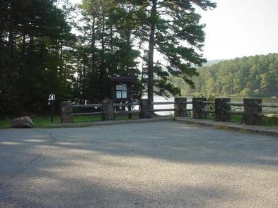
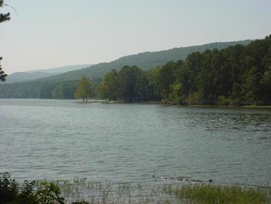
The Cove Lake Recreation Area is a perfect summer getaway and an ideal place to camp, picnic or recreate. It envelops the shores of a 160-acre mountain lake near the 2,700-foot-tall Mount Magazine, the highest point in the state of Arkansas.

Recreation

Popular activities include swimming, fishing, hiking, water skiing and scenic drives. A boat ramp is available and an on-site concessionaire provides boat rentals and other equipment available for purchase.

The lake is home to catfish, large mouth bass, bluegill, sunfish, crappie and perch. It is stocked every other year, although a small amount of catfish are stocked annually and just prior to a yearly kids’ fishing derby hosted at the lake.

Facilities

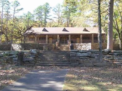
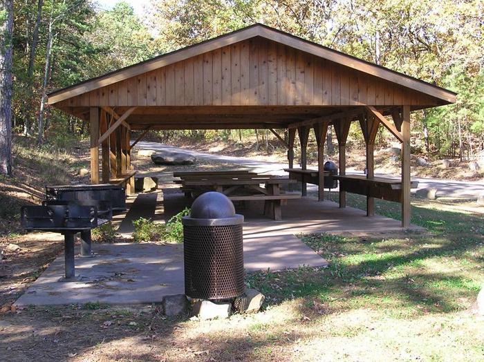
The recreation area provides picnic areas, campsites and a group shelter, as well as multiple activities, including miniature golf, canoe and paddleboat rentals. The campground offers multiple single-family sites for tent or RV camping.

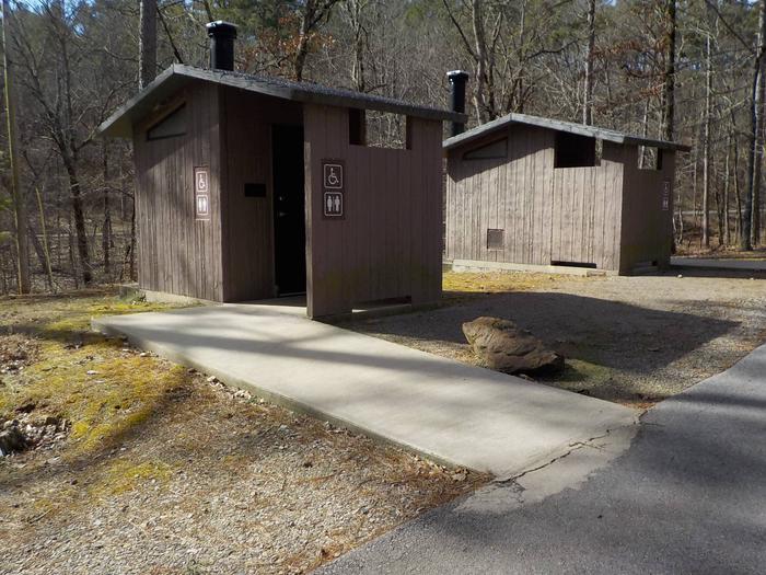
Each site is equipped with tables and campfire rings with grills. Accessible flush toilets, hot showers and drinking water are also provided. Multiple picnic areas are available on the lake shore, including a picnic shelter that has electricity.

Natural Features

The recreation area is situated in a mixed forest of mature trees and is located in the Arkansas River Valley in the Ozark National Forest.

Nearby Attractions

The recreation area is about 15 miles south of the town of Paris, in Logan County, Arkansas. A scenic route to the top of Mount Magazine is a beautiful 10 mile drive north from Havana, Arkansas.

Reservation

More from CampingHiking.net:

WASHUNGA BAY, Oklahoma Campground Images, Info & Reservations

Listen Directions From Kaw City, Oklahoma, travel nearly 3 miles east on Highway 11, turn north onto County Road. Follow signs for about 5 miles to the campground. Phone 580-762-5611 Activities BOATING, CAMPING, FISHING, WILDLIFE VIEWING Keywords WABA,KAW LAKE,KAW LAKE Related Link(s) Rec Area Info & Images Oklahoma State Road

RUSSIAN RIVER, Alaska Campground Images, Info & Reservations

Listen Directions From Anchorage, Alaska, travel south for 110 miles to Milepost 54 on the Sterling Highway, Alaska State Highway 1. Phone (907)288-7756 Activities BIKING, CAMPING, FISHING, HIKING Keywords RUSR,CHUGACH NF – FS Related Link(s) Rec Area Info & Images Alaska State Tourism Alaska State Road Conditions Forest Service Concessionaire

PICNIC POINT (ID), Idaho Campground Images, Info & Reservations

Listen Directions From Cascade, turn east on Warm Lake Highway. Travel approximately 26 miles along the paved road to Forest Road 489 and turn south. Continue about a half-mile past the Shoreline Campground and North Shore Lodge. The campground will be located just past the lodge, on the left side

WHITE FLINT PARK, Texas Campground Images, Info & Reservations

Listen Directions From Interstate 35 in Temple, Texas take State Highway 36 west towards Gatesville. Just after crossing the Leon River bridge, turn right on White Flint Park Road and follow it to the park and campground entrance. Phone 254-986-3421 Activities BOATING, CAMPING, FISHING, WILDLIFE VIEWING, PADDLING, KAYAKING, CANOEING, BIRDING,

SOUTHSHORE AT DETROIT LAKE, Oregon Campground Images, Info & Reservations

Listen Directions From Detroit, Oregon, travel east on State Highway 22 for 2.7 miles to Blowout Road/Forest Service Road 10. From Idanha, Oregon, travel west on State Highway 22 for 0.7 miles to Blowout Road/Forest Service Road 10. Proceed on Blowout Road 4.7 miles to Southshore Campground on the right.