
Directions
From Seattle, take I-5 north to the Arlington exit. Turn east on Highway 30 to the town of Darrington, then turn south on Mt. Loop Highway and continue 3 miles to Clear Creek Campground.
Phone
360-804-1103
Activities
BIKING, BOATING, CAMPING, FISHING, HIKING, HUNTING, WATER SPORTS, SWIMMING SITE
Keywords
CLRC,MT. BAKER-SNOQU NF – FS
Related Link(s)
Washington State Road Conditions
Overview
Clear Creek Campground is located just off the Mountain Loop Highway in the stunning Mt. Baker-Snoqualmie National Forest.
Nestled in a towering canopy of fir trees, this campground offers plenty of open spaces, making it perfect for small groups and family excursions.
Mt. Baker-Snoqualmie National Forest sits on the west side of the Cascades in Washington, showcasing glacier-covered peaks, wide mountain meadows and old-growth forests, rich in history and outdoor opportunities.
Recreation
The Mt. Baker-Snoqualmie National Forest boasts 1,500 miles of trails. From smooth paths meandering through deep quiet forests to challenging ascents up boulder-studded mountains, opportunities abound for every skill level. Access to biking, rafting and fishing is also readily available.
The nearby Frog Lake Trail is a short nature hike, climbing steadily up the side of the hill, with views of Clear Creek far below. The trail comes out at the road after nearly a mile, then makes a sharp turn back toward the lake, passing through dense forest, and eventually ending at the 1.5-acre Frog Lake.
Old Sauk Trail winds along the banks of the Sauk River, providing a pleasant hike amongst the wildlife and waterfowl that frequent the area.
Facilities
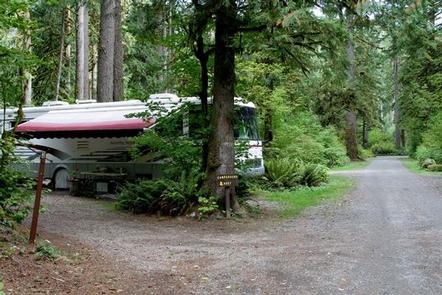
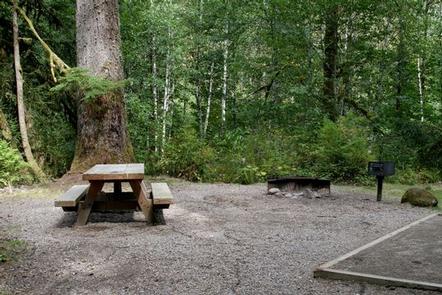
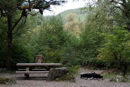
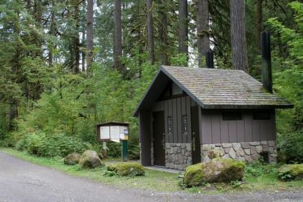
Clear Creek Campground offers 13 standard sites. Picnic tables, tent pads, campfire rings, and vault toilets are provided for guests.
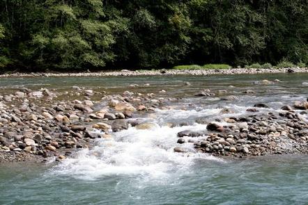
Visitors can access the Sauk River from the campground.
Natural Features
On a clear day visitors can spot Mt. Baker, the most prominent feature of the Mt. Baker Wilderness Area. Rising to an elevation of 10,781 feet, this active volcano is perpetually snow-capped and mantled with an extensive network of creeping glaciers. Mt. Baker’s summit, Grant Peak, is actually a 1,300-foot-deep mound of ice, which hides a massive volcanic crater.
Along the banks of the Sauk River an outstanding show of wildflowers in July and August includes paintbrush, phlox, tiger lilies, aster, columbine and lupine. During the summer salmon and steelhead appear in abundance as they head up the river to spawn.
The surrounding undeveloped wilderness, clean streams and diverse forests support an abundance of wildlife. In addition to being home to a multitude of mammals, birds, amphibians and reptiles, the area sustains more rare species such as lynx, moose, wolves and wolverine.
Nearby Attractions
Visitors enjoy the North Cascades and Mt. Rainer National Parks, where interpretive programs and exhibits offer education about the diverse landscape and history of the area.