NEWMAN LAKE SHELTER, WI Campground Reservation, Info, Images, Map, Directions

NEWMAN LAKE SHELTER, Wisconsin Campground Images, Info & Reservations

Directions

From the intersection of Highways 13 and 182 in Park Falls, drive east on Highway 182 for about 13 miles to Forest Road 144. Turn right (south) and continue on Forest Road 144 for 1 mile to Forest Road 1903. Turn left (east) onto Forest Road 1903 and drive 2 miles to the Newman Lake Recreation Area.

Phone

715-762-2461

Activities

BIKING, BOATING, CAMPING, FISHING, HIKING, WILDLIFE VIEWING, SWIMMING, CANOEING, BIRDING

Keywords

NLSH,CHEQUAMEGON-NICOLET NF – FS

Related Link(s)

Rec Area Info & Images

Wisconsin State Road Conditions

Wisconsin State Tourism

Overview

Newman Lake Shelter is a day-use picnicking shelter available for large groups. It is situated within the Newman Lake Recreation Area. A variety of recreational opportunities abound.

Recreation

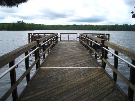
The recreation area contains a boat ramp, beach, accessible fishing dock, horseshoe pits and a playground for children. Visitors enjoy exploring many hiking and biking trails that are located near the picnic shelter. During the winter months, the trails are popular for cross country skiing. The beach provides opportunities for swimming, while the lake is a welcome respite for boaters and anglers alike. Fishing is a popular activity and a typical catch might include bluegill, crappie, various bass and perch.

Facilities

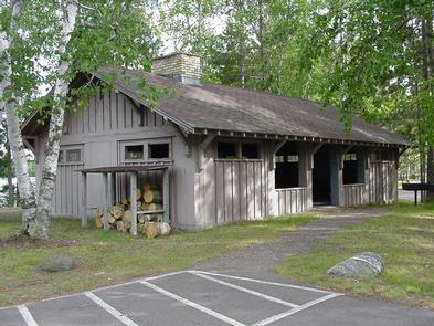
The accessible shelter can accommodate up to 50 people. It is equipped with tables, grills and a fire place. Vault toilets and drinking water are provided. Trash collection is also available.

Natural Features

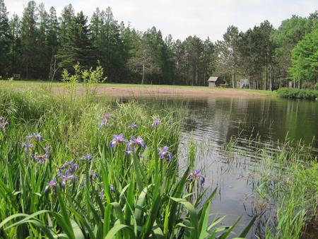
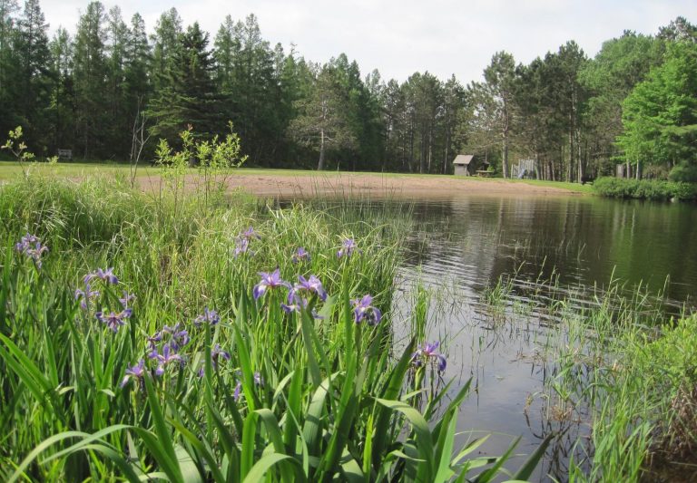
The picnic shelter is located on the southeastern shores of Newman Lake in the Chequamegon-Nicolet National Forest in northern Wisconsin. The cold water lake and neighboring picnic shelter are nestled in a mixed forest of aspen and pine trees. A variety of birds and wildlife also make their home in the area.

Nearby Attractions

Park Falls, Wisconsin is 15 miles from Newman Lake and is a full service community.

Reservation

More from CampingHiking.net:

DAVIS LAKE CAMPGROUND, Mississippi Campground Images, Info & Reservations

Directions From Tupelo, drive 17 miles south on the Natchez Trace Parkway to the Davis Lake Recreation Area Exit at milepost 243. Turn right on Davis Lake Road and continue 4 miles to the campground. Phone 662-285-3264 Activities BIKING, BOATING, CAMPING, FISHING, HIKING, WATER SPORTS, WILDLIFE VIEWING, SWIMMING SITE Keywords

BLACK CANYON RIM CAMPGROUND, Arizona Campground Images, Info & Reservations

Directions Located 13 miles west of Heber, Arizona. From Forest Lakes, travel east on Highway 260 for approximately 1 mile. Turn south on Forest Road 300 and travel approximately 2.4 miles. The campground is located at the intersection of Forest Roads 300 and 86. Phone 9285359859 Activities CAMPING Keywords BLACK

SANTA BARBARA CAMPGROUND, New Mexico Campground Images, Info & Reservations

Directions From the junction with State Road 75, follow SR 73 1.4 miles to the Santa Barbara Road. Turn left onto the Santa Barbara Road. Then travel 6.2 miles to the campground. Santa Barbara Road becomes Forest System Road 116 when the pavement ends. Phone 435-245-6521 Activities CAMPING, HIKING, HORSEBACK

BLIND PASS CABIN, Alaska Campground Images, Info & Reservations

Directions The cabin is located approximately 40 air miles north of Ketchikan on the northwest shore of Hassler Island, across from Black Island. Accessible by float plane or by boat. Mooring buoy in front of cabin is first-come, first-serve. Refer to USGS topographic map, Ketchikan D-5, and check local tide

SPRING CANYON, Washington Campground Images, Info & Reservations

Directions Take State Highway 2 west of Spokane for 65 miles to the town of Wilbur, Washington. Turn north on State Highway 174 (follow road signs). Travel 19 miles and turn right at the sign for Spring Canyon Campground. Phone 509-754-7889 Activities BIKING, BOATING, HISTORIC & CULTURAL SITE, CAMPING, INTERPRETIVE