EVANS GROUP CAMP, WA Campground Reservation, Info, Images, Map, Directions

EVANS GROUP CAMP, Washington Campground Images, Info & Reservations

Directions

Take Washington state Highway 395 north from Spokane. Travel 83 miles to the town of Kettle Falls, take Highway 25 north and travel 11 miles. Follow signs to the campground. It is on the west side of the highway.

Phone

509-754-7889

Activities

BOATING, HISTORIC & CULTURAL SITE, CAMPING, INTERPRETIVE PROGRAMS, FISHING, HIKING, PICNICKING, WATER SPORTS, WILDLIFE VIEWING, DAY USE AREA, SWIMMING, CANOEING, WATER ACCESS

Keywords

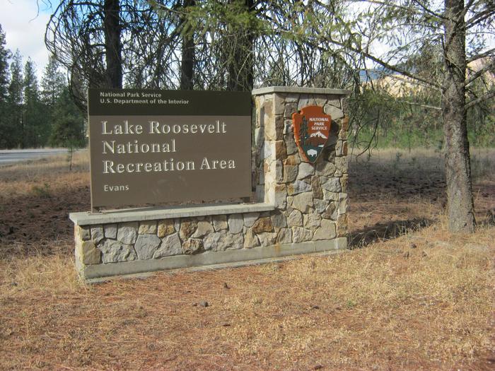
EVAN,LAKE ROOSEVELT NRA

Related Link(s)

Rec Area Info & Images

Washington State Tourism

Washington State Road Conditions

Overview

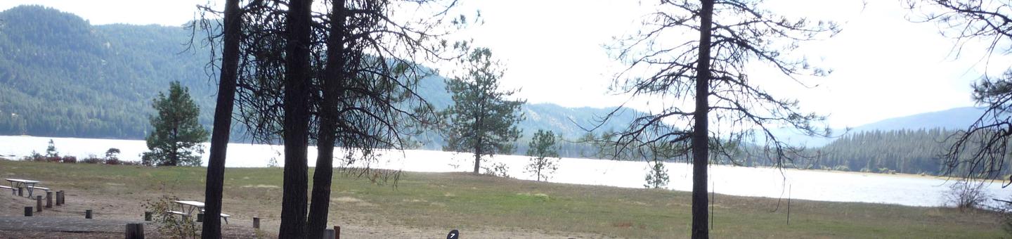
Evans Group Camp, along the northern shoreline of Lake Roosevelt, is the most northern campground on the lake that can be reserved. The site is long and narrow, an orientation that allows for a fantastic, clear view of the lake from every vantage point. There is one group campsite that can accommodate one group of up to 25 people at a time.

Lake Roosevelt is a 130-mile lake on the Columbia River created by the Grand Coulee Dam. Named after President Franklin D. Roosevelt, it is part of the Lake Roosevelt National Recreation Area and managed by the National Park Service.

Recreation

The boat launch provides year-round access to the lake. Boating, fishing, swimming and water skiing are activities that can easily take place from the campground. Campers might also enjoy relaxing and taking in the beautiful view or attending educational ranger programs.

Facilities

Evans Group Camp can be reserved March through November. Great for family reunions and other medium-sized gatherings, there are picnic tables, drinking water available seasonally, fire pits, water access and a playground within the facility.

Natural Features

Evans provides ample shade with thick forests of ponderosa pine, douglas fir and maple trees. The lake area is abundant with wildlife, including moose, elk and deer. Quite a few bald eagles have been spotted around Evans, and dozens of species of fish inhabit the lake, such as walleye, bass, rainbow trout, salmon and sturgeon. Fishing for sturgeon is now allowed during a short season. Much of the water in the originates from glaciers and snow in the cold, high Canadian Rockies, though temperatures are pleasant to swim in during summer.

Reservation

More from CampingHiking.net:

RUJADA CAMPGROUND, Oregon Campground Images, Info & Reservations

Directions From Cottage Grove, take exit 174 on Interstate 5, then take Row River Road #2400 east 19 miles to Layng Creek Road #17. Turn left (northeast) on Road #17 and continue for 2 miles until you reach Rujada Campground, located on the right, across Layng Creek. Phone 541-767-5000 Activities

RISING STAR, Arkansas Campground Images, Info & Reservations

Directions From Pine Bluff, Arkansas, take U.S. Highway 65 south for 7.8 miles to Linwood. Turn left on Blankinship Road, drive 3.5 miles and follow the signs for Rising Star Campground. Phone 870-479-3292 Activities BOATING, CAMPING, FISHING, HUNTING, WILDLIFE VIEWING Keywords RISI,POOL 3 LOCK AND DAMR – ARK.RIV,POOL 3 LOCK

NANCYTOWN GROUP CAMPGROUND, Georgia Campground Images, Info & Reservations

Directions From Interstate 85 in Georgia, merge onto Interstate 985 via exit 113. Interstate 985 will eventually become State Highways 441/365. Continue north for about 5 miles to Cornelia, then take the Clarkesville/Highway 197 exit and turn right. Turn right again at Dick’s Hill Parkway. Continue approximately a mile and

SILVER LAKE EAST- ELDORADO, California Campground Images, Info & Reservations

Directions From Pioneer, CA, take State Route 88 east 36.6 miles to campground on right. Phone 209-258-2287 Activities CAMPING, FISHING, HIKING, SWIMMING SITE Keywords SILE,SILVER LAKE EAST ELDORADO,ELDORADO NF – FS Related Link(s) Rec Area Info & Images California State Tourism California State Road Conditions Forest Service Concessionaire Overview Silver

KIT PRICE, Idaho Campground Images, Info & Reservations

Directions From Coeur d’Alene, drive 28 miles east on Interstate 90, then 26 miles north (Kingston exit) on paved Forest Road #9, then 11 miles north from Prichard on paved Forest Road 208. Phone 435-245-6521 Activities CAMPING, FISHING, HIKING, SWIMMING SITE Keywords KITP,IDAHO PANHANDLE NF – FS Related Link(s) Rec

RILEY CREEK, Idaho Campground Images, Info & Reservations

Directions From Highway 2 in Laclede, Idaho, turn south onto Riley Creek Road, then continue about 1 mile to the campground entrance. Phone 208-437-3133 Activities BIKING, BOATING, CAMPING, INTERPRETIVE PROGRAMS, FISHING, HIKING, PICNICKING, WATER SPORTS, WILDLIFE VIEWING, DAY USE AREA, SWIMMING SITE Keywords RILC,ALBENI FALLS DAM Related Link(s) Rec Area