

Directions
From Highway 58, turn east onto Crescent Road at the sign for Davis Lake and Wickiup Reservoir, midway between mileposts 72 and 73. In 3.3 miles, turn left on Forest Road 46. Drive north for 18 miles and turn east on Forest Road 42 at the sign for Twin Lakes and Crane Prairie. Drive east on Forest Road 42 for 3.8 miles, then turn north on Forest Road 4270.
From Bend, go west on the Cascade Lakes Scenic Byway, which becomes Forest Road 46. Follow this road to its intersection with Forest Road 42, about 52 miles from Bend. Turn onto Forest Road 42 at the sign for Twin Lakes and Crane Prairie. Drive east on Forest Road 42 for 3.8 miles, then turn north on Forest Road 4270.
From Highway 97 between Bend and Klamath Falls, turn west to the Cascade Lakes Scenic Byway, 12 miles north of La Pine. After one mile, turn south on South Century Drive, which becomes Forest Road 42. Follow it for just over 17 miles to Forest Road 4270 and turn north at the sign for Crane Prairie.
Phone
541-323-1746
Activities
BOATING, CAMPING, FISHING
Keywords
CRAP,DESCHUTES NF – FS
Related Link(s)
Overview
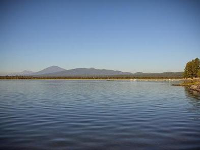
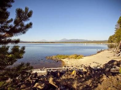
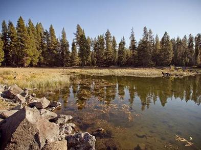
Crane Prairie Campground is located on the east shore of its namesake reservoir on Deschutes National Forest just off the scenic Cascade Lakes Scenic Byway. Crane Prairie Reservoir offers a variety of recreation opportunities, including fishing, boating and swimming with glimpses of South Sister and Mt. Bachelor on the horizon.
Recreation
Crane Prairie Reservoir is a prime location for boating and fishing. Fisheries in close proximity to the site also add to its popularity among anglers. The Oregon Department of Fish and Wildlife manages populations of rainbow trout, mountain whitefish, brook trout and largemouth bass. Fish cleaning stations and a boat ramp are within the campground.
Hiking and hunting are popular activities in the surrounding area.
Facilities
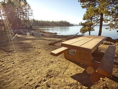
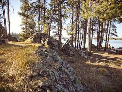
Crane Praire Campground offers many sites that accommodate both tent and RV camping, though electric hookups are not available. Several campsites are located right on the waterfront. Sites are equipped with tables and campfire rings with grills. Vault toilets and drinking water are also available. Roads and most parking spurs throughout the campground are paved. Showers and a small grocery store are available at a nearby resort.
Natural Features
Crane Prairie Reservoir hosts a number of waterfowl, including Sandhill cranes, Canada geese, bald eagles and osprey The adjacent forest is home to black-backed woodpecker, Williamson’s sapsucker and mountain chickadee. Deer, squirrel, beaver and an occasional black bear also find habitat in the surrounding forest.
Nearby Attractions
Nearby Osprey Point is a unique interpretive area for visitors to learn about local fauna and observe osprey nesting platforms erected after natural snags toppled from age. Crane Prairie Campground offers easy access to the Cascade Lakes Scenic Byway which weaves through multiple high lakes with views of South Sister, Broken Top and Mt. Bachelor. Newberry National Volcanic Monument offers a glimpse into Central Oregon’s rich geologic history. Travel 25 miles to Lava Lands Visitor Center to explore exhibits at the interpretive center, attend a ranger talk, take in scenic views from the top of Lava Butte and travel one-mile underground through Lava River Cave. Travel 40 miles to Newberry Caldera to visit Paulina and East Lake, Paulina Peak and Paulina Falls.