
Directions
Take exit 45 off I-81 at Marion ,Virginia. Take Rt.16 south for approximately 17 miles to VA 603 at Troutdale. Turn right onto VA 603 and drive for about 3 miles to the campground on the right. Follow signs.
Phone
276-783-5196
Activities
CAMPING, FISHING, HORSEBACK RIDING, HUNTING, WILDLIFE VIEWING
Keywords
OVGH,OLD VIRGINIA HORSE CAMP,OLD VIRGINIA GROUP CAMP,GEORGE WASHINGTON/JEFFERSON NF-FS
Related Link(s)
Virginia State Road Conditions
Overview
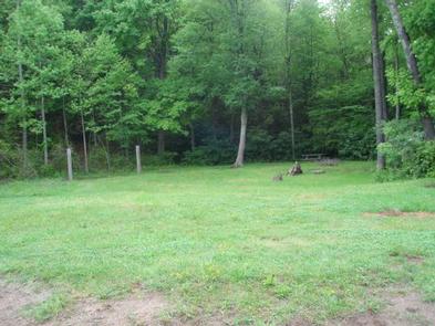
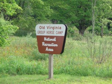
Old Virginia Group Horse Camp provides group equestrian camping just minutes from a large network of horse trails in the Mount Rogers National Recreation Area. Old Virginia is a secluded, picturesque campground that can accommodate up to 25 guests and 25 horses. The picturesque views of the mountains and the trickling sounds of the stream create a relaxing, serene vibe for visitors at the primitive camping site.
Recreation
Old Virginia offers easy access to the Virginia Highlands Horse Trail, which connects to the Iron Mountain Trail. From the Iron Mountain Trail, riders can also access the Virginia Creeper Trail to the west or the New River Trail to the east. The Virginia Creeper Trail boasts 33.4 miles of scenery with about 100 trestles and bridges.
Facilities
No drinking water is provided. Please bring plenty of water and tools for manure removal. The campground is easily accessed from a paved road and two portable toilets are provided. Showers are not available, but can be access at nearby campgrounds for a fee. The nearest pay phone is at Grindstone Campground.
Horses may drink from the stream.
Natural Features
The campground sits in the Fairwood Valley along a stream that flows into Fox Creek. The valley is part of the George Washington and Jefferson National Forests in western Virginia. The forests span 1.8 million acres of rugged Appalachians through Virginia and parts of West Virginia and Kentucky.
Nearby Attractions
Mount Rogers National Recreation Area high country trails, Virginia Creeper Trail, Grayson Highlands State Park, Hungry Mother State Park