
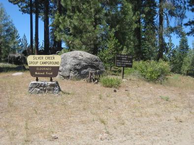
Directions
Travel 23 miles east of Placerville on Highway 50. Turn north and travel 9 miles on Forest Road 3 (Ice House Road). Look for signs to Silver Creek Campground.
Phone
831-245-6891
Activities
BIKING, BOATING, CAMPING, FISHING, HIKING, WATER SPORTS, WILDLIFE VIEWING, SWIMMING SITE, BIRDING
Keywords
SILG,ELDORADO NF – FS
Related Link(s)
California State Road Conditions
Overview
Silver Creek, located in the Crystal Basin area, offers a fun atmosphere with beautiful scenery for group gatherings. The Ice House Reservoir is less than 2 miles away, providing fun options for motor boating, jet skiing and more.
Eldorado National Forest includes the famed gold mining territory of the 1800s. Remnants of the days of the California Gold Rush are all around the region.
Recreation
Swimming and fishing are both excellent recreation options on the creek. Rainbow and brown trout are found in these waters.
The nearby Ice House Campground is convenient for access to Ice House Reservoir. Here, campers can swim, sunbathe, canoe or go water skiing. Hikers and mountain bikers can also find trails in the area.
Facilities
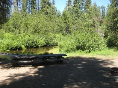
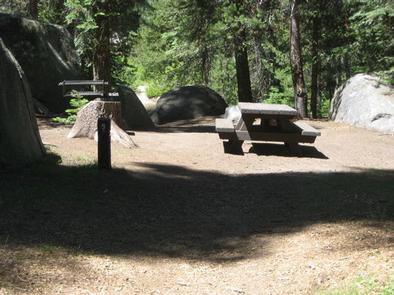
No drinking water is available, so bring water or use properly boiled stream water. The group site can accommodate 40 guests for tent camping. The sites include 9 walk-to units and 4 sites with parking spurs.
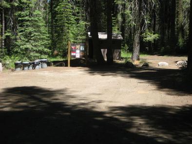
There is a central kitchen area for cooking. Here, there is one large group fire ring. This is the only fire ring at the site. Parking is only in the parking lot (more campground details).
A dump station is provided at nearby Ice House Campground, and showers are at Fashoda Campground.
Natural Features
Silver Creek sits under canopy of conifers like the ponderosa pine. The South Fork Silver Creek runs through the southern end of the campground, providing a peaceful soundtrack with its gently flowing water.
The Eldorado Forest is in the Sierra Nevada Mountains, an area known for granite peaks, alpine lakes and pine forest.
An abundance of wildlife can be found within the Sierra Nevada Range, including black bears, mule deer, bobcat, gray fox, bighorn sheep, pikas, martens and a variety of squirrels. Several species of reptiles, amphibians and birds also inhabit the area.
Nearby Attractions
The Desolation Wilderness is nearby, offering the opportunity to get away from the crowds and enjoy the serenity of nature.