UMPQUA SAND CAMPING, OR Campground Reservation, Info, Images, Map, Directions

UMPQUA SAND CAMPING, Oregon Campground Images, Info & Reservations

Listen

Directions

From Reedsport Oregon, travel 2 miles south on Highway 101 to Winchester Bay. Turn right on Salmon Harbor Drive. Proceed 4 miles to the Oregon Dunes National Recreation Area. Access the sand either at boundary, 2nd Beach Parking Sand Access, or 3rd Beach Parking Sand Access.

Phone

541-271-6000

Activities

CAMPING, FISHING, WILDLIFE VIEWING, SWIMMING, BEACHCOMBING

Keywords

UMPA,Winchester Bay,Umpqua Dunes,ODNRA,Oregon Dunes,Sand Dunes,Sand Camps,Umpqua ODNRA,SIUSLAW NF – FS

Related Link(s)

Rec Area Info & Images

Oregon State Road Conditions

Oregon State Tourism

Overview

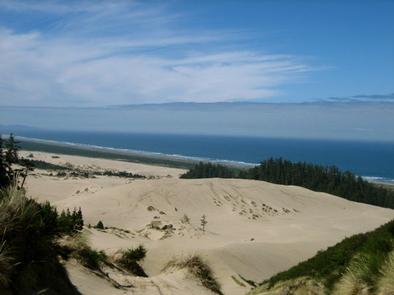
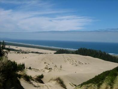
Umpqua is noteworthy as home to the tallest sand dunes in the Oregon Dunes National Recreation Area. Off-road vehicle riding is a huge sport here and visitors are rewarded with incredible views of the Pacific Ocean from the tops of the dunes.

Recreation

The featured attraction is off-road vehicle riding. Rather than trails, the area offers clear and open spaces for adventure-seeking riders. The Reedsport/Winchester Bay Chamber of Commerce puts on the summertime Dunefest to bring together families of all ages for motocross racing, treasure hunting in the sand, freestyle riding shows and more.

Facilities

Note that all sites can only be accessed by 4X4 vehicles. No water is available so campers should bring an ample amount. Campsites are primitive and it’s recommended that all campers bring portable toilets and fire pans. Seasonal rainfall may affect campsites. Contact Oregon Dunes NRA for seasonal information. Standard sites fit five vehicles and up to 20 people. The two group campsites fit 10 vehicles and 40 people. Campsites are available year-round and reservations may fill up quickly in peak summer season.

Natural Features

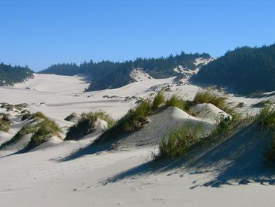
Campsites are dispersed along the Oregon Dunes National Recreation Area on the Pacific Coast. Winchester Bay is a short drive north and Eel Lake is a short drive south. The camping area is part of the Oregon Dunes National Recreation Area, known for its wind-sculpted sand dunes towering up to 500 feet above sea level.

Nearby Attractions

Visit Umpqua Lighthouse State Park, along Lake Marie. The Umpqua River Lighthouse stands on the site of the first lighthouse built on the Oregon Coast in 1857. The current lighthouse dates back to 1890.

Reservation

More from CampingHiking.net:

Big Meadow Campground, California Campground Images, Info & Reservations

Listen Directions Take Highway 180 east to the Kings Canyon National Park entrance, where you will be required to purchase a forest/park permit. After entering the park, continue 2 miles where you will stay to the right as though you were going to Sequoia National Park. Continue on the General’s

MOGOLLON CAMPGROUND, Arizona Campground Images, Info & Reservations

Listen Directions Located on Road 300 approximately 5 miles off of Highway 260. Phone 928-535-9859 Activities CAMPING, INTERPRETIVE PROGRAMS Keywords Related Link(s) Rec Area Info & Images Arizona State Road Conditions Arizona State Tourism Overview Mogollon Campground, although not directly in the Woods Canyon Recreation area, sits just outside and

VERMILLION, California Campground Images, Info & Reservations

Listen Directions From Clovis, take Highway 168 east to Shaver Lake. Continue through Shaver Lake to Huntington Lake. At the east end of Huntington Lake, turn right on the Kaiser Pass Road (at Eastwood Visitor Center). Travel 17 miles to the Edison Lake Road. Turn left toward Edison Lake and

JOHNSON CREEK, Oklahoma Campground Images, Info & Reservations

Listen Directions From Durant, OK, travel 11 miles west on Highway 70. Exit off Highway 70 to the north and the park entrance is 300 yards ahead. Physical address: 215 Johnson Creek Road, Mead, OK 73449. Phone 580-924-7316 Activities CAMPING Keywords JOCR,TEXOMA LAKE,TEXOMA LAKE Related Link(s) Rec Area Info &

ALLRED FLATS GROUP PICNIC SITE, Wyoming Campground Images, Info & Reservations

Listen Directions From Afton, Wyoming, take Highway 89 south for approximately 21 miles over Salt Pass and look for a brown sign signaling the right-hand turn for Allred Flats Campground. The picnic area is on the left, just before the campground entrance kiosk. Phone 307-828-5100 Activities BIKING, CAMPING, FISHING, HIKING,

EMIGRANT GROUP, California Campground Images, Info & Reservations

Listen Directions From Truckee, Calif., travel east on Highway 80 for 10 miles, to the Hirschdale Road exit. Follow Hirschdale Road/Stampede Dam Road north for eight miles, to the Stampede Reservoir. Take a left on Dog Valley Road to go over Stampede Dam. In a quarter mile the campground will