

Directions
From Wytheville, follow I-77 north to Exit 47. Turn left onto Route 717 and follow for 4 miles to Stony Fork Campground. Total travel distance from Wytheville, VA is 10 miles.
Phone
800-628-7202
Activities
BIKING, BOATING, CAMPING, FISHING, HIKING, HUNTING, WILDLIFE VIEWING
Keywords
STOF,SMOKEY’S RETREAT,GEORGE WASHINGTON/JEFFERSON NF-FS
Related Link(s)
Virginia State Road Conditions
Overview
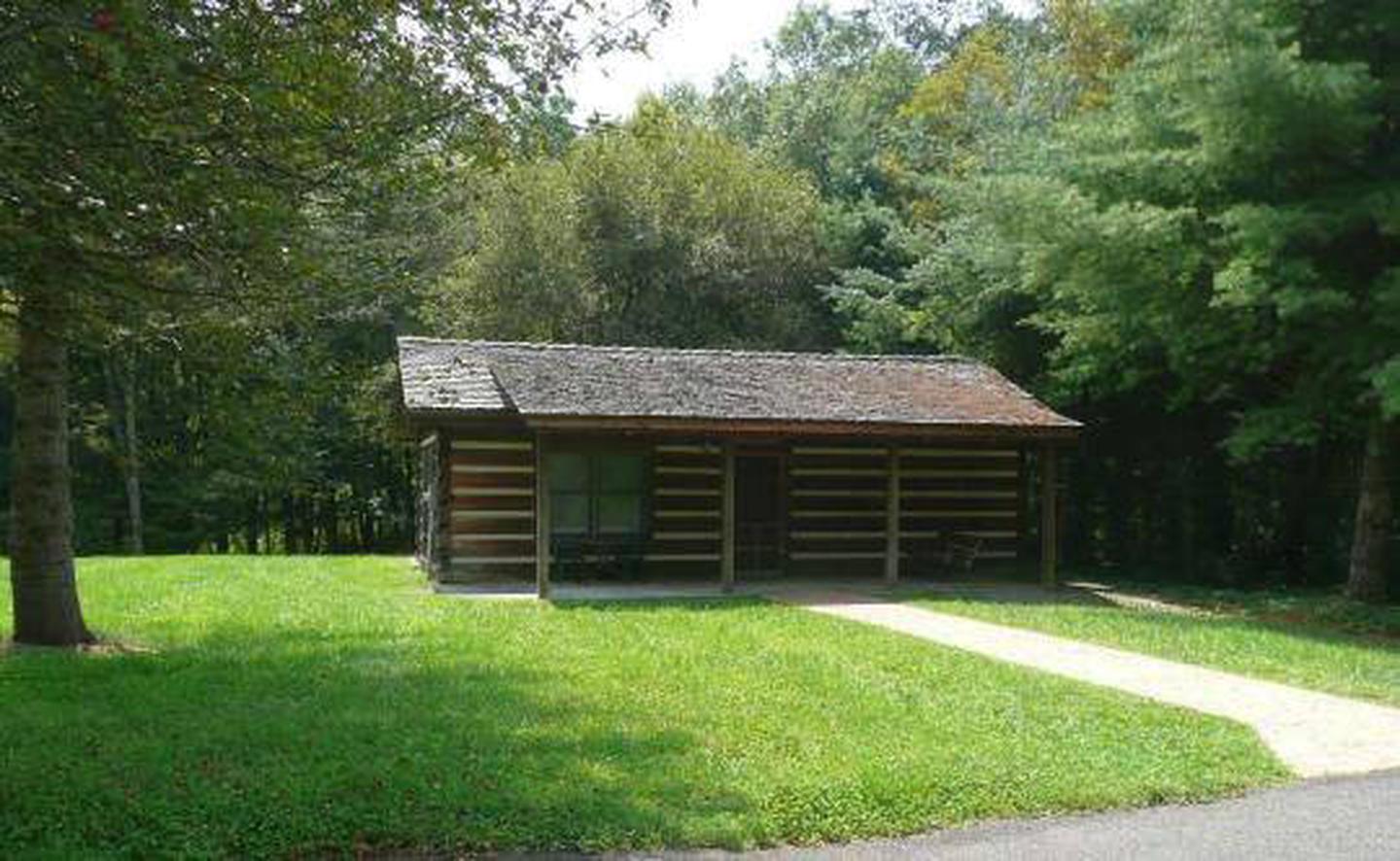
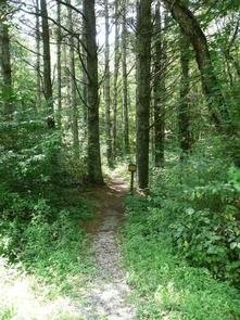
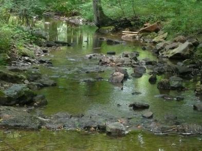
Stony Fork Cabin is a cozy one-bedroom hideaway with most of the comforts of home. Visitors can hike, mountain bike, explore the many nearby creeks, or simply relax on the cabin’s private patio.
The cabin is located within the Stony Fork Campground along the Big Walker Mountain Scenic Byway. The Appalachian Trail, Seven Sisters Trail, and stocked fishing streams are all within a close proximity, and the site is easily accessed from I-77.
Recreation
The Big Walker Mountain Scenic Byway is an incredible drive for viewing the blooms of rhododendron, azalea and mountain laurel in spring, and fiery red and gold foliage in fall. Scenic overlooks highlights include views of Mount Rogers and the many ridges and valleys.
Experienced hikers love the Seven Sisters Trail, which leads from the campground to the top of Little Walker Mountain, then onto the Scenic Byway. The creek offers trout fishing for campers.
Facilities
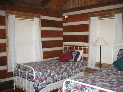
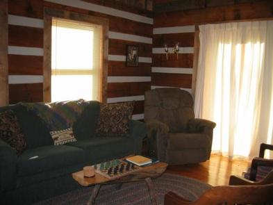
The 900 square foot log cabin has oak hardwood floors, a kitchen, full bathroom, and a living and dining area. It sleeps up to four guests with two twin beds and a sleeper sofa.
Cabin amenities include a private patio, plenty of cookware and utensils, a toaster, oven, refrigerator, microwave and coffee maker. Behind the cabin is a picnic table and campfire ring with grate.
Electricity and drinking water is included, but the cabin does not have air conditioning. Campers are asked to bring a flashlight, pillows, sheets, blankets, food, trash bags, bath towels, dishwasher detergent, firewood, a first aid kit and charcoal for the grill.
Natural Features
Stony Fork Cabin sits at the foot of Big Walker Mountain at an elevation of 2,400 feet. Its creekside setting provides a peaceful soundtrack of running water. In springtime, wildflowers and rhododendron dot the region with spectacular colors, and fall is reliably scenic with its red and yellow foliage.
Nearby Attractions
Located within 10 miles of the cabin, the legendary Appalachian Trail extends for more than 2,175 miles through the Appalachian Mountains across 14 states. It was the first trail to be designated as a National Scenic Trail.