Rocky Bend Group Campground, OR Campground Reservation, Info, Images, Map, Directions

Rocky Bend Group Campground, Oregon Campground Images, Info & Reservations

Listen

Directions

From Hebo, Oregon, travel north on Highway 101 four miles to Beaver, Oregon and turn on Blaine Road for 6 miles. Turn right on Upper Nestucca River Road and follow for 10 miles. Site is on the right.

Phone

503-392-5100

Activities

BIKING, FISHING, HIKING, WATER ACCESS

Keywords

Related Link(s)

Rec Area Info & Images

Rocky Bend Group Campground

Overview

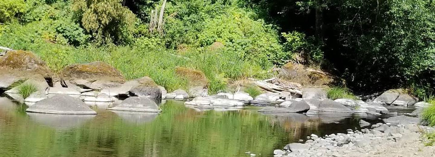
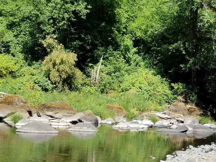
Nestled on the banks of the Nestucca River, Rocky Bend Group Campground is ideal for family gatherings and group events. The site is located on Upper Nestucca River Road 16 miles east of Beaver, Oregon. This group camp offers a picturesque setting, with plenty of recreation opportunity.

Recreation

Anglers enjoy casting a line into the Nestucca River, where steelhead and salmon can be caught during open fishing season. The campground is near hiking trails and waterfalls.

Facilities

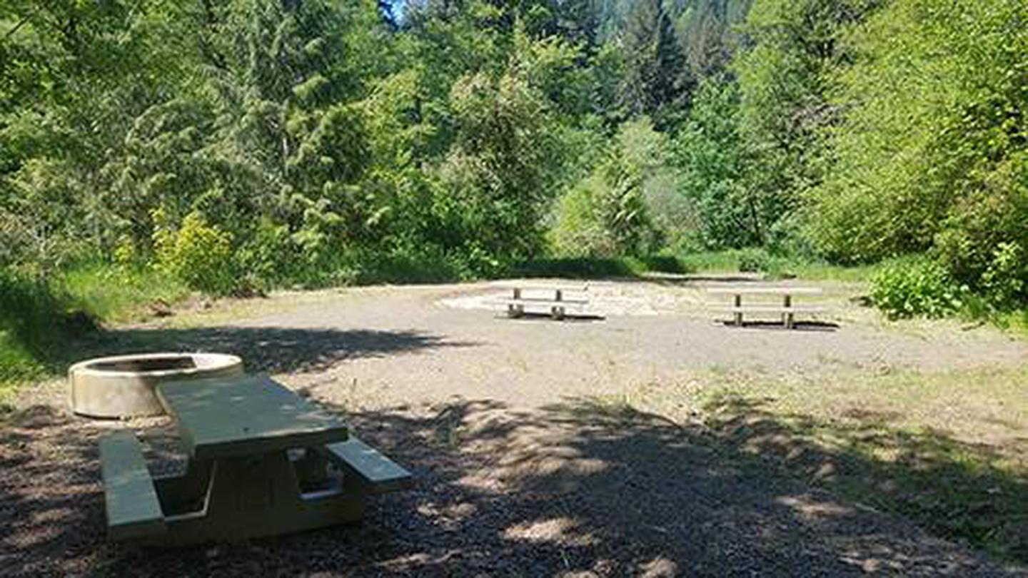
Group site can accomodate up to 50 visitors. Sufficient parking for 3 to 4 RVs or trailers, and 3 to 5 vehicles. The site offers 5 picnic tables, a large fire ring, vault toilet, garbage dumpster and easy access to Nestucca River.

Natural Features

Enjoy the Nestucca River, surrounded by Oregon’s coastal mountain range.

Nearby Attractions

  • The campground is along the Nestucca Country Scenic Byway
  • Niagara Trailhead is nearby, which leads to Niagara and Pheasant Creek Falls
  • Clarence Creek Falls  

Reservation

More from CampingHiking.net:

BEAR CREEK, Texas Campground Images, Info & Reservations

Listen Directions From Interstate 20 or 820 in southwest Fort Worth, take exit 429A for Highway 377 toward Granbury and go south 5.7 miles (9.2 km); turn left or southeast onto FM Road 1187 and continue for 1.4 miles (2.2 km), then turn left or east onto Ben Day-Murrin Road

TIE HACK, Wyoming Campground Images, Info & Reservations

Listen Directions Take US Hwy. 16 west from Buffalo, Wyoming for about 12 miles. Then take Tie Hack Reservoir Road (FDR #21) about 0.5 miles to the campground. Phone 406-587-9054 Activities BIKING, BOATING, FISHING, HIKING, HORSEBACK RIDING, WILDLIFE VIEWING, OFF ROAD VEHICLE TRAILS, CANOEING, NON-MOTORIZED BOATING Keywords TIEH,BIGHORN NF –

VENANGO PARK, Kansas Campground Images, Info & Reservations

Listen Directions From the North: Take HWY 140 to HWY 141. Travel south on HWY 141, then 1/2 mile west on Venango Road; look for signs to the park. From the South: Take HWY 4 to HWY 141. Travel north on HWY 141, then 1/2 mile west on Veanago Road;

TWO LAKES, Wisconsin Campground Images, Info & Reservations

Listen Directions From Drummond follow Forest Road 213 southeast to the intersection of Forest Road 213 and 216. Veer left (east) and continue on Forest Road 213 for 2 miles. Veer right (south) onto Forest Road 214 and travel 0.5 mile to the campground. Phone 715-739-6334 Activities BIKING, BOATING, CAMPING,

INDIAN HOLLOW, Massachusetts Campground Images, Info & Reservations

Listen Directions Driving directions to the campground: Address: 200 Indian Hollow Rd, Chesterfield, MA 01012 From intersection of State Route 143 and South Street in the center of Chesterfield, turn south on South Street. Follow for approx. 2 miles and turn right onto Indian Hollow Road. Follow Indian Hollow Road