
Directions
This campground is about 350 miles north of Los Angeles and 150 miles south of Reno, Nevada. Take U.S. Highway 395 to its junction with Highway 158. Take 158 for 7 miles to Silver Lake Campground.
Phone
760-934-5795
Activities
BIKING, BOATING, CAMPING, FISHING, HIKING, HORSEBACK RIDING, WILDLIFE VIEWING
Keywords
SLVL,INYO NF – FS,JUNE LAKE
Related Link(s)
California State Road Conditions
Overview
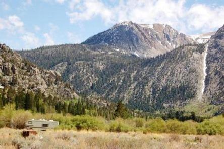
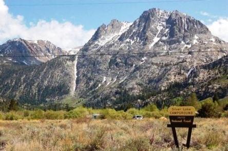
Silver Lake Campground is nestled between Silver Lake and the dramatic scenery of the Ansel Adams Wilderness in the eastern Sierra Nevada Mountains of California. This is a great base camp for fishing, boating, hiking, picnicking, horseback riding and photography. The facility has creekside camping with a boat ramp and pack station nearby.
Recreation
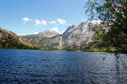
Rush Creek and 97-acre Silver Lake offer peaceful places for anglers to cast a line for rainbow trout. Boating is allowed on the lake, which has a 10 mph speed limit.
The area’s majestic scenery and challenging trails are an obvious draw for hiking and horseback riding. A nearby trail provides access to the Ansel Adams Wilderness. Within the facility, campers can go for a relaxing 1-mile walk or horseback ride along Rush Creek.
The scenic drive along the June Lake Loop results in expansive views of rugged mountain peaks and several lakes.
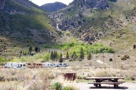
Facilities
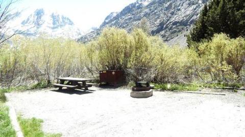
This is a moderate-sized facility that is fairly spread out. Some sites border the creek, and several border the lake. The facility provides drinking water, flush toilets, picnic tables, campfire rings and bear-proof lockers for food storage.
A small store, cafe, hiking trailhead and pack station are all within easy walking distance.
Natural Features
Some campsites are in open areas while others are shaded by aspen and willow trees. Rush Creek and Silver Lake border the facility, and June Lake is a short drive away. Silver Lake lies at an elevation of 7,200 feet at the base of 11,000 and 12,000′ mountain peaks.
Many species of wildlife call the mountains home, such as black bear, mountain lions, mule deer, pine marten, pika and numerous fish and birds.
Nearby Attractions
The small town of June Lake has various amenities. Hikers can access the Ansel Adams Wilderness via area trails, and Mono Lake and Yosemite National Park are great day trips.