


Directions
From US Highway 2 (to the north) or State Highway 200 (to the south), travel on State Highway 56 to the East Fork Bull River Road #407 at approximately the 8 mile marker. Take Road #407 for about 1.5 miles and turn right on Road #2701. The cabin is approximately .5 miles past the junction of #407 and #2701. Directional signs are present.
Phone
406-827-3533
Activities
BOATING, CAMPING, FISHING, HIKING, HUNTING
Keywords
BRGS,KOOTENAI NF – FS
Related Link(s)
Overview
The Bull River Guard Station was built in 1908 as the Ranger’s house and office. This structure was a primary ranger station from 1908 to 1920, surviving the legendary 1910 fires that swept through the area. The cabin was home to Granville “Granny” Gordon (District Ranger), his wife and three daughters.
Full vehicle access to the cabin depends on weather conditions. The road is normally plowed within 1 mile of the cabin during winter months.
Recreation
The Bull River is 24.7 miles long from its headwaters to where it meets the Cabinet Gorge Reservoir. Fish species include westslope cutthroat trout, large scale sucker and mountain whitefish. Visit the Montana Fish, Wildlife and Parks website for fishing regulations and hunting seasons and permits.
Hikers might be interested in two excellent day hiking options located near the guard station: the Pilick Ridge Trail #1036 and the Berray Mountain Trail #967. Both lead to lookouts with impressive views of the Cabinet Mountains. The Berray Mountain Lookout tower, built in the 1930’s, is listed on the National Historic Lookout Register.
For those interested in horseback riding, there is plenty of opportunity to explore the surrounding land. Stock animals are not allowed in the cabin area, but visitors may tie up across the road or 50 yards behind the station. As always, certified weed free hay is required on all Forest Service lands.
Facilities
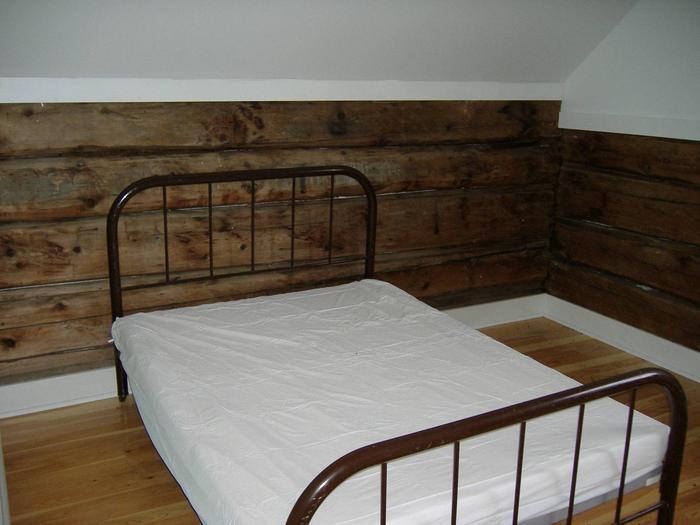
The two-story cabin spans 700 square feet and is equipped with period furniture, including three full beds and two single beds with mattresses. The cabin can accommodate a maximum of 8 people and does require guests to bring a few of their own supplies to ensure a comfortable stay.
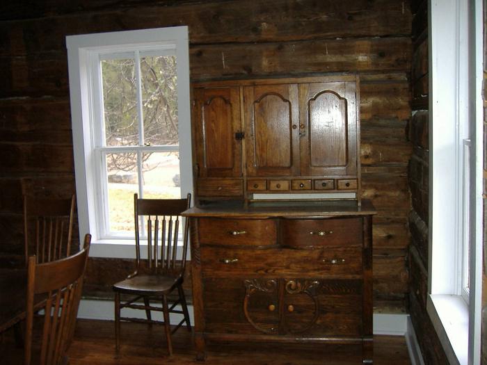
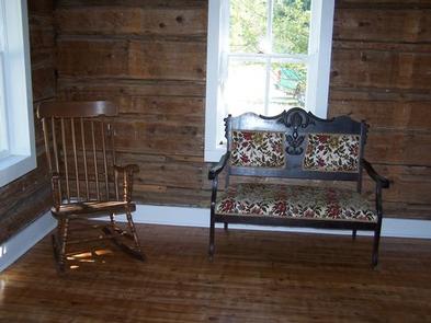
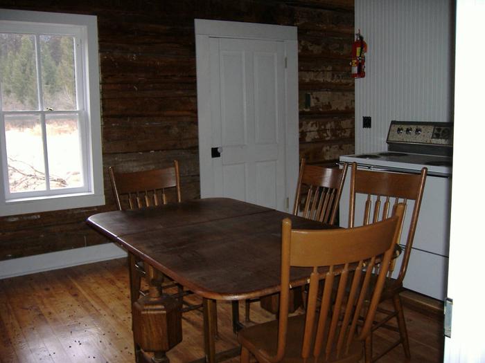
In addition to the beds, the cabin features a sitting room with chairs and a kitchen/dining room with a hutch, table and chairs and electric range.
The space is heated with a forced air electric furnace, and comes with some cleaning supplies. There is no indoor plumbing at the cabin; an outhouse with vault toilet is located nearby. A horse corral is located behind the cabin.
Drinking water is also not available; guests must bring plenty of their own.
Natural Features
The Bull River Guard Station is located in the Cabinet Mountain Range near the East Fork of the Bull River in the Kootenai National Forest.
The Cabinet Mountains were named by early French settlers who thought the mountains had a cabinet-like appearance when viewed from the valley floor.
The cabin is located minutes from from the Cabinet Mountains Wilderness area which is home to a large range of wildlife from the high rocks of the mountain goat, mountain sheep, pika and golden eagle, to the lower slopes and brushy canyon bottoms of the beaver, woodrat, and beautiful Western Tanager.
Fall foliage in this area is truly stunning with a wonderful assortment of Mountain Maple scarlets, Mountain Ash reds, Alder browns, and the Larch golden yellows.