Directions
From Lincoln, Montana, take State Route 200 east for 6.5 miles to the campground sign. Turn right at the sign, onto a gravel road, and go .5 miles to campground. After entering the campground facility, follow the signs to the Group Use area at the far eastern edge of the campground
Phone
406-362-7000
Activities
CAMPING, FISHING, HIKING, HUNTING, WINTER SPORTS, WILDLIFE VIEWING, DAY USE AREA
Keywords
ASGG,ASPEN GROVE GROUP USE,ASPEN GROVE PICNIC AREA,ASPEN PICNIC AREA,ASPEN GROUP SITE,HELENA NF – FS
Related Link(s)
Overview
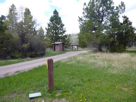
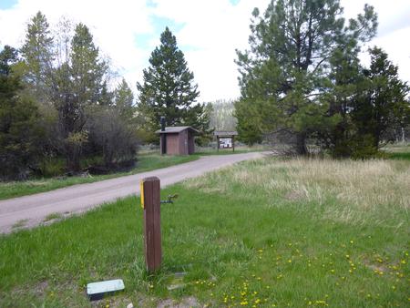
Aspen Grove Group Use Campground sits in forested mountain terrain on the banks of the Blackfoot River in the Helena-Lewis and Clark National Forest. At an elevation of 4,800 feet beneath a canopy of cottonwood, aspen, juniper, Lodgepole pine and Douglas fir, this campground is an ideal setting for larger families or groups seeking relaxation and recreation. It is seperated fom the rest of the campground and offers guests there ownprivate area, bathroom, water spigot, and parking.
Recreation
Aspen Grove Group Campground offers outdoor enthusiasts the opportunity to hike, fish, bike, hunt and enjoy a long list of outdoor recreational activities throughout the year. Indian Meadows Trailhead, located approximately 9 miles from Aspen Grove, offers access to a number of hiking trails in the Scapegoat Wilderness. Alice Creek Trailhead, located approximately 15 miles from Aspen Grove, also offers hiking opportunities into the Scapegoat Wilderness and along the Lewis and Clark historic trail to Lewis and Clark Pass. Visitors can also access the Continental Divide National Scenic Trail in several different locations around the Lincoln Valley. The CDT offers sweeping views of the area and highlights the marked change in landscape on either side of the Divide. The Blackfoot River, adjacent to the campground, is renowned for its recreational opportunities, most notably fly fishing. The Blackfoot is a fast, cold river with many deep spots, making it prime habitat for populations of cutthroat, rainbow, and brown trout.
Facilities
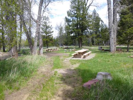
Aspen Grove Group Campground has six sites, able to accommodate 40 people and a maximum of 15 vehicles, including trailers up to a maximum of 20 feet. Space is available for 10-15 four-person tents.
The site is equipped with picnic tables, campfire rings, drinking water and vault toilets.
Access to Blackfoot River is within walking distance from the campground.
Natural Features
Visitors to the Helena-Lewis and Clark National Forest are treated spectacular scenery as well as an abundance of natural and cultural resources in the area. Rugged ridges, alpine meadows, forests, grasslands and rivers provide wildlife diverse ecosystems. Grizzly bear, lynx, wolverine, deer, elk, gray wolf, moose, black bear, mountain lion, mountain goat and mountain sheep all call the area home.
Nearby Attractions
Located in Northwestern Montana on both sides of the Continental Divide, the Scapegoat Wilderness-Bob Marshall Wilderness Complex is more than 1.5 million acres, the third largest in the lower 48 states. The Lewis and Clark Expedition of 1804-1806 spent many months traveling through the varied scenery of Montana. Many areas of the landscape along the expedition’s route on the Helena National Forest look much the same as in 1805-1806. Visit the routes of the famous explorers on public lands in Helena-Lewis and Clark National Forest. Click here for more information about the Lewis and Clark National Historic Trail.


