CEDAR CREEK (Sam Tobias), NM Campground Reservation, Info, Images, Map, Directions

CEDAR CREEK (Sam Tobias), New Mexico Campground Images, Info & Reservations

Directions

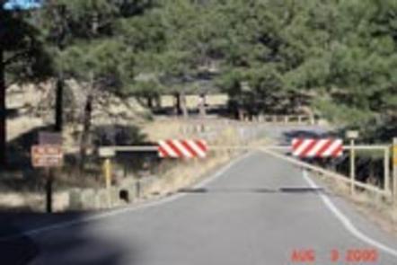
From Ruidoso on Mechem Drive, take Cedar Creek Road west .5 miles. Cedar Creek is the first recreational area located on the right (north).

Phone

575-257-4095

Activities

BIKING, CAMPING, HIKING, WILDLIFE VIEWING

Keywords

CEDC,SAM TOBIAS GROUP CAMPGROUND,CEDAR CREEK SAM TOBIAS,LINCOLN NF – FS

Related Link(s)

Rec Area Info & Images

New Mexico State Road Conditions

New Mexico State Tourism

Overview

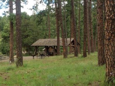
Located on the outskirts of Ruidoso, Cedar Creek provides a wonderful space for groups visiting for the day or staying overnight. With a picnic shelter and three group campsites, the recreation area is ideal for an outing in Lincoln National Forest. A popular pastime is is hiking and mountain biking along the scenic multi-use trails adjacent to the Sam Tobias Memorial Group Campground. There are opporunities to see a number of different wildlife, including Mule deer and Elk in the area.

Recreation

Hiking and biking are among the most popular activities here, with options like the T90 fitness Trail which extends 1.3 miles and includes exercise stations. Bilking trails T120 A-D and T121 A& B are also nearby. Also we have an expert-only downhill mountain bike trail, located near the water tower to the east of the Campgrounds. The trail ends at the picnic area. Dogs must be kept on leash at all times while hiking. Dogs are not allowed on the Fitness trail.

Facilities

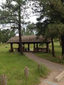
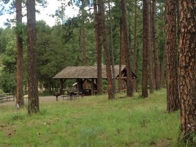
The group picnic shelter offers drinking water and accessible vault toilets. Non-sheltered picnic tables are open to the general public.

The group campgrounds range from 60 to 100 person capacities and the group picnic shelter fits up to 40 people. Each site comes with accessible picnic shelters, campfire rings, drinking water vault toilets and grills.

Picnic Pavilion is for day use only. If you would like to camp overnight please book one of the group campgrounds.

Natural Features

Cedar Creek is perched along its namesake, Cedar Creek at a 7,000 foot elevation. Lincoln National Forest, located in south-central New Mexico, is most notable as the birthplace of the original Smokey Bear.

Nearby Attractions

Ruidoso is a delightful town with quaint shops, restaurants and art galleries. If picnickers wish to camp overnight, they can head to Sam Tobias Memorial Group Campground.

Reservation

More from CampingHiking.net:

BAR GULCH, Montana Campground Images, Info & Reservations

Directions Bar Gulch Cabin is located 24 miles from Helena and 30 miles from Townsend on Magpie Road (#425). From Helena, take Canyon Ferry Road over the dam, past Kim’s Marina. Continuing east, watch for a left-hand turn onto Magpie Road. From this intersection, proceed up Magpie Road 3.9 miles.

BICENTENNIAL CAMPGROUND, California Campground Images, Info & Reservations

Directions Upon entering the Marin Headlands follow the signs to the Visitor Center. The campground is less than 1/2 mile drive from the Visitor Center. Phone 415-331-1540 Activities BIKING, HISTORIC & CULTURAL SITE, CAMPING, INTERPRETIVE PROGRAMS, VISITOR CENTER, MOUNTAIN BIKING, BERRY PICKING Keywords Related Link(s) Rec Area Info & Images

TYEE CAMPGROUND, Oregon Campground Images, Info & Reservations

Directions From Florence, OR, travel south on Highway 101, six miles to Pacific Avenue. Turn left on Pacific Avenue and travel approximately 100 feet. Campground is located on the right (south) side of Pacific Avenue. Phone 541-271-6000 Activities BOATING, CAMPING, FISHING, HIKING, WILDLIFE VIEWING Keywords TYEE,OREGON DUNES,SIUSLAW NF – FS

AVOSS LAKE CABIN, Alaska Campground Images, Info & Reservations

Directions Accessible early June through October. Located 35 air miles southeast of Sitka, east of Whale Bay, within South Baranof Wilderness Area. Access by floatplane takes 35 minutes from Sitka. This cabin is in a designated wilderness area; access by helicopter is illegal. For geographic features surrounding the cabin, refer

NORTH SANDUSKY DAY-USE, Illinois Campground Images, Info & Reservations

Directions From I-57 take take exit 77, and turn west onto Route 154. Continue for 4.5 miles, then turn south on Rend City Road. Continue through the stop sign to the park entrance. Phone 618-724-2493 Activities BIKING, BOATING, HIKING, SWIMMING SITE, DISC GOLF Keywords NSAD,REND LAKE,NORTH SANDUSKY,NORTH SANDUSKY DAY USE,NORTH

SMITH AND MOREHOUSE, Utah Campground Images, Info & Reservations

Directions From Salt Lake City, Utah, take Highway 80 east for 36 miles to the Kamas exit. Travel south for 12 miles to Oakley, turn left on Highway 213 and travel 12 miles to end of pavement. Turn right and go 2 miles to the campground entrance. Phone KAMAS RANGER