LAKE SHORE GROUP CAMP, FL Campground Reservation, Info, Images, Map, Directions

LAKE SHORE GROUP CAMP, Florida Campground Images, Info & Reservations

Directions

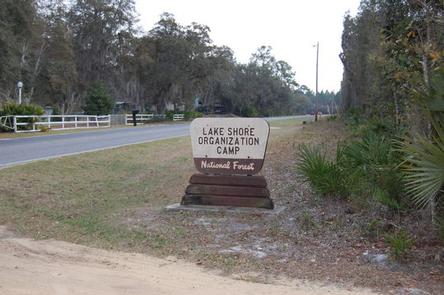
From I-75, west of Ocala, take exit 352 onto State Route 40 east. Continue for 10 miles to County Road 314. Turn left on 314 and go 6 miles. Turn left onto 147th Avenue Road and look for the Lake Shore sign and entrance on left.

Phone

352-625-2520

Activities

CAMPING, FISHING, HIKING, PICNICKING

Keywords

LSGC,BACKSIDE OF FORE LAKE,BACKSIDE OF FOUR LAKE,LAKE SHORE,LAKESHORE,NFs IN FLORIDA – FS

Related Link(s)

Rec Area Info & Images

Florida State Tourism

Florida State Road Conditions

Overview

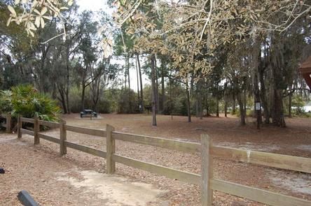
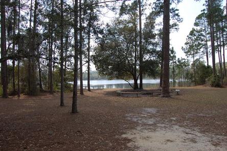
Lake Shore Group Campground sits on the north shore of Fore Lake in Ocala National Forest. It is a favorite for scout, church and civic groups, as well as large families and reunions.

Recreation

Fore Lake is an excellent spot for birding. Visitors can also picnic and fish along the shore. Campers who wish to venture out into the water can launch their electric-motor boats, canoes and kayaks from the facility’s boat ramp.

Swimming is allowed, but campers should be aware that there are alligators in this lake.

Facilities

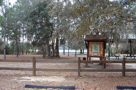
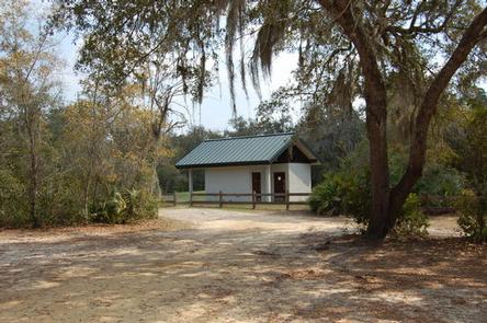
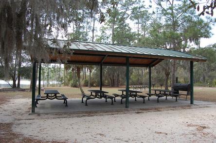
Lake Shore Group Camp is for tent camping, however RVs are allowed in the small parking area. The site can accommodate up to 50 guests and there are campsites in the shade and in the sun, all within sight of the lake. The centerpiece of the facility is the large accessible picnic shelter, perfect for group gatherings. A group grill, picnic tables and a restroom with showers and flush toilets are available.

The lake is situated in the historic community of Scrambletown, which has a store.

Natural Features

Located in north central Florida, the Ocala National Forest spans four counties and 383,000 acres. It is the southernmost and oldest national forest east of the Mississippi River and protects the world’s largest contiguous sand pine scrub forest.

Lined by marshes, the 12-acre Fore Lake is home to many species of birds. The surrounding landscape is forested with saw palmetto and oak trees.

Nearby Attractions

The Ocala National Forest is notable for its extensive off-road trail system catering to both ATV enthusiasts and Jeeps, as well as being a traditional destination for deer hunters. These opportunities are available within a short drive.

Reservation

More from CampingHiking.net:

DONEY CABIN, Montana Campground Images, Info & Reservations

Directions Phone 406-859-3211 Activities BIKING, CAMPING, HIKING, HUNTING, WINTER SPORTS, WILDLIFE VIEWING Keywords DONE,DONEY LAKE CABIN,BEAVERHEAD-DEERLODGE NF -FS Related Link(s) Rec Area Info & Images Montana State Road Conditions Montana State Tourism Overview DUE TO EARTHQUAKE DAMAGE THIS CABIN IS NO LONGER FOR RENT AND IS OFF THE SYSTEM. Recreation

MILLPOND PAVILION, Oregon Campground Images, Info & Reservations

Directions From Roseburg, travel east on Highway 138 for 22 miles. Turn left (north) on Rock Creek Road and proceed 5 miles. Campground is on the right. Phone 541-440-4930 Activities BIKING, CAMPING, WATER SPORTS, FISH HATCHERY, SWIMMING SITE Keywords MIPA,Mill Pond Pavilion Related Link(s) Rec Area Info & Images Oregon

HOOK POINT CABIN, Alaska Campground Images, Info & Reservations

Directions Access to the cabin is by wheeled plane on the beach at low tide only, 15 minutes from Cordova. The landing area is a half-mile from the cabin. Click here for local tide information. Inclement weather conditions may cause an extension of your trip during any time of the

MCGEE CREEK, California Campground Images, Info & Reservations

Directions From U.S. Highway 395 in California, take the McGee Creek exit, located 8 miles south of Mammoth Lakes and 37 miles north of Bishop. Proceed 2 miles south up the paved McGee Creek Road. The campground is on the left. Phone 760-935-4213 Activities CAMPING, FISHING, HIKING, HORSEBACK RIDING, WILDLIFE

VETERANS LAKE PAVILION, Oklahoma Campground Images, Info & Reservations

Directions From I-35, take Exit #55 or #51 and drive towards the city of Davis, OK. Once in Davis, go east towards Sulphur on Highway 7 Watch for the Chickasaw National Recreation Area signs to direct you to your selected area: Campgrounds, Boat Ramps, Pavilion, and Picnic Area.- Drive approximately

MYSTIC LAKE CABIN, Montana Campground Images, Info & Reservations

Directions There is no motorized access to this cabin. 1. Sourdough Canyon Trailhead: From Bozeman, MT. Drive south on S. 19th Ave. for 5.1 miles to Nash Rd. Turn left (east) onto Nash Rd. Drive 1.7 miles to Sourdough Canyon Road, turn right (south), and drive for 0.9 miles to