CHAPMAN, CA Campground Reservation, Info, Images, Map, Directions

CHAPMAN, California Campground Images, Info & Reservations

Listen

Directions

From Sierraville, take Highway 49 south 14.8 miles. The campground is on the right side of the highway.

Phone

(530)478-6253

Activities

BIKING, BOATING, CAMPING, FISHING, HIKING, HUNTING, SWIMMING SITE

Keywords

CHPM,TAHOE NF – FS

Related Link(s)

Rec Area Info & Images

California State Tourism

California State Road Conditions

Overview

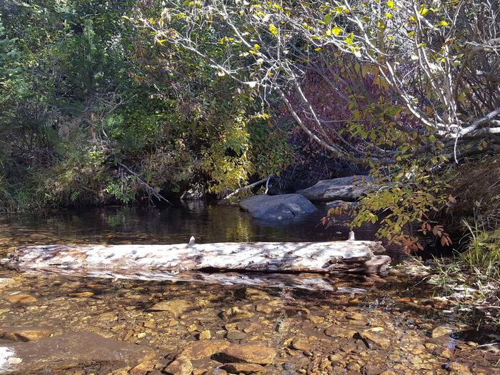
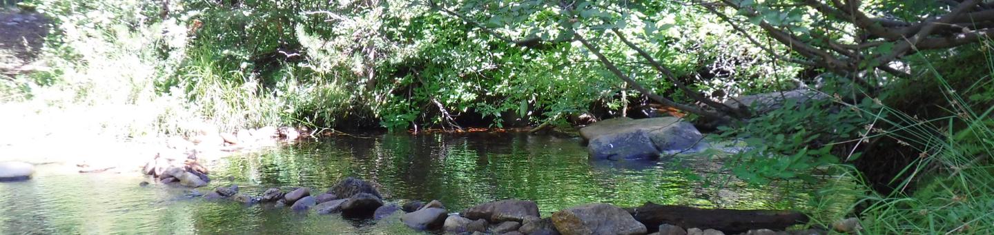
Chapman Creek Campground is located next to Chapman Creek, near the North Yuba River. Visitors enjoy a wide variety of recreational activities in the area, including hiking, mountain biking, hunting, fishing and wildlife viewing,  This facility is operated and maintained by the Tahoe National Forest.

Recreation

A large network of hiking trails is available in the area, including the nearby Pacific Crest Trail. The trailhead for the 2-mile long Chapman Creek Trail is located within the campground.  Boating, fishing and swimming opportunites are available at nearby Sardine Lakes, about five miles from the campground. Sardine Lakes Resort offers boat rentals.

Facilities

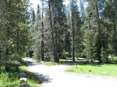
The campground offers several single-family campsites. Each site is equipped with a picnic table, food storage locker and campfire ring. Vault toilets and drinking water are provided.

Natural Features

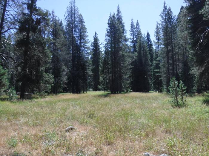
The campground is split into two loops, with one overlooking Chapman Creek and the other, neighboring a small meadow.  Stands of mature fir and lodgepole pine trees covers the area, providing pleasant shade at most campsites.

Nearby Attractions

The nearby Lakes Basin area offers boating, fishing, hiking and more than 30 miles of maintained trails, that are also open to biking and horseback riding. The lakes provide visitors with ample opportunities to enjoy boating, canoeing and fishing. Anglers will find rainbow and brook trout in many of the scenic bodies of water in the area. A boat ramp is located at Gold Lake.

Reservation

More from CampingHiking.net:

EAST FORK (TX), Texas Campground Images, Info & Reservations

Listen Directions From Wylie, TX, take State Highway 78 North to Eubanks Lane. Turn left onto Eubanks, stay to the right at the fork in the road (onto Forrest Ross Road) and continue to the stop sign at the intersection of Forrest Ross Road and Skyview Drive. Continue straight into

SNOW CAMP LOOKOUT, Oregon Campground Images, Info & Reservations

Listen Directions From Portland take I-5 South to OR-38 East to US-101 South to Gold Beach. From US-101 in Gold Beach, turn onto Jerrys Flat Road. In 9.8 miles, this becomes Forest Road (FS) 33. Continue on FS-33 for an additional 3.2 miles, then turn right onto FS-3313. In 8.2

COVERED BRIDGE, New Hampshire Campground Images, Info & Reservations

Listen Directions From Conway, New Hampshire: Take Kancamagus Highway (State Route 112), 6 miles west, then turn on Dugway Road and proceed into the campground. Vehicles 7’9" or taller are unable to pass through due to height restriction for the covered bridge and must use an alternate route: At traffic

LIVE OAK RIDGE, Texas Campground Images, Info & Reservations

Listen Directions From Interstate 35, take Farm-to-Market Road 2305 (West Adams Ave.) west. Drive for nine miles and turn left on Farm-to-Market Road 2271 (Morgan’s Point Road). Go two miles to the park entrance. The campground is adjacent to the Belton Dam and spillway. Phone 254-780-1738 Activities BOATING, CAMPING, HIKING,

GERLE CREEK, California Campground Images, Info & Reservations

Listen Directions From Placerville, drive 21 miles east on Highway 50 to the Icehouse Road turnoff. Turn left and go 28 miles north. Take the left fork 3 miles to the campground. Phone 831-245-6891 Activities CAMPING, FISHING, HIKING, SWIMMING SITE Keywords GERL,ELDORADO NF – FS Related Link(s) Rec Area Info