CARLTON, CA Campground Reservation, Info, Images, Map, Directions

CARLTON, California Campground Images, Info & Reservations

Listen

Directions

From Downieville, travel south on Highway 49 for just over 13 miles. The campground is on the left side of the highway.

Phone

(530)478-6253

Activities

BOATING, CAMPING, FISHING, HIKING, HUNTING, WATER SPORTS, SWIMMING SITE

Keywords

CRTN,TAHOE NF – FS

Related Link(s)

Rec Area Info & Images

California State Road Conditions

California State Tourism

Overview

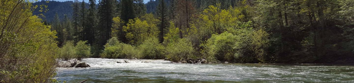
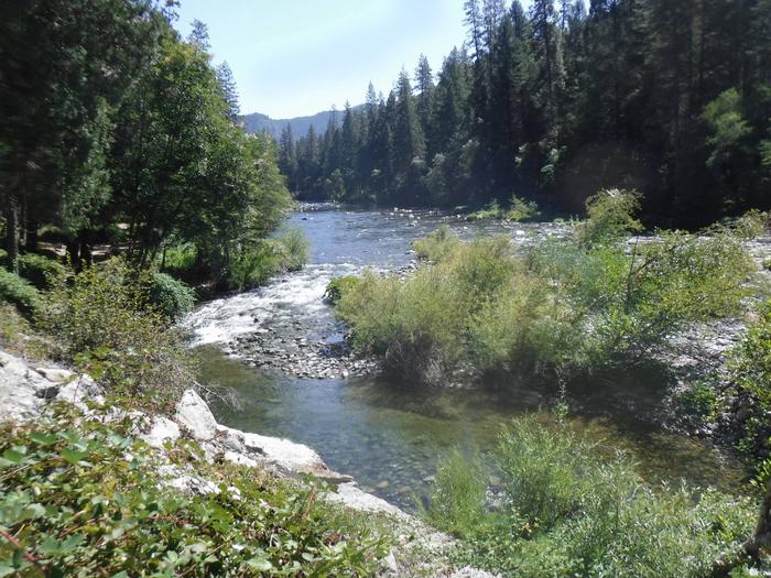
Carlton Campground is located along the North Yuba River, adjacent to Highway 49 and 13 miles from Downieville. Visitors enjoy a wide variety of recreational activities in the area, including hiking, hunting, fishing, canoeing and biking. This facility is operated and maintained by the Tahoe National Forest.

Recreation

The North Yuba River offers swimming, wading and rainbow trout fishing. Seasonal rafting and kayaking are popular water activities. A network of trails through the surrounding area providing opportunities for hiking, biking and OHV use.  The North Yuba River Trail can be accessed from the nearby Rocky Rest trailhead.

Facilities

The campground offers single-family campsites suited for both tent and trailer camping. Each site is equipped with a picnic table and campfire ring. Vault toilets and drinking water are provided.

Natural Features

The campground stretches along the North Yuba River, next to the highway.  Stands of cedar, ponderosa pine and oak trees cover the area providing shade from the afternoon sun. 

Reservation

More from CampingHiking.net:

KENT SPRINGS CABIN, Arizona Campground Images, Info & Reservations

Listen Directions From the intersection of I-10 and I-19 in Tucson, travel south on 1-19 about 35 miles to the Continental Road exit (Exit 63) in Green Valley, Arizona. Turn left (east) onto Continental Road and go approximately 1 mile to the junction with the Madera Canyon/White House Canyon Road.

GOOSEBERRY GROUP, Utah Campground Images, Info & Reservations

Listen Directions From Fairview, Utah, travel north about a mile on Highway 89, to the junction with Highway 31. Travel east on Highway 31 for about nine miles, to the junction with Forest Development Road 124. Go north on Forest Development Road 124 for one mile to the campground. Phone

LOWER HYALITE GROUP, Montana Campground Images, Info & Reservations

Listen Directions From Main Street in Bozeman, travel south on 19th Avenue for 7 miles, to the paved Hyalite Canyon Road. Turn left and continue south for two miles, to the group area. Phone 406-646-1012 Activities BOATING, CLIMBING, CAMPING, FISHING, HIKING, WILDLIFE VIEWING, PHOTOGRAPHY, BERRY PICKING, STAR GAZING, BIRDING, BACKPACKING

NARROWS CAMPGROUND, Wyoming Campground Images, Info & Reservations

Listen Directions From Pinedale, take U.S. Highway 191 northwest for 6 miles. Turn north onto State Highway 352 and travel just over 14 miles. Turn east onto New Fork Lake Road, which is gravel, and travel 5 miles to the campground. Though the road is suitable for two wheel drive

TIMBER BUTTE CABIN, Oregon Campground Images, Info & Reservations

Listen Directions Total mileage from Lowell to Timber Butte Cabin is 19 miles. From Interstate 5 (I-5), take Highway 58 East (Exit 188) and travel for 13 miles toward Oakridge. Turn left off of Highway 58 at the Lowell covered bridge and proceed toward the town of Lowell. At the

SQUIRREL MEADOWS CABIN, Idaho Campground Images, Info & Reservations

Listen Directions From Ashton, ID, take Highway 47 a half-mile to Highway 32 and turn right (south). Travel 1 mile to Ashton-Flagg Ranch Road (#261). Turn left (east) and travel 22 miles to Road #032. Turn right (south) and go a half-mile to the cabin. Phone 208-652-7442 Activities CAMPING, HORSEBACK