BIG HART (DAY-USE SHELTER), GA Campground Reservation, Info, Images, Map, Directions

BIG HART (DAY-USE SHELTER), Georgia Campground Images, Info & Reservations

Directions

From Thomson, Ga, travel 10 miles west on US-78, then 6 miles north on park access road. Park is located in McDuffie, GA.

Phone

800-533-3478

Activities

BOATING, FISHING, PICNICKING, DAY USE AREA, SWIMMING SITE, WATER ACCESS

Keywords

BHAT,J STROM THURMOND LAKE

Related Link(s)

Rec Area Info & Images

Georgia State Road Conditions

Georgia State Tourism

Overview

Big Hart Day Use Shelter is located in Big Hart Recreation Area on J. Strom Thurmond Lake. The park is just off Highway 78 between the towns of Washington and Thomson, Georgia.

The 70,000 acre lake and its 1,000+ miles of shoreline provide excellent boating, water skiing, swimming, fishing, hiking and picnicking.

Recreation

Thurmond Lake provides some of the best fishing, hunting, and water sports in the southeastern United States. Anglers fish for largemouth bass, bream, crappie, catfish and striped bass. The large lake offers endless boating, water skiing, jet skiing, canoeing and swimming opportunities.

Facilities

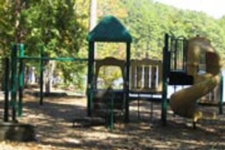
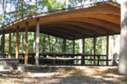
Big Hart Day Use Shelter is in a wooded day-use area on the waterfront. The shelter can accommodate up to 90 people. Amenities include a 20-amp electrical hookup, flush toilets, drinking water, a playground and boat ramp.

Natural Features

Hot, humid summers and mild, pleasant winters characterize this heavily wooded area on the shore of Thurmond Lake. A mixed pine and hardwood forest covers the site, providing summer shade and fall color. Elevation is 235′ above sea level.

Wildlife is abundant around the lake. Visitors regularly see southern bald eagles, migratory waterfowl, wild turkeys and whitetail deer.

Nearby Attractions

Numerous parks and recreation areas lie around Thurmond Lake, providing additional boating, swimming, hunting and hiking opportunities. Nearby cities house museums, art galleries, zoos, restaurants, and shopping areas.

The Augusta National Golf Club hosts the Masters Golf Tournament annually the first week of April.

Reservation

More from CampingHiking.net:

CRESCENT LAKE (MN), Minnesota Campground Images, Info & Reservations

Directions Travel Highway 61 along Lake Superior’s north shore to Tofte, Minnesota. In Tofte, turn north (away from Lake Superior) on Sawbill Trail (CCHS 2). Follow the Sawbill Trail for 16 miles to The Grade (Forest Road 170). Turn right onto the The Grade and proceed east for 7 miles.

JUNIPER LAKE GROUP, California Campground Images, Info & Reservations

Directions From the Red Bluff (I.5), drive east on state HWY 36 approximately 70 miles to Chester. Turn left at fire station immediately after crossing Feather River Bridge (watch for National Park Service sign on right) continue approximately 13 miles follow signs to Juniper Lake Campground and Group Campsite Area.

WAITSBORO CAMPGROUND, Kentucky Campground Images, Info & Reservations

Directions From Somerset Kentucky, take Highway 27 south for 5 miles. Turn right on Waitsboro Road and follow signs to the campground. Phone 606-561-5513 Activities BOATING, CAMPING, FISHING, DAY USE AREA Keywords WAIT,LAKE CUMBERLAND,WOLF CREEK DAM Related Link(s) Rec Area Info & Images Kentucky State Road Conditions Kentucky State Tourism

CAMPBELL POINT, Missouri Campground Images, Info & Reservations

Directions From Cassville, Missouri, take Highway 76 to Highway 39, then turn southeast onto the Highway YY access road and follow to the campground. Phone 417-858-3903 Activities BIKING, BOATING, CAMPING, FISHING, HIKING, PICNICKING, VISITOR CENTER, WATER SPORTS, WILDLIFE VIEWING, DAY USE AREA, SWIMMING SITE, PHOTOGRAPHY, SWIMMING, RANGER STATION, KAYAKING Keywords

ASPEN CABIN, Oregon Campground Images, Info & Reservations

Directions From Lakeview, drive 6 miles north on Highway 395 and turn right (east) on Highway 140. Drive for 8 miles on Highway 140 and turn left on Forest Road 3615. Drive 7.5 miles on Forest Road 3615 to arrive at the cabin. The entire route to the cabin is

PIGOT BAY CABIN, Alaska Campground Images, Info & Reservations

Directions The cabin is located on the southwest shore near the head of Pigot Bay, northeast of Whittier. Access by a float plane is a 40 minute trip from Anchorage or a 60 minute trip from Cordova. By boat, it is a 18 mile trek from Whittier. Check local tide