NORTH FORK (CA), CA Campground Reservation, Info, Images, Map, Directions

NORTH FORK (CA), California Campground Images, Info & Reservations

Listen

Directions

From east bound Interstate 80 take exit 158A or west bound Interstate 80 take exit 158B south to Emigrant Gap. After exiting the interstate take a right on Texas Hill Road towards Emigrant Gap. Continue on Texas Hill Road for about 6.5 miles and turn right into the campground.

Phone

530-265-4531

Activities

CAMPING, FISHING, HIKING, HUNTING, SWIMMING, WATER ACTIVITIES

Keywords

NOFR,TAHOE NF – FS

Related Link(s)

Rec Area Info & Images

California State Road Conditions

California State Tourism

Overview

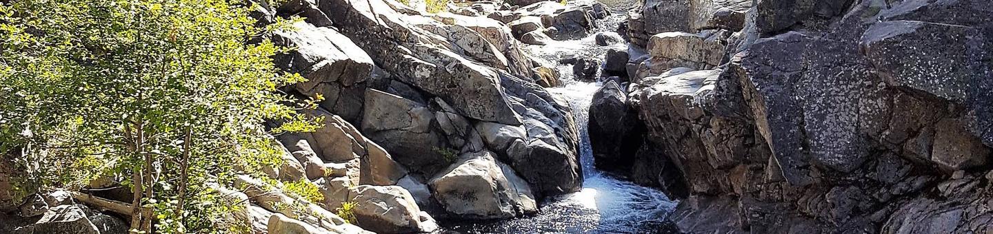
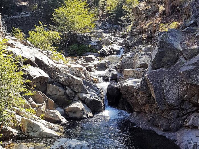
North Fork Campground is located along the North Fork of the North Fork American River in the Tahoe National Forest, off of Interstate 80, at the Emigrant Gap Exit. Visitors enjoy fishing and swimming in this scenic area.

Recreation

A great swimming hole is located a short walk from the end of the campground, on the river. Rainbow trout fishing is a popular activity enjoyed by visitors to the campground. Hiking trails and hunting opportunities are found in the surrounding area.

Facilities

The campground offers single-family sites, a few of which are designated for tent camping only. Each site is equipped with a picnic table and campfire ring. Vault toilets and drinking water are provided.

Natural Features

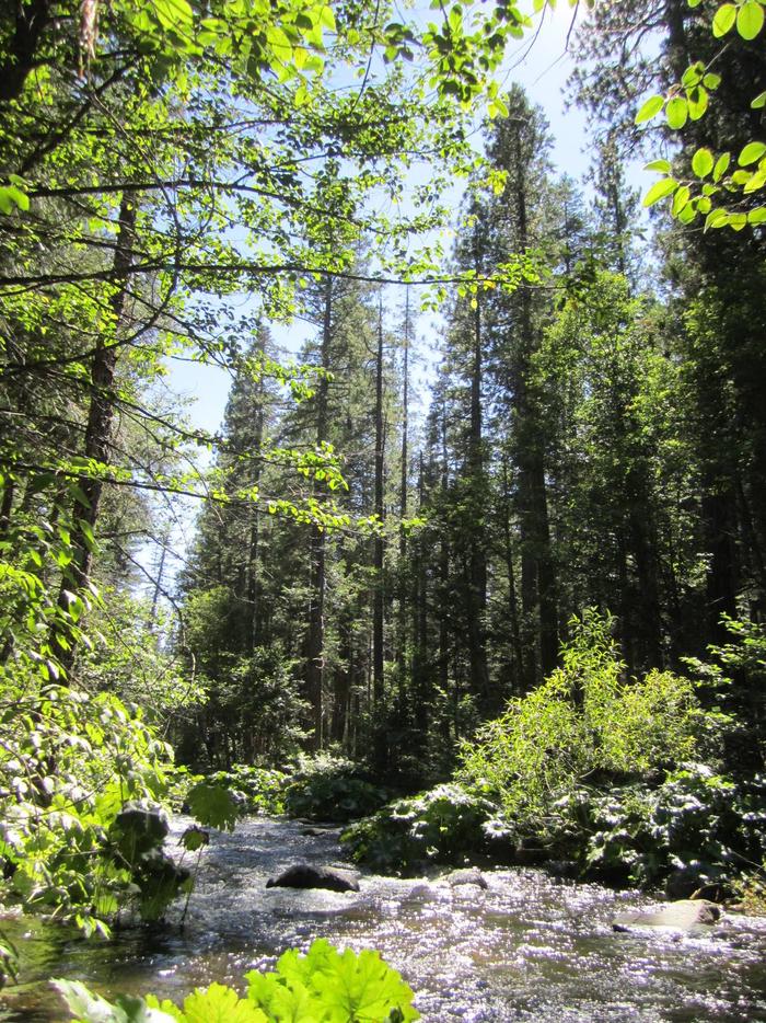
The campground is near the beautiful creek-sized river, in a remote location. It is shaded by cedar, pine and fir trees and is a pleasant escape from urban life.

Nearby Attractions

Many hiking, and OHV trails are located nearby as well as foot trail access into the North Fork American Wild and Scenic River canyon. Many more trails can be found a short distance east on Interstate 80 at Grouse Ridge Non-Motorized Area and Donner Summit.

Reservation

More from CampingHiking.net:

HECKMAN LAKE CABIN, Alaska Campground Images, Info & Reservations

Listen Directions The cabin is located approximately 15 miles from Ketchikan within the Naha Recreation Area. It is located near the outlet of Heckman Lake at the terminus of the Naha Recreation Trail. It is 6 miles up the trail from Naha Bay. Access is by hiking the trail from

JUNIPER LAKE STOCK CORRAL, California Campground Images, Info & Reservations

Listen Directions From Red Bluff I-5, drive east on State Highway 36 approximately 70 miles to Chester. Turn left at the fire station immediately after crossing Feather River Bridge (watch for National Park Service sign on right) and continue approximately 13 miles following signs to Juniper Lake. The Juniper Lake

White Earth Campground, Montana Campground Images, Info & Reservations

Listen Directions Heading north along MT highway 12/287 from Townsend. Drive north to the town of Winston, MT, and turn right onto Beaver Creek Road and follow the road 5.5 miles to the campground. Phone 406-475-3921 Activities BOATING, CAMPING, FISHING, WATER SPORTS, WILDLIFE VIEWING, MOTOR BOAT, KAYAKING Keywords White Earth

CHEOAH POINT CABIN 2, North Carolina Campground Images, Info & Reservations

Listen Directions From Robbinsville, North Carolina, continue on Highway 129 north for approximately 6 miles. Turn left on SR # 1145 – Thunderbird Mountain Road. Continue approximately 1.3 miles on Thunderbird Mountain Road to the Cheoah Point Campground. The cabin is located in the Cheoah Point Campground. Phone 828-479-6431 Activities

MAPLE GROVE, Utah Campground Images, Info & Reservations

Listen Directions From Scipio, Utah, take U.S. 50 south. Turn west at Maple Grove Campground sign/Forest Road 101 at milepost 146. Travel 4 miles to the campground. Phone 435-743-5721 Activities CAMPING, HIKING Keywords MAPL,FISHLAKE NF – FS Related Link(s) Rec Area Info & Images Utah State Tourism Utah State Road

ASPEN (UT), Utah Campground Images, Info & Reservations

Listen Directions From Duchesne, Utah: Take Highway 87 north to the junction with Highway 35. Turn west on Highway 35 towards Tabiona and travel about 28 miles to the campground in the North Fork Drainage. From Highway 40, turn north on Highway 208 towards Tabiona, then proceed northwest through Hanna