OAK GROVE CAMPGROUND, CA Campground Reservation, Info, Images, Map, Directions

OAK GROVE CAMPGROUND, California Campground Images, Info & Reservations

Listen

Directions

From Interstate 15 take the 79 East. The campground is on the north side of the highway, across from the fire station. From Temecula, take State Rt. 79 south 24.1 miles and turn left at campground sign.

Phone

(760) 788-0250

Activities

HISTORIC & CULTURAL SITE, CAMPING, FISHING, HIKING, VISITOR CENTER, DAY USE AREA

Keywords

Related Link(s)

Rec Area Info & Images

California State Road Conditions

California State Tourism

Overview

Located on the Cleveland National Forest, Oak Grove Campground is nestled in a valley of large oak groves and manzanita.

Recreation

Oak Grove Trail is a short walk of 1.5 miles and is located across Rt. 79, behind the Ranger Station. Oak Grove Trail is the oldest established trail on the Palomar Ranger District. Although a steep trail, it offers great views of the San Jacinto and San Gorgonio Mountains and the Oak Grove Valley as you gain elevation. The trail connects with the Oak Grove Truck Trail offering access to High Point Lookout (an additional 5 miles one way). Be prepared with plenty of drinking water.

Hikers interested in exploring will find nearby Agua Tibia Wilderness worth the drive as well.

Facilities

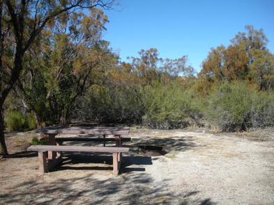
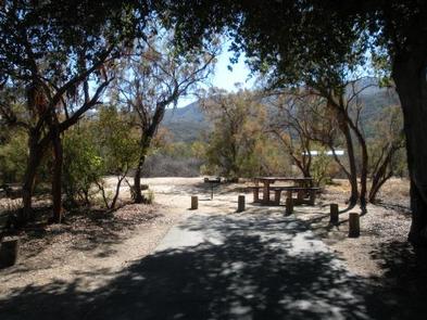
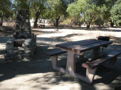
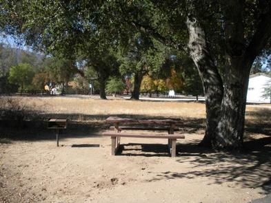
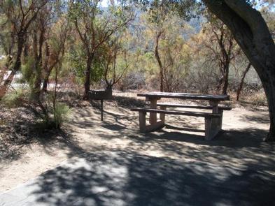
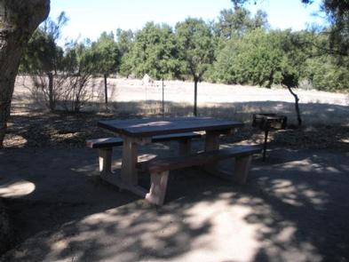
The campground is composed of two loops: Oak and Ribbonwood. Each campsite offers a picnic table and grill. There are vault toilets in Ribbonwood loop, and flush toilets on Oak loop. Drinking water is available.

Natural Features

The attractive campground is comprised of chaparral vegetation such as canyon live oaks, ribbonwood and chamise and offers open, but secluded sites. The area offers stargazers an opportunity to view the clear night skies. Birders will be pleased with the variety of wildlife and opportunities for viewing. The Cleveland National Forest also boasts such species as mountain lion, bobcat, mule deer, coyote, gray fox, ringtail cat, long tail weasel, opossum, jackrabbits, desert cottontails, and California ground squirrel among many others.

Nearby Attractions

Palomar State Park and Palomar Observatory are located on county Rt. S6, where an active telescope is available for viewing by the public. Temecula Wine Country is also within driving distance. The closest town is Warner Springs

Reservation

More from CampingHiking.net:

INDIAN POINT, Missouri Campground Images, Info & Reservations

Listen Directions From Branson, Missouri, take Highway 76 west for 3 miles, then turn south on Indian Point Road and follow for 2 miles to park entrance. Phone 417-338-2121 Activities BOATING, CAMPING, FISHING, HIKING, PICNICKING, WATER SPORTS, WILDLIFE VIEWING, DAY USE AREA, SWIMMING SITE, PHOTOGRAPHY, RANGER STATION, KAYAKING, WATER ACCESS

WARM LAKE, Idaho Campground Images, Info & Reservations

Listen Directions From Boise, Idaho, travel 85 miles north on Highway 55 to Cascade. Turn east on Warm Lake Highway and travel 25 miles to Forest Road 579KA. Turn south and travel a short distance to the campground. Phone 208-382-7400 Activities BIKING, BOATING, CAMPING, FISHING, HIKING, WILDLIFE VIEWING, SWIMMING SITE

ST. MARY CAMPGROUND, Montana Campground Images, Info & Reservations

Listen Directions Located a half-mile west of the St. Mary entrance near St. Mary, Montana. Access is from U.S. Highway 89 approximately 33 miles northwest of Browning, Montana or over Logan Pass when open. Vehicle restrictions are in effect. Phone 406-732-7708 Activities CAMPING, INTERPRETIVE PROGRAMS, FISHING, HIKING, DAY USE AREA

PARKER CREEK, Arkansas Campground Images, Info & Reservations

Listen Directions From Texarkana, Arkansas, take Interstate 30 east for 46 miles to Prescott. Continue onto Highway 19 north to Narrows Dam. After crossing the bridge across the Little Missouri River, proceed about 3 miles to the campground. Phone 870-285-2151 Activities BOATING, CAMPING, FISHING, HIKING, HUNTING, SWIMMING SITE Keywords PARR,Couch

SHEEP BRIDGE, Oregon Campground Images, Info & Reservations

Listen Directions From Bend, Oregon: Travel 26.8 miles south on Hwy 97 to Wickiup Junction, then 11.0 miles west on County Road 43, then continue 4.6 miles west on Forest Road 42 , and finally 0.8 miles south on Forest Road 4260. Phone 541-323-1746 Activities BOATING, CAMPING, FISHING, HIKING Keywords

ROCK CREEK (OR), Oregon Campground Images, Info & Reservations

Listen Directions From Portland, travel east on Highway 26 for 42 miles. Take the Highway 35 exit to Hood River and travel northeast for 3 miles. Turn right on Forest Road 48 and travel 22 miles. Turn left on Forest Road 4810 and continue to the campground. Phone 503-630-5721 Activities