WASH CREEK HORSE CAMP, NC Campground Reservation, Info, Images, Map, Directions

WASH CREEK HORSE CAMP, North Carolina Campground Images, Info & Reservations

Listen

Directions

From exit 40 on Interstate 26 take travel west on Hwy 280 (passing the Asheville Airport and going towards Brevard). Go six miles to light and turn right on North Mills River Road. Go six miles and just before entering the North Mills River Campground, turn right on Forest Service (gravel) Road #5000. Proceed two miles to site on right.

Phone

(828) 552-8040

Activities

BIKING, CAMPING, FISHING, HIKING

Keywords

Related Link(s)

Rec Area Info & Images

North Carolina State Road Conditions

North Carolina State Tourism

Overview

Wash Creek Horse Camp is a small group area designed for equestrian use located two miles northeast of the North Mills River Recreation Area and Bent Creek of the Pisgah Ranger District.

Recreation

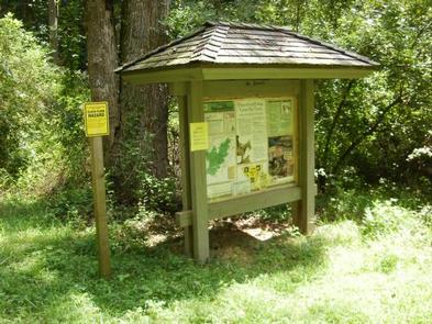
As part of the Pisgah National Forest, a network of equestrian trails are available in the North Mills River, Trace Ridge and Wash Creek areas and are easily accessible with space for several horse trailers. Hiking, fishing and hunting are popular activities in the area. Some of these trails are shared by mountain bikers. Routes are marked with signs and colored blazes.

Facilities

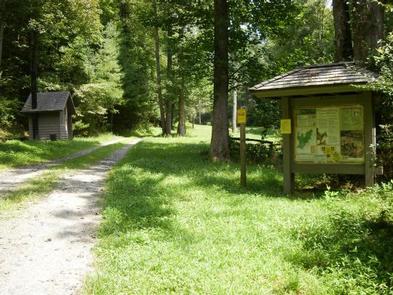
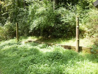
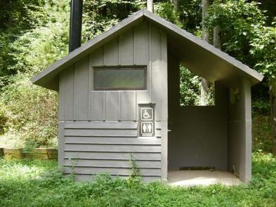
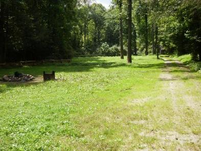
The campground has one site and a vault toilet and hitching posts for horses. This small group facility can accommodate 30 people and 10 vehicles.

Natural Features

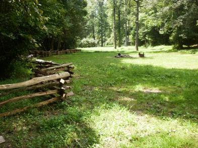
Wash Creek offers a remote hardwood forest setting with a small, shallow stream nearby.

Nearby Attractions

The site is 20 minutes from the North Mills River Recreation Area and 45 minutes from Lake Powhatan Recreation Area. It is approximately 1 hour from attractions in both Brevard and Asheville.

Reservation

More from CampingHiking.net:

Money Creek Campground, Washington Campground Images, Info & Reservations

Listen Directions From Everett, Washington, take Highway 2 toward Monroe. From Monroe go east approximately 30 miles to campground sign. Turn south and travel a mile to campground. Phone 360-419-5115 Activities BIKING, CAMPING, FISHING, HIKING Keywords MONE,MT. BAKER-SNOQU NF – FS Related Link(s) Rec Area Info & Images Washington State

HILLTOP CAMPGROUND, Arizona Campground Images, Info & Reservations

Listen Directions From Phoenix, Arizona: Traveling Northbound on I-17 take Exit 262 onto Hwy 69 North to Prescott and cointnue on Hwy 69 for 30 miles to S Walker Rd. Turn left and proceed South on S. Walker Rd. (by Costco, Petsmart, and AM/PM gas station). Drive about 3.8 miles

WATSADLER, Georgia Campground Images, Info & Reservations

Listen Directions Watsadler Campground Address: 286 Watsadler Road, Hartwell, Ga 30643. From I-85 North in Georgia, take exit 177 onto Highway 77 towards Hartwell, Georgia. In Hartwell, take Hwy 29 North towards Anderson, South Carolina. Continue approximately 4 miles, take a Left onto Watsadler Road; entrance will be a short

NORTH RIM CAMPGROUND, Arizona Campground Images, Info & Reservations

Listen Directions North Rim Campground is 210 driving miles (4.5 hours) north of Mather Campground on the South Rim. This facility is located at the end of State Highway 67, about 41 miles south of Jacob Lake, Arizona, 87 miles south of Kanab, Utah and 120 miles southwest of Page,

QUAIL PRAIRIE LOOKOUT, Oregon Campground Images, Info & Reservations

Listen Directions From Brookings and U.S. Highway 101, drive east on North Bank Chetco River Road (County Road 784). This becomes Forest Service Road 1376 in approximately 8 miles. Turn left after crossing the South Fork Bridge (16 miles from Brookings). Turn right on Forest Service Road 1917, approximately 1