ANDERSON MEADOW CAMPGROUND, UT Campground Reservation, Info, Images, Map, Directions

ANDERSON MEADOW CAMPGROUND, Utah Campground Images, Info & Reservations

Directions

Travel east of Beaver approximately 10 miles on SR 153, turn right on to Forest Road 137 for about 8 miles.

Phone

435-438-2436

Activities

CAMPING, FISHING, WILDLIFE VIEWING

Keywords

Anderson Meadow Campground,Anderson Campground

Related Link(s)

Rec Area Info & Images

Utah State Road Conditions

Utah State Tourism

Overview

Anderson Meadow Campground is nestled above Anderson Meadow Reservoir in the Fishlake National Forest. The area boasts spectacular high mountain scenery and excellent fishing.

Recreation

Fishing for brook and rainbow trout in the eight-acre Anderson Meadow Reservoir is popular from either the shoreline or small non-motorized boat. Trailheads to the Piute ATV trail are close by.

Facilities

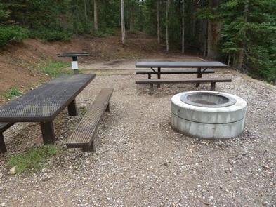
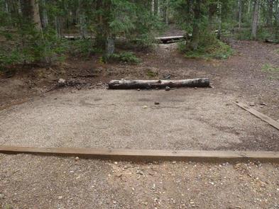
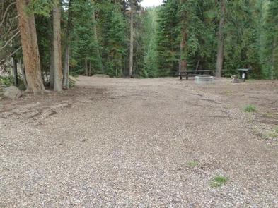
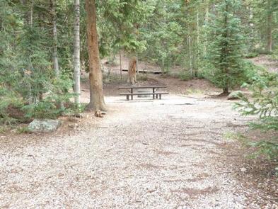
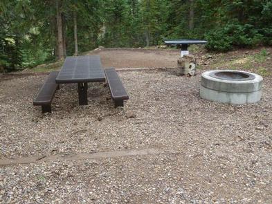
Anderson Meadow Campground has eight single family campsites and two multiple family campsites. Sites are back-in only and will accommodate 24 to 40 feet long trailers. All units have prep tables, campfire rings and picnic tables. Drinking water is available throughout the campground. There are two vault toilets in the campground. Camping limit is 14 days.

No hook-ups or dump station are available. The nearest dump station is located in Beaver, Utah.

Natural Features

The campground is surrounded by a mix of aspen and conifers. The trees provide a range of shade depending on campsite locations with a majority of the sites well-shaded.

The Fishlake National Forest offers spectacular vistas and opportunities to view wildlife in their natural habitat. Elk, deer, black bear, moose, cougar and mountain goats are some of the large animals that call the forest home.

Nearby Attractions

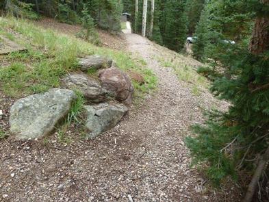
The Piute ATV Trail is nearby; however there is no access directly from the campground. Be prepared to trailer ATVs to the nearby trailheads for access.

Reservation

More from CampingHiking.net:

SALTHOUSE BRANCH, Virginia Campground Images, Info & Reservations

Directions From US 220, turn onto Henry Road (SR-605), go 6 miles; turn left onto Knob Church Road and go 2 miles. Turn left onto Salthouse Branch Road and follow signs to the entrance. GPS Users: Do not use SR-727 (Stoney Brook Lane) or SR-894 (Johnson Hill Road). Phone (540)

BACKBONE ROCK CAMPGROUND, Tennessee Campground Images, Info & Reservations

Directions Highway TN 133 north from Highway 91. The campsite is on Highway 133, just north of Backbone Rock. Phone 423-735-1500 Activities BIKING, CAMPING, FISHING, HIKING, HUNTING, WILDLIFE VIEWING, SWIMMING, STAR GAZING, SCENIC DRIVE, BACKPACKING, ROCK CLIMBING Keywords Related Link(s) Rec Area Info & Images Tennessee State Road Conditions Tennessee

PINEY POINT, Texas Campground Images, Info & Reservations

Directions From Texarkana, take Highway 59 south to Wright Patman Lake. Just south of Sulphur River Dam, turn right into the park area, following signs. Proceed one mile to the park. Piney Point is just north of Rocky Point Park. Phone 903-796-0684 Activities BOATING, CAMPING, FISHING, HIKING, WATER SPORTS Keywords

GRAYS MEADOWS, California Campground Images, Info & Reservations

Directions Grays Meadows is 6 miles west of the town of Independence, California. Take U.S. Highway 395 to Independence. Turn west on Market Street (which turns into Onion Valley Road) and follow for 6 miles. The first gate accesses sites 36-52. The second gate is 0.25 miles up the road

WHEELER GORGE, California Campground Images, Info & Reservations

Directions From Ventura, take Highway 33 north about 14 miles. Turn left, continuing on Highway 33 for another 8 miles to the campground. From Los Angeles, take I-5 north, then turn west onto Highway 126 for about 28 miles, to Santa Paula. Continue north on Highway 150 for 16 miles.