FALL RIVER CAMPGROUND, OR Campground Reservation, Info, Images, Map, Directions

FALL RIVER CAMPGROUND, Oregon Campground Images, Info & Reservations

Directions

From Bend, OR: Travel 17.3 miles south on Hwy 97, then 12.2 miles southwest on County Road 42.

Phone

541-323-1746

Activities

CAMPING

Keywords

Related Link(s)

Rec Area Info & Images

Oregon State Tourism

Oregon State Road Conditions

Overview

Fall River Campground is located along Fall River within the Deschutes National Forest west of La Pine. 

Recreation

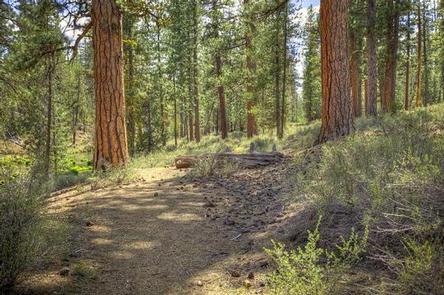
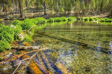
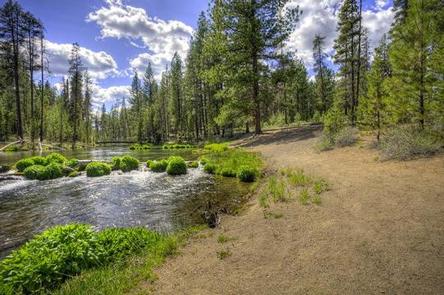
Campers can enjoy the nearby Fall River Trail which offers frequent views of crystal clear Fall River. This trail can be accessed from one of three Fall River Trailheads. Visitors can also enjoy fishing on Fall River although it is limited to fly fishing only.

Facilities

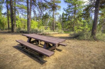
Fall River Campground sites tend to be on the smaller side without any RV hookups or services. Campers will need to provide their own water supply. All sites are equipped with a picnic table and campfire ring with grill and the campground has vault toilets available.

Natural Features

Fall River’s headwaters bubble from the ground approximately 1/4 mile from the campground. The river meanders through the forest before joining the Deschutes River. Legal-sized brook and rainbow trout are stocked several times a year.

Nearby Attractions

Fall River Trail leaves from this campground and follows the river.

Reservation

More from CampingHiking.net:

FISH CREEK PAVILION, Idaho Campground Images, Info & Reservations

Directions From Grangeville, head south on Grangeville-Salmon Road for approximately 7 miles to the Fish Creek Meadows area. Turn right onto Forest Road 4600. The entrance to Fish Creek Pavilion is located 300 feet ahead on the left. Phone 208-983-1950 Activities CAMPING, HIKING, HORSEBACK RIDING Keywords None Related Link(s) Rec

Goose Island Group Sites, Utah Campground Images, Info & Reservations

Directions From Moab, drive north on Highway 191 to the junction of State Route 128. Drive two miles on SR 128 to the entrance to Goose Island campground. The group sites are at the far end of the campground. Phone 435-259-2100 Activities AUTO TOURING, BIKING, CAMPING, PHOTOGRAPHY, MOUNTAIN BIKING, SCENIC

DUTCH JOHN DRAW CAMPGROUND, Utah Campground Images, Info & Reservations

Directions The campground is located 2 miles north of Flaming Gorge Dam on U.S. Highway 191. Turn west onto Forest Road 695 and travel a mile to the site. Phone 435-889-3000 Activities BOATING, CAMPING, FISHING, SWIMMING SITE Keywords Dutch John,DUTC,FLAMING GORGE,ASHLEY NF – FS,Flaming Gorge National Recreation Area Related Link(s)

QUAKING ASPEN CABIN, California Campground Images, Info & Reservations

Directions From Porterville, California, take Highway 190 east. Continue through Springville for approximately 28 miles to the Quaking Aspen Campground. From Bakersfield, California, take Highway 65 North to Highway 190 east. Continue for approximately 28 miles to the campground. Phone 559-539-5230 Activities BIKING, CAMPING, FISHING, HIKING, HORSEBACK RIDING, HUNTING, WILDLIFE