ELK LAKE CAMPGROUND, OR Campground Reservation, Info, Images, Map, Directions

ELK LAKE CAMPGROUND, Oregon Campground Images, Info & Reservations

Directions

From Bend, travel 33.1 miles southwest on Cascade Lakes Hwy (46) to north end of Elk Lake.

Phone

541-323-1746

Activities

CAMPING

Keywords

Related Link(s)

Rec Area Info & Images

Oregon State Tourism

Oregon State Road Conditions

Overview

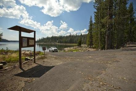
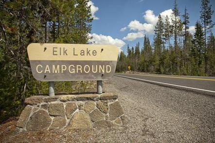
Elk Lake Campground is located on the north end of Elk Lake along the Cascade Lakes National Scenic Byway.

Recreation

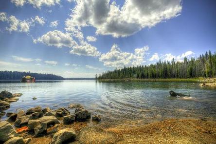
Both motorized and non-motorized boating are allowed on Elk Lake providing the opportunity for swimming, fishing, windsurfing and water skiing. Hiking and horseback riding are popular activities on the Elk-Devils Trail, which follows an historic route from Elk Lake to the Wickiup Plains Trail, just west of Devils Lake.

Facilities

Elk Lake Campground can accommodate RV, trailer or tent-campers, however, electric hookups are not available. All sites are equipped with a picnic table and campfire ring with grill. The campground has drinking water and vault toilets available. This campground also features a boat ramp to provide access to Elk Lake.

Natural Features

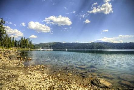
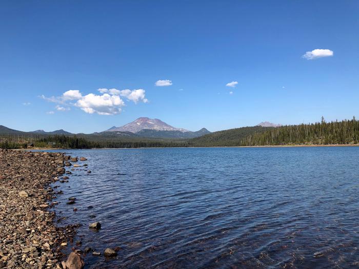
Elk Lake offers magnificent views of South Sister, Mt. Bachelor and numerous other mountainous features. Wetlands, diverse forests and rocky slopes near the campground provide habitat for shorebirds, porcupine, deer, bats and the occasional black bear.

Nearby Attractions

Visitors enjoy traveling the Cascade Lakes Scenic Byway which climbs from Central Oregon’s high desert floor into the Cascade Range on a 66-mile drive winding through snow-capped peaks and alpine lakes.

Reservation

More from CampingHiking.net:

QUAIL PRAIRIE LOOKOUT, Oregon Campground Images, Info & Reservations

Directions From Brookings and U.S. Highway 101, drive east on North Bank Chetco River Road (County Road 784). This becomes Forest Service Road 1376 in approximately 8 miles. Turn left after crossing the South Fork Bridge (16 miles from Brookings). Turn right on Forest Service Road 1917, approximately 1 mile

COYOTE POINT, California Campground Images, Info & Reservations

Directions From Stockton California, take Highway 26 east for 30 miles. Turn right on Hogan Dam Road and continue for a mile, then follow signs to the campground. Park Headquarters: 2713 Hogan Dam Road Valley Springs, CA 95252 Coyote Point (located in Oak Knoll Campground): 3027 South Petersburg Road Valley

RIVER ROAD, Arkansas Campground Images, Info & Reservations

Directions From Ola, Arkansas, take Route 7 south for 9 miles to the Access Road and follow the signs to the campground. Phone 479-272-4835 Activities BOATING, CAMPING, FISHING Keywords RRAR,NIMROD LAKE,PROJECT POINT,NIMROD LAKE Related Link(s) Rec Area Info & Images Arkansas State Tourism Arkansas State Road Conditions Overview River Road

PENDLETON BEND, Arkansas Campground Images, Info & Reservations

Directions From Dumas, Arkansas, take US-165 north for 9 miles to State Route 212. Head east for 2 miles and follow signs to the park. Phone 870-548-2291 Activities BOATING, CAMPING, FISHING, HIKING, HUNTING, DAY USE AREA, BIRDING Keywords PEND,PENDELTON,WILBUR D.MILLS LOCK AND DAM,WILBUR D MILLS LOCK Related Link(s) Rec Area

HUME LAKE, California Campground Images, Info & Reservations

Directions From Fresno, take Highway 180 east to the Park Wye. Go left and continue on Highway 180, past Grant Grove for 12.25 miles. Turn right on Hume Road and continue 3 miles to Y intersection. Take the road to the left 0.5 mile to Hume Lake Campground entrance. Phone

LAKE FORK CAMPGROUND, Colorado Campground Images, Info & Reservations

Directions Lake Fork campground is located off of Hwy 50 between Gunnison and Montrose, along Blue Mesa reservoir. Phone 970-641-2337 Activities BIKING, BOATING, CAMPING, FISHING, HIKING, HUNTING, WATER SPORTS, WILDLIFE VIEWING, SWIMMING SITE Keywords LAFO,CURECANTI NATIONAL RECREATION,CURECANTI Related Link(s) Rec Area Info & Images Colorado State Road Conditions Colorado State