
Directions
From 395 North:
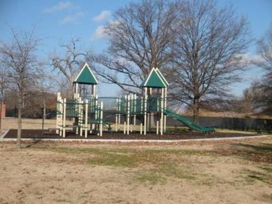
Take 395 NORTH across the 14th Street Bridge. Take Exit #2 POTOMAC PARK/PARK POLICE. Follow the signs towards Hains Point. Turn Left onto Buckeye Dr. Take a right onto Ohio Dr. Keep straight to the tip of the point. The picnic area is fenced in where the two playgrounds are located.
From 395 South:
Take the Exit #2 towards POTOMAC PARK/PARK POLICE. Turn right at the end of the ramp onto Ohio Dr. Follow the signs towards Hains Point. Keep straight to the tip of the point. The picnic area is fenced in where the two playgrounds are located.
Phone
202-245-4715
Activities
BIKING, FISHING, OTHER RECREATION CONCESSION SITE
Keywords
Hains Point Picnic Area,East Potomac Park
Related Link(s)
District of Columbia State Road Conditions
District of Columbia State Tourism
Overview
Hains Point Picnic Areas are located in East Potomac Park. Reservations for picnic areas (A, B, C, D) are required seven days a week (Sunday through Saturday) all year-round.
Recreation
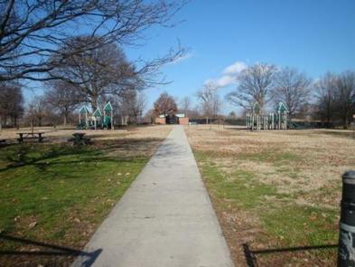
Hains Point Picnic Areas are a convenient spot to have a picnic near the water. Other popular activities on Hains Point include fishing, bicycling, running, and playtime for the kids on the playground.
Facilities
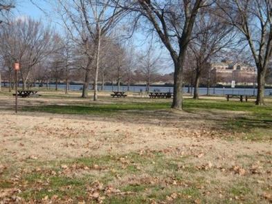
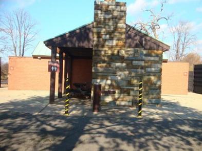
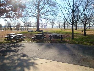
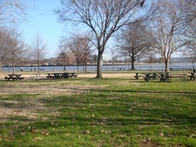
Hains Point offers four picnic areas for reservation (Areas: A, B, C, D). Each area accommodates up to 75 people. Picnic areas include limited picnic benches with no shelters. A public restroom is located in the area. Limited parking is available. There are no electrical outlets and grills are not provided.
Picnic areas can be reserved for half day $90.00 (Week Days: 8:00 a.m. – 2:00 p.m. or 3:00 p.m. – 8:00 p.m.; Weekends: 9:30 a.m. – 2:00 p.m. or 3:00 p.m. – 8:00 p.m.); full day $180.00 (Week Days: 8:00 a.m. – 8:00 p.m.; Weekends: 9:30 a.m. – 8:00 p.m.).
Natural Features
Hains Point is at the southern tip of East Potomac Park, and offers beautiful views of the Potomac River, Anacostia River and the Washington Channel. Surrounded by beautiful greenery and trees, the area is a popular destination for a delightful picnic and relaxation.
Nearby Attractions
East Potomac Park offers additional attractions managed by outside agencies including the East Potomac Swimming Pool (DC Department of Parks and Recreation) and the East Potomac Golf Course.
Other local attractions within approximately a five-mile radius include: Jefferson Memorial, Lincoln Memorial, Washington Monument, Franklin D. Roosevelt Memorial, WWII Memorial, and the National Mall.