
Directions
From Pensacola or Mobile, or other points east on I-10: Travel west to Exit 57, Gautier/Ocean Springs. Turn left (South) onto MS Hwy 57. Travel 1/2 mile and take a right at the red light (Hwy 90). Look for brown sign on right, Park road on left. Stay straight to enter Gulf Islands National Seashore, Davis Bayou. Follow signs to Davis Bayou Campground and Registration Office.
From Pascagoula or other points east on Hwy 90: Travel west on Hwy 90 until you enter Ocean Springs city limits. Take a left on Park Road, entering Gulf Island National Seashore Parkway. Stay straight to enter the Visitor Center. Follow signs to Davis Bayou Campground and Registration Office.
From Gulfport, Biloxi or other points west on Hwy 90: Travel east on Hwy 90 until you enter Ocean Springs city limits. Take a right onto Park Road, entering Gulf Island National Seashore Parkway. Stay straight to enter the Visitor Center. Follow signs to Davis Bayou Campground Registration Office.
From New Orleans, Slidell, Diamondhead or other points west on I-10: Travel east to Exit 50 MS 609/Ocean Springs. Keep right (South) on Washington Ave. toward Ocean Springs. In 2.5 miles turn left at the Red Light onto Bienville Blvd/Hwy 90 east. Turn right on Park Road entering Gulf Islands National Seashore Parkway. Stay straight to enter the Visitor Center. Follow signs to Davis Bayou Campground and Registration Office.
Phone
228-230-4136
Activities
BOATING, CAMPING, FISHING, HIKING
Keywords
DAVIS BAYOU CAMPGROUND,DAVIS,DAVIS BAYOU
Related Link(s)
Mississippi State Road Conditions
Overview
Davis Bayou Campground is located east of downtown Ocean Springs, Mississippi, and is a part of Gulf Islands National Seashore. Visitors enjoy the campground for its easy access to boating, fishing, biking and hiking trails.
Recreation
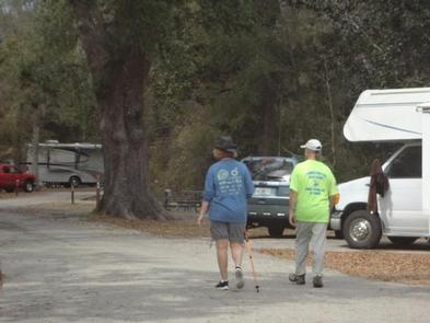
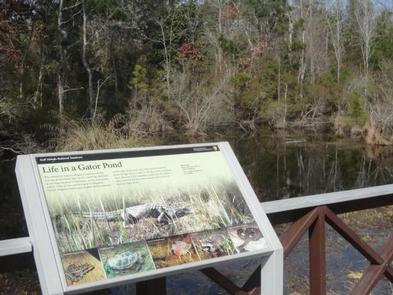
Davis Bayou offers many recreational opportunities for visitors year-round such as fishing, boating, biking, bird watching, picnicking and attending ranger-led programs. Visitors may also enjoy hiking along the Davis Bayou Trail, which takes visitors through a coastal forest and over two local bayous, with an opportunity to see alligators and other reptiles. The campground offers easy access, a 1/2 mile, to the park’s boat launch, as well as the scenic Davis Bayou Trail. The fishing pier, located near the Visitor Center, may be used by visitors who possess a Mississippi State Saltwater Fishing License.
Facilities
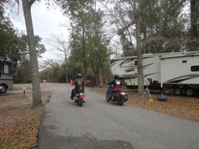
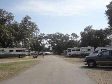
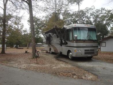
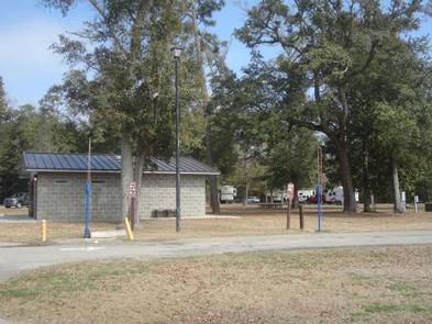
This small, yet quaint, campground is open for reservations year-round. It contains 52 sites with electric and water hookups. Sites can accommodate tents and RVs, big or small. The majority of the sites are 40+ feet in length.
A group site, with water hookup, is also available to parties with a minimum of 10 individuals and a maximum of 40. Amenities include flush toilets, showers, drinking water and a dump station.
Natural Features
The campground is nestled among live oaks and pine trees and is adjacent to a saltwater marsh. Most campsites offer some shade throughout the day and all offer a tranquil setting for migratory bird watching and picnicking.
Nearby Attractions
Davis Bayou is home to many of the park’s highly visited barrier islands, such as Horn, Petit Bois, East Ship and West Ship islands. Private boaters may enjoy fishing and swimming, as well as beach combing and bird watching. Private boaters may also enjoy island camping on all islands except West Ship Island, which is only open to visitors from sunrise to sunset. The barrier islands are accessible by boat only, therefore you may visit with your own boat or by private charter. Visitors may call 228-875-9057, ext. 114, for a list of park-approved licensed boat operators. Ferries run to West Ship Island from Gulfport, MS during the months March through October. For more information about the ferry service, please call Ship Island Excursions at 228-864-1014.