BUSH RECREATION AREA, PA Campground Reservation, Info, Images, Map, Directions

BUSH RECREATION AREA, Pennsylvania Campground Images, Info & Reservations

Listen

Directions

From Pittsburgh, take I-376 E (12.1 miles) keep left and continue onto US-22 E. Make a left at PA-981 N located in New Alexandria, PA near the Sheets gas station. Make a left onto Bush Road, passing Mannitto Golf Course, make another left into the Bush Recreation Area.

200 Boat Dock Road

New Alexandria PA, 15670

Phone

724-639-9013

Activities

CAMPING, DAY USE AREA

Keywords

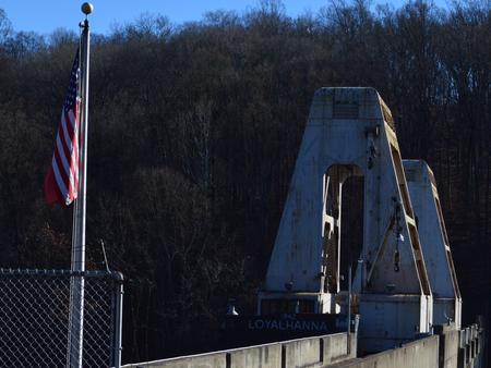
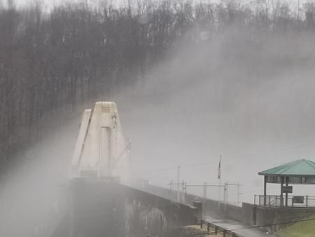
Loyalhanna Recreation Area,Loyalhanna Dam

Related Link(s)

Rec Area Info & Images

Pennsylvania State Road Conditions

Pennsylvania State Tourism

Overview

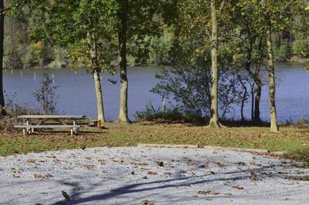
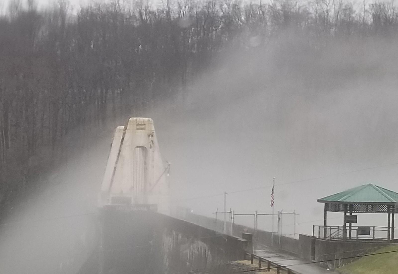
The Bush Recreation Area is located next to the scenic Loyalhanna Lake. This location provides picturesque views of the lake as well as opportunities for bird watching, boating, fishing, hunting and paddle sports.

Recreation

The Bush Recreation Area offers boating with unlimited horse power. Visitors to the area can kayak or canoe the lake as well, and take advantage of kayak rentals located in the Bush Recreation Area.
The Loyalhanna Lake offers great fishing opportunities, with multiple bass tournaments each year. This lake also has some of the best channel catfishing in Pennsylvania, with multiple fish stockings each year. If you like fishing from shore there are plenty of opportunities to fish both moving and still waters.
Those that like to go bike riding can find the West Penn Trail located at our sister project just 10 minutes away.

Facilities

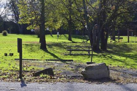
This campground has a variety of sites available from full RV hookup to primitive tent camp sites. Picnic tables and campfire grill rings are equipped at every campsite.
Patrons at the campground will have access to flushing toilets, drinking water, showers and a dump station.

Natural Features

The campground is located in a beautiful valley overlooking Loyalhanna Lake. Among terrain characterized by its diversity, visitors will discover rolling foothills of the Laurel Highlands, from which the headwaters of the Loyalhanna Creek flow.

Nearby Attractions

The West Penn Trail offers excellent hiking and biking opportunities within a short 10 minute drive. Additionally the site of Loyalhanna dam provides interpretive displays of the dam as well as a great scenic view.

Reservation

More from CampingHiking.net:

PINEY POINT, Texas Campground Images, Info & Reservations

Listen Directions From Texarkana, take Highway 59 south to Wright Patman Lake. Just south of Sulphur River Dam, turn right into the park area, following signs. Proceed one mile to the park. Piney Point is just north of Rocky Point Park. Phone 903-796-0684 Activities BOATING, CAMPING, FISHING, HIKING, WATER SPORTS

BOULDER GULCH, California Campground Images, Info & Reservations

Listen Directions From Highway 99 in Bakersfield, California, take Highway 178 east to the town of Lake Isabella. Take Highway 155 around the west side of Lake Isabella for 4 miles to the campground entrance. Phone 760-376-1815 Activities CAMPING, HIKING Keywords BOGU,LAKE ISSABELLA,KERN VALLEY,SEQUOIA NF – FS Related Link(s) Rec

COOKSON BEND, Oklahoma Campground Images, Info & Reservations

Listen Directions From Tahlequah, OK go 17.5 miles southeast on Highway 82. Look for sings for Tenkiller and turn right, then go two miles west on the paved access road. Phone 918-487-5252 Activities BOATING, CAMPING, SWIMMING SITE Keywords COBE,TENKILLER LAKE,TENKILLER FERRY LAKE,TENKILLER FERRY Related Link(s) Rec Area Info & Images

STONEY GROUP SHASTA-TRINITY, California Campground Images, Info & Reservations

Listen Directions From I-5 in Redding, California, take 299 west to Weaverville. Go north on State Highway 3 for 14 miles. The campground is on the left. Phone 530-275-8113 Activities BOATING, CAMPING, FISHING, WATER SPORTS, SWIMMING SITE Keywords STON,STONEY GROUP SHASTA TRINITY,SHASTA-TRINITY -FS Related Link(s) Rec Area Info & Images

EAST FORK CABIN, Montana Campground Images, Info & Reservations

Listen Directions From Sula, travel northwest on Highway 93 for less than a mile. Turn northeast (right) onto East Fork Road/County Road 472 and continue about 16 miles to the cabin. Maps may be purchased by calling the Darby-Sula Ranger District at 406-821-3913. Phone 406-821-3913 Activities HISTORIC & CULTURAL SITE,

WINHALL BROOK, Vermont Campground Images, Info & Reservations

Listen Directions From Brattleboro, Vermont, travel 30 miles north on Route 30. Turn north onto Route 100 and continue for 2.5 miles. Turn onto to Winhall Station Road and follow for a mile to the campground. From Manchester, Vermont, travel 5 miles east on Route 11. Turn right onto Route