
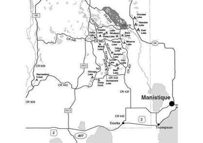
Directions
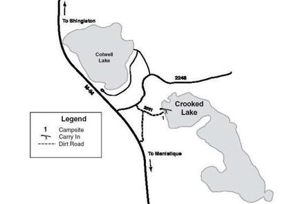
From Manistique drive north 25 miles on M-94 to FR 2246 (Clear Lake Road). Turn right (east) and drive 0.15 mile to FR 2661. Turn right (southeast) and drive 0.25 mile south of Forest Road 2246 on the hard-pack, sandy road.
Phone
906-474-6442 OR 906-387-2512
Activities
CAMPING
Keywords
Dispersed campsites,Manistique,Rapid River,lyman lake,swan lake,bass lake,bear lake,camp cook,carr lake,chicago lake,clear lake,crooked lake,east lake,gooseneck lake,ironjaw lake,jackpine lake,lake nineteen,leg lake,little bass lake,minerva lake,mowe lake
Related Link(s)
Michigan State Road Conditions
Overview
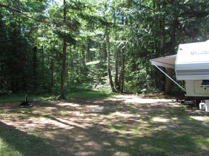
The campsites on the Rapid River/Manistique Ranger District are located on inland lakes and are in a rustic forest environment with few, if any amenities. The rustic environment offers a wonderfully serene and peaceful setting for your next camping experience.
Recreation
Visitors will be able to enjoy swimming, berry picking, and fishing at these campsites. Licenses are required for fishing in Michigan waters. Some of these campsites offer only one site on these inland lakes allowing for a very peaceful and wilderness-like experience.
Facilities
Although there is only one campsite on Crooked Lake, the lake is busy with a private resort and many private homes and cabins dotting its lengthy shoreline. Anglers will find good fishing for bluegill, crappie and northern pike, and some small mouth bass are also occasionally caught. Boat access to the lake is by carry-in only, which can be found at the campsite. There are no toilets or drinking water at this site.
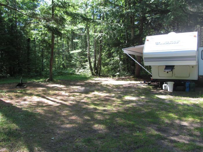
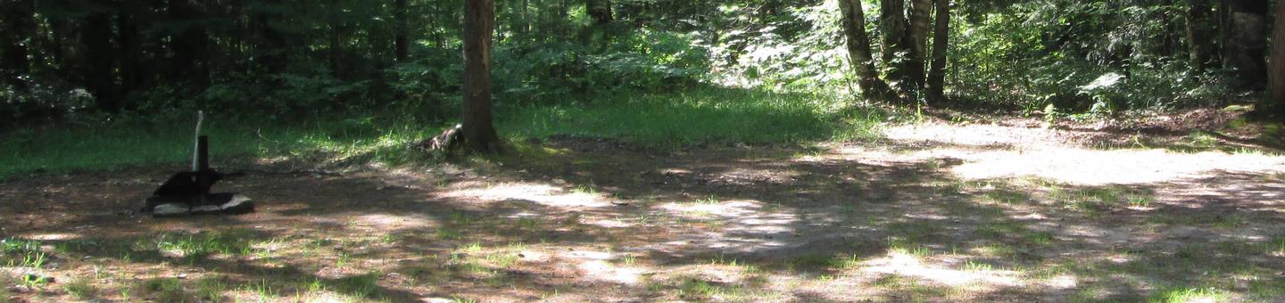
There is only one primitive campsite on Crooked Lake. It is small (35 ft. by 35 ft.), level and suitable for one family and a trailer. Swimming is considered to be poor. Keep in mind that the boat access must be shared with the public, and anglers may pass through your campsite to access the lake.
Gasoline, groceries, fishing and camping supplies, boat rentals, ice and MDNR licenses are available at Steuben, approximately four miles southwest, on County Road 437.
| Lake Name | Number of Sites | Maximum number of people per site | Toilets | Boat Access | Lake Size (acres) |
|---|---|---|---|---|---|
| Crooked Lake | 1 | 8 | No | Cl | 190 |
Natural Features
All of these sites are nestled in hardwood trees and pines. All of them are on small inland lakes, which offer a wide variety of fishing opportunities. There is one exception; Camp Cook, which is close to the Fishdam River and provides opportunities for good brook trout fishing.
Nearby Attractions
There are a number of horse, bike, and hiking trails within minutes of several of the sites. In over a mile from these campsites, visitors can expect to find: bait shops, general and grocery stores, gas, a pay phone, trailheads, a fishing pier, biking, and kayak/canoe rentals.