ALLEN SPRINGS CAMPGROUND, OR Campground Reservation, Info, Images, Map, Directions

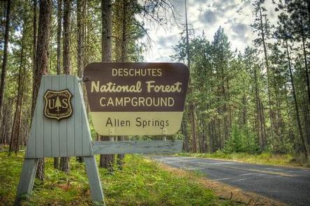
ALLEN SPRINGS CAMPGROUND, Oregon Campground Images, Info & Reservations

Directions

From Sisters OR: Travel 9.6 miles northwest on Highway 20, then 11.1 miles north on Forest Road 14.

Phone

541-323-1746

Activities

CAMPING

Keywords

Related Link(s)

Rec Area Info & Images

Oregon State Tourism

Oregon State Road Conditions

Overview

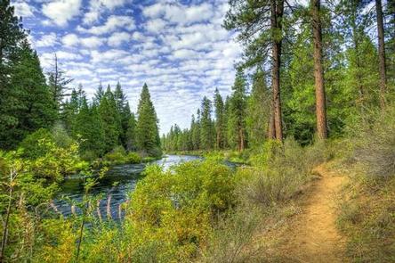
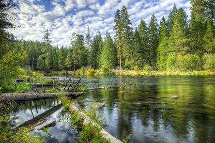
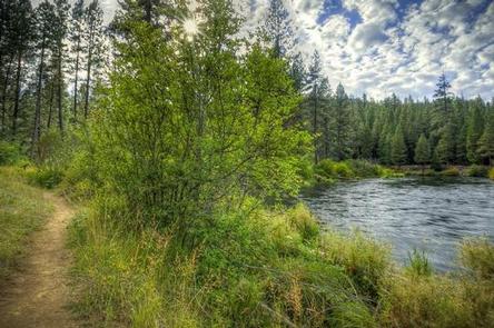
Like the other campgrounds on the Metolius, Allen Springs is located amongst towering Ponderosa Pines, on a turn of the Metolius River that broadens the river view. Most of the campsites are better suited to tents rather than RV’s.

Recreation

This campground offers many opportunities for hiking and biking with the many trails nearby. The ponderosa pine forest provides shade as well as the chance to go bird or nature watching.

Facilities

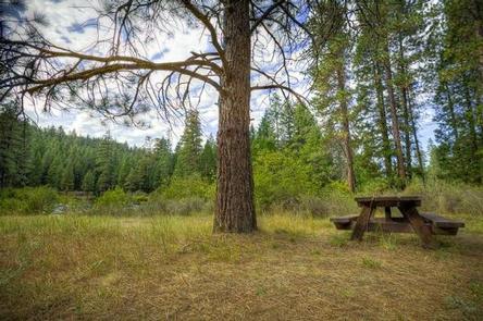
This facility has 16 sites that are nestled along the Metolius River. The circular shape of the campground means most of the campsites are better suited to tents rather than RVs. Allen Springs is a No Water campground so campers will need to bring their own supply. Each site is equipped with a picnic table and fire pit. We do have vault toilets onsite There is also a small picnic area onsite.

Natural Features

Nestled in the forest with near the Metolius River. Allen Springs Campground is a great shady family spot with short hikes all around.

Nearby Attractions

The close proximity to the town of Sisters offers many additional amenities and attractions, as well as the nearby Sisters Wilderness Trails.

Reservation

More from CampingHiking.net:

ARROYO SECO, California Campground Images, Info & Reservations

Directions Coming from the south on Highway 101 to Greenfield, take the first exit (Arroyo Seco) into town. Turn left on Elm Street and go west to Arroyo Seco Road and turn left. Arroyo Seco Road dead-ends at the campground. Coming from the north on Highway 101, just past Soledad,

GROOM CREEK SCHOOLHOUSE, Arizona Campground Images, Info & Reservations

Directions From Phoenix, Arizona, take I-17 north for 61.8 miles. Take exit 262 toward Cordes Junction/Prescott. Merge onto State Route 69 west and follow for 33.8 miles. At the split, take the ramp for Route 89 south. Turn slight left onto East Gurley Street/89 and follow for about 0.8-mile. Turn

NOISY CREEK, Washington Campground Images, Info & Reservations

Directions Campground is located ninety miles north of Spokane, Washington. From the junction of State Highway 20, take Highway 31 north for three miles to the junction of the Sullivan Lake Road (County Road 9345Follow the Sullivan Lake Road for 8 miles to the campground entrance. The campground is located

SULPHUR CAMPGROUND, Wyoming Campground Images, Info & Reservations

Directions From Evanston, Wyoming, take Utah Highway 150 (Mirror Lake Scenic Byway) south for 39 miles. Sulphur Campground is on the west side of the highway. From Kamas, Utah, take Center Street east. It becomes Utah Highway 150 (Mirror Lake Scenic Byway). Travel about 40 miles. There will be a

SPRING CREEK CAMPGROUND, Idaho Campground Images, Info & Reservations

Directions From Weiser, Idaho, travel north on Highway 95 for approximately 12 miles, then turn onto Upper Mann Creek Road/Forest Road 009 and travel another 18 miles to the campground. Phone 208-549-4200 Activities BIKING, CAMPING, FISHING, HIKING, HUNTING, WILDLIFE VIEWING, DAY USE AREA Keywords SPCK,SPRING CREEK GROUP SITE,SLEEPING SPRINGS INTERPRETATION,PAYETTE