CULTUS LAKE CAMPGROUND, Oregon Campground Reservation, Info, Images, Map, Directions

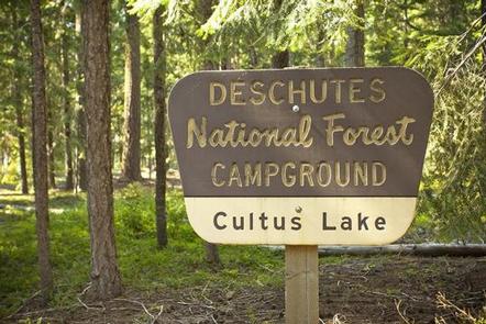
CULTUS LAKE CAMPGROUND, Oregon Campground Images, Info & Reservations

Directions

From Bend, OR: Travel 46 miles southwest on Cascade Lakes Hwy (46), then west on Forest Road 4635 for 2 miles.

Phone

541-323-1746

Activities

BIKING, BOATING, CAMPING, FISHING, HIKING, MOTOR BOAT, MOUNTAIN BIKING, JET SKIING, AMPHITHEATER

Keywords

Related Link(s)

Rec Area Info & Images

Oregon State Road Conditions

Oregon State Tourism

Overview

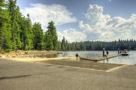
Cultus Lake is one of the few lakes along the Cascade Lakes National Scenic Byway that allows high speed motorized water craft. Cultus Lake Campground offers opportunities for waterskiing, windsurfing, swimming, sailing and jet skiing, as well as, access to trails leading into the Three Sisters Wilderness.

Recreation

Cultus Lake Campground offers opportunities for waterskiing, windsurfing, swimming, sailing and jet skiing, as well as, access to trails leading into the Three Sisters Wilderness.

Campers have the option to launch their boat from a walk-in boat launch located within the campground or the more developed boat launch located within the day use area.

Facilities

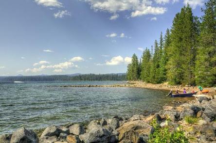
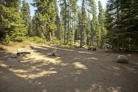
Cultus Lake Campground offers visitors 55 campsites suitable for tents, trailers and RVs under 30 feet. Larger RVs are not recommended due to narrow roads and smaller campsite sizes. The majority of campsites are well-shaded by the tree canopy with many sites offering water-front access. This facility has a number of vault toilets interspersed throughout the campground while each site comes equipped with a picnic table and a fire pit.

Nearby Attractions

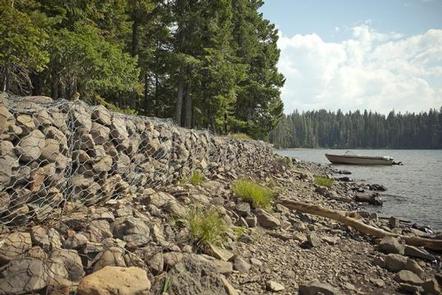
Cultus Lake Campground is located on the shore of Cultus Lake just a few miles off the Cascade Lakes Highway. The campground offers visitors access to boating on Cultus Lake, hiking in the Three Sisters Wilderness and exploring the rich volcanic hisotry of Central Oregon’s Cascades.

Reservation

More from CampingHiking.net:

JOHNSON GUARD STATION, Idaho Campground Images, Info & Reservations

Directions From Soda Springs, take Highway 34 north approximately 12 miles to the China Hat turnoff (Blackfoot River Narrows). This road will follow Blackfoot River for another 11 miles to a junction; there is a Forest Service sign at this point. Take the right fork (Caribou National Forest Road 102)

ACORN CAMPGROUND, California Campground Images, Info & Reservations

Directions From Stockton California, take Highway 26 east for 30 miles. Turn right on Hogan Dam Road and continue for a mile, then follow signs to the campground. Park Headquarters: 2713 Hogan Dam Road Valley Springs, CA 95252 Acorn Campground: 3027 South Petersburg Road Valley Springs, CA 95252 Phone 209-772-1343

SILESCA CABIN, Colorado Campground Images, Info & Reservations

Directions Follow Highway 90 southwest from Montrose. Watch for signs as the highway makes several turns as it weaves its way out of town. The pavement ends where the road begins to climb out of the Uncompahgre River Valley and enters lands administered by the Bureau of Land Management. In

KALALOCH, Washington Campground Images, Info & Reservations

Directions Kalaloch Campground is on Highway 101, 34 miles south of Forks, Washington, and 73 miles north of Aberdeen, Washington. Phone 360-565-3130 Activities CAMPING, HIKING, VISITOR CENTER, WILDLIFE VIEWING Keywords Clay-lock,Clay Lock,Olympic National Park Related Link(s) Rec Area Info & Images Washington State Tourism Washington State Road Conditions Overview Kalaloch