LAKE RUSSELL RECREATION AREA, GA Campground Reservation, Info, Images, Map, Directions

LAKE RUSSELL RECREATION AREA, Georgia Campground Images, Info & Reservations

Listen

Directions

Take Ga 365/U.S. 23 North from Gainesville past Cornelia to Hwy 197. Turn right for approximately 3 miles until dead-end. Right on Dicks Hill Parkway for approx.3/4 mile. Turn left onto the paved Lake Russell Road.

Phone

1-706-778-8427

Activities

CAMPING, FISHING, HIKING, SWIMMING SITE

Keywords

Related Link(s)

Rec Area Info & Images

Georgia State Road Conditions

Georgia State Tourism

Overview

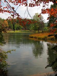
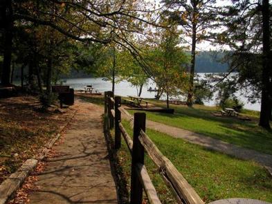
This North Georgia mountain mecca has something for everyone; swimming, camping, picnicking, hiking, biking, fishing and boating.

Recreation

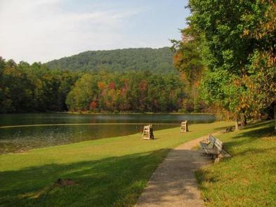
The campground has easy access to the beach area, boat ramp, and the adjacent Lake Russell Wildlife management area. There are numerous hiking and biking trails including the Lady Slipper Trail, Lake Russell Foot Trail, Rhododendron Trail and Sourwood Trail. Swimming, fishing and boating opportunities abound.

Facilities

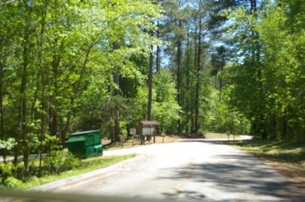
The campground offers 42 campsites for tents and RVs, however there are no hook ups. Campsites have a fire ring, picnic table and lantern hook. Water is available throughout the campground via water hydrants. Bathrooms are have flush toilets with showers.

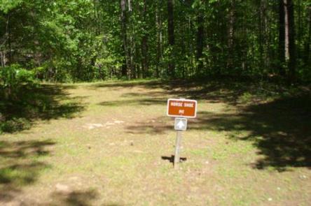
The campground area includes a grass covered beach and swimming area, picnic shelter/picnic area, biking, boat launch, fishing dock and dump station.

Natural Features

Nestled in the Chattahoochee Oconee Forest, 100-acre Lake Russell is an ideal summer camping location because of the cool mountain air. There are two paved campground loops for easy access to anything you might want to do here.

Nearby Attractions

Visitors to the area can enjoy exploring Anna Ruby Falls; Brasstown Bald Recreation Area (Georgia’s highest point); Cornelia, GA; and the Chenocetah Fire Tower.

Reservation

More from CampingHiking.net:

PINE ISLAND GROUP AREA, Wyoming Campground Images, Info & Reservations

Listen Directions Located 27 miles west of Dayton, Wyoming, on U.S. Highway 14. Phone 406-587-9054 Activities BIKING, BOATING, CAMPING, FISHING, HIKING, WILDLIFE VIEWING Keywords PIIS,PINE ISLAND,BIGHORN NF – FS Related Link(s) Rec Area Info & Images Overview Pine Island Group Area is located along the Bighorn Scenic Byway (U.S. Highway

EAST TWIN, Wisconsin Campground Images, Info & Reservations

Listen Directions Drive 4 miles north from Clam Lake on County Highway GG. Turn right (east) on Forest Road 190 and continue for about one mile to the campground. Phone (715) 634-4821 OR (715) 264-2511 Activities BIKING, BOATING, CAMPING, FISHING, HIKING Keywords EATW,CHEQUAMEGON-NICOLET NF – FS Related Link(s) Rec Area

UPPER TWILIGHT GROUP SITE, Arizona Campground Images, Info & Reservations

Listen Directions From Safford, Arizona: Take State Route 191 south for 6 miles. Turn right onto State Route 366/Swift Trail and travel 14.5 miles to the Twilight Campground entrance (MM 128.4), following the road for 1 mile to the Upper Twilight Group Site.  From Tucson, Arizona: Take I-10 East for

RIVERSIDE (ID – TARGHEE), Idaho Campground Images, Info & Reservations

Listen Directions From Ashton, Idaho, travel north on Highway 20 for 15 miles, take Riverside Campground turnoff, travel 1 mile to the campground entrance. Phone 208-558-7658 OR 208-270-0094 Activities CAMPING, FISHING, WILDLIFE VIEWING Keywords RIV1,RIVERSIDE TARGHEE,CARIBOU-TARGHEE NF – FS Related Link(s) Rec Area Info & Images Idaho State Road Conditions