TWIN CREEK CAMPGROUND GROUP CAMPING SITE, ID Campground Reservation, Info, Images, Map, Directions

TWIN CREEK CAMPGROUND GROUP CAMPING SITE, Idaho Campground Images, Info & Reservations

Listen

Directions

Twin Creek Campground Group Camping Site can be accessed from two directions on Highway 93. From North Fork, Idaho, travel 15 miles north on US 93, turn left on Forest Road 156 and travel an additional .5 miles. Turn left into the Group Camping Site. From the top of Lost Trail Pass travel 8.5 miles south on US 93, turn right on Forest Road 156, travel an additional .5 miles and turn left into the Group Camping Site.

Phone

(208)-756-5209

Activities

CAMPING

Keywords

Related Link(s)

Rec Area Info & Images

Idaho State Tourism

Idaho State Road Conditions

Overview

Twin Creek Group Camping Site is part of the larger Twin Creek Campground. This beautiful campsite is located 15 miles north of North Fork, Idaho, and is situated along Twin Creek at an elevation of 5,100 feet.

Recreation

The recreational opportunities are abundant in this corner of the Salmon-Challis National Forest. There are fishing opportunities in the North Fork of the Salmon River and in Twin Creek. For the hikers, there are numerous trails in the area but trails #6108 and #6109 are located just behind the campground (pick up a visitor map or contact the North Fork District Office for more information). During certain parts of the year berry picking can be excellent around the campground.

Facilities

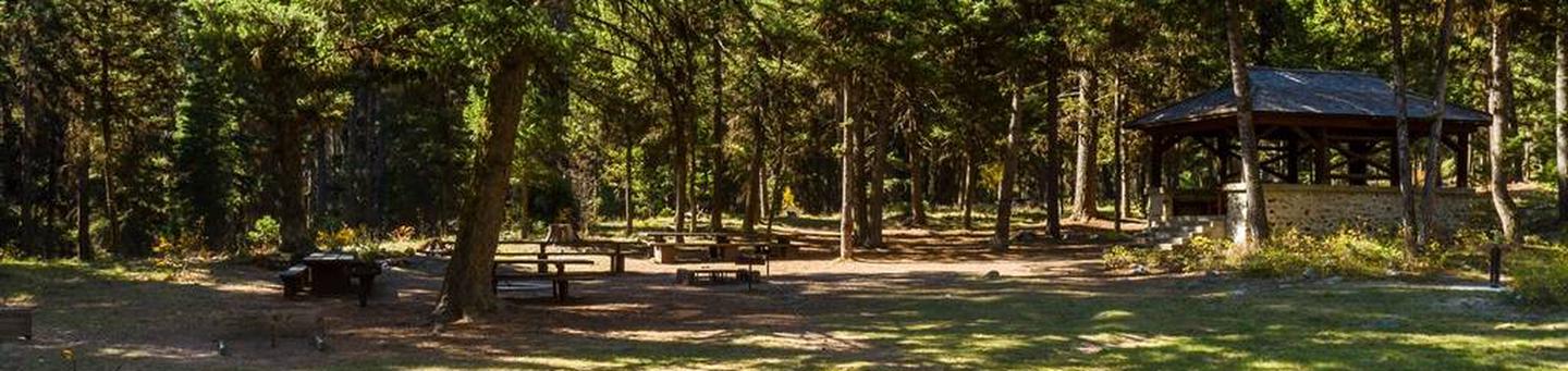
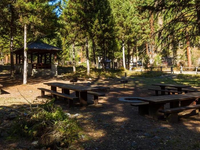
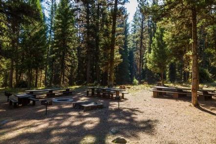
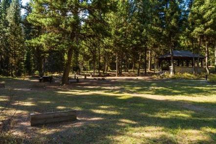
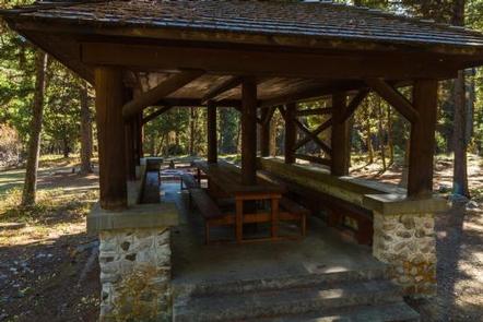
Twin Creek Campground Group Camping Site has numerous amenities including a large parking area (for multiple vehicles and or trailers), a double vault toilet, drinking water, four picnic tables (two of which are extra-long), a large fire ring, multiple barbeque pedestals, a large barbeque pit, a historic pavilion with a picnic table and benches, and two horseshoe pits. Electricity and water/sewer hookups are not available at this site/campground.

Natural Features

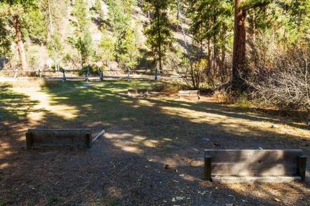
Twin Creek Campground Group Camping Site is located in the Twin Creek drainage near its confluence with the North Fork of the Salmon River. Large pine trees and brush surround the campsite offering plenty of shade and privacy.

Nearby Attractions

While you are in the area be sure to check out the beautiful Salmon River, located 15 south of the campsite. Also, brush up on some history and imagine you are Lewis and Clark as you travel along Highway 93, which contains portions of the Lewis and Clark National Historic Trail.

Reservation

More from CampingHiking.net:

HIGHWAY K, Missouri Campground Images, Info & Reservations

Listen Directions From Annapolis, MO, follow MO Highway K west for 5 miles. The park will be on the left, and is on both sides of the bridge. Phone 573-223-7777 (CLEARWATER LAKE PROJECT OFFICE) 573-558-2202 (HIGHWAY K GATEHOUSE) Activities BOATING, CAMPING, FISHING, SWIMMING SITE Keywords HIGW,CLEARWATER LAKE,CLEARWATER LAKE Related Link(s)

LAKE ALPINE – LODGEPOLE GROUP, California Campground Images, Info & Reservations

Listen Directions From Angel Camp, drive 50 miles east on Highway 4. Phone 209-753-6350 Activities BOATING, CLIMBING, CAMPING, INTERPRETIVE PROGRAMS, FISHING, HIKING, PICNICKING, RECREATIONAL VEHICLES, VISITOR CENTER, WILDERNESS, DAY USE AREA, SWIMMING SITE, SWIMMING, MOTOR BOAT, OFF ROAD VEHICLE TRAILS, PADDLE BOATING, WATER ACTIVITIES, KAYAKING, NON-MOTORIZED BOATING, DISC GOLF, SCENIC

CAMP CREEK, Oregon Campground Images, Info & Reservations

Listen Directions From Portland, travel east on Highway 26 for approximately 32 miles. Camp Creek Campground is located on the south side of the highway, about 3 miles past the community of Rhododendron. Phone 503-630-5721 Activities BIKING, CAMPING, FISHING, HIKING, VISITOR CENTER Keywords CACR,MT. HOOD NF – FS Related Link(s)

SOUTH RUBY CAMPGROUND, Nevada Campground Images, Info & Reservations

Listen Directions Take Interstate 80 to Highway 93. Exit at Wells and follow Highway 93 south for 30 miles to State Route 229. Follow State Route 229 for 15 miles, then head south on State Route 767 and County Road 788 for 30 miles, to the campground. Phone 775-752-3357 Activities

WALLASHUCK, Iowa Campground Images, Info & Reservations

Listen Directions 890 190th Ave Pella, Iowa 50219 Take County Highway G-28 4 miles west of Pella, then go 0.8 miles south on 190th Avenue. Phone 641-828-7522 Activities BIKING, BOATING, CAMPING, FISHING, HIKING, VISITOR CENTER Keywords WALA,LAKE RED ROCK Related Link(s) Rec Area Info & Images Iowa State Road Conditions