MCNARY BEACH - SOCKEYE SHELTER (OR), OR Campground Reservation, Info, Images, Map, Directions

MCNARY BEACH – SOCKEYE SHELTER (OR), Oregon Campground Images, Info & Reservations

Listen

Directions

From Highway 730 turn north onto Beach Access Road, drive for about a mile and then turn right onto McNary Beach Road and that will take you right into McNary Beach Park.

Phone

541-922-2268

Activities

FISHING, HIKING, HORSEBACK RIDING, DAY USE AREA, SWIMMING, CANOEING, WATER ACCESS

Keywords

Related Link(s)

Rec Area Info & Images

Oregon State Road Conditions

Oregon State Tourism

Overview

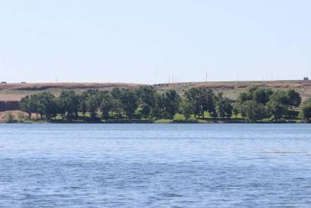
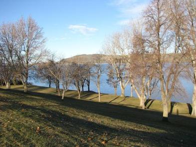
McNary Beach is located on Lake Wallula just upstream of McNary Lock and Dam in eastern Oregon on the Mid-Columbia River.

Recreation

The lake provides great boating opportunities with the Oregon Boat Ramp just downstream and a nice designated swimming area. The trailhead for the Lewis and Clark trail is also located at the east end of the park.

Facilities

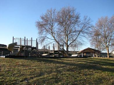
McNary Beach offers one day-use group picnic shelter with six tables and two fire grills.

Natural Features

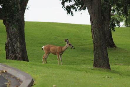
The park is situated along the bank of the Columbia River. Day users enjoy the relaxing shade of the mature trees throughout the park.

Nearby Attractions

McNary Dam is just downstream with the Pacific Salmon Visitor Center, Oregon Fish Viewing Room and the McNary Dam Wildlife Area with its beautiful natural trails.

Reservation

More from CampingHiking.net:

RIPPLEBROOK, Oregon Campground Images, Info & Reservations

Listen Directions From Estacada, travel east on Highway 224 for 26 miles to the campground, which is just past the Ripplebrook Camp Store. Phone 503-630-5721 Activities CAMPING, FISHING, WATER SPORTS Keywords RIPP,MT. HOOD NF – FS Related Link(s) Rec Area Info & Images Oregon State Tourism Forest Service Concessionaire Oregon

GROUP LANDING, Florida Campground Images, Info & Reservations

Listen Directions From the intersection of Hwy 441 and Hwy 90 in Lake City, FL, drive east on Hwy 90 for 12.6 miles. Turn left at the flashing light onto Pine Street. Cross over the railroad tracks. After about half a mile, you will see a sign directing you to

BEAVER LAKE, Wisconsin Campground Images, Info & Reservations

Listen Directions 61324 Beaver Lake Rd. (FR 199) From Mellen, Wisconsin, take County Highway GG west for about 8 miles. Turn right onto Forest Service Road 187/Mineral Lake Road and follow it about 3 miles to the intersection with Forest Service Road 198/Pine Stump Corner. Continue straight onto Forest Service