
Directions
From the North:
At the intersection of 280/64 West, turn onto 276 North.
-Go 11.7 miles.
Turn Right onto Yellow Gap Road (Forest Service Road 1206) – an unpaved, gravel road.
-Go 3.3 miles.
Turn Right onto South Mills River Road (Forest Service Road 475) – an unpaved, gravel road.
Wolf Ford Horse Camp will be immediately on your left.
From the South:
Turn onto 276 South.
-Go 18 miles.
Turn Left onto Yellow Gap Road (Forest Service Road 1206) – an unpaved, gravel road.
-Go 3.3 miles.
Turn Right onto South Mills River Road (Forest Service Road 475) – an unpaved, gravel road.
Wolf Ford Horse Camp will be immediately on your left.
Phone
828-877-3265
Activities
CAMPING, FISHING, HIKING, HORSEBACK RIDING, HUNTING, PHOTOGRAPHY, HORSE CAMPING, MOUNTAIN BIKING, STAR GAZING, BIRDING, SCENIC DRIVE, BACKPACKING
Keywords
Wolf Ford
Related Link(s)
Overview
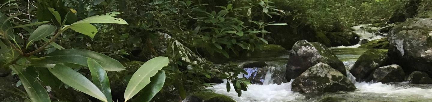
Wolf Ford Horse Camp is a reservation only campground located in the Pisgah Ranger District of Pisgah National Forest, near the town of Brevard. The campground is designed and intended for equestrian use. This campground provides access to a comprehensive network of multiple use trails, as well as creeks, streams, and waterfalls, which the Pisgah is known for. In addition to its many waterfalls, Pisgah Ranger District is famous for its scenic vistas and the Cradle of Forestry, which is located only a short 4 mile drive from the campground itself.
Wolf Ford Horse Camp is located 3.2 miles down Yellow Gap Road, gravel Forest Service Road 1206, therein providing a serene escape from the main visiting traffic on Highway 276. Consequently, this campground provides the perfect launching point to explore many different destinations in the Forest, including the Blue Ridge Parkway, 276 Corridor, and countless other waterfalls accessed off of the district’s many gravel Forest Service roads.
After you make your reservations online, we highly reccomend a stop to our visitor center located right off Route 276 near the forest entrance for help in creating your itinerary. The visitor center provides a wide variety of resources and local experts happy to answer any of your questions.
Recreation
Pisgah Ranger District contains over 100 miles of equestrian use trails. Beyond trails, there are also plenty of Forest Service roads that enable miles more of recreational use. Wolf Ford provides the perfect access point for many of these trails and roads, enabling a variety of lengths and difficulty levels.
The forest provides a perfect blend of natural and cultural history, best seen through the Forest Heritage National Scenic Byway and a trip to the Cradle of Forestry, the first school of forestry in America. In addition, the nearby Blue Ridge Parkway affords hundreds of miles worth of scenic views, including long mountain vistas, roadside waterfalls, and pastoral farmland.
Finally, all National Forests in North Carolina property is considered North Carolina gamelands. See the North Carolina Wildlife Resources Commission for rules and restrictions.
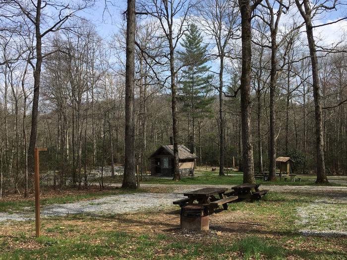
Facilities
This campground is remote with pit toilets. No water or electricity is available.
Natural Features
This campground is located near the confluence of many creeks, as well as the South Fork of the Mills River. Additionally, the area is home to a wide variety of bird species and animal species ranging from chipmunks to black bears. Finally, the campground affords plenty of shade with large trees including maples, oaks, poplars, birches, and pines, that create a patchwork quilt of beauty in the fall season.
Nearby Attractions
Wolf Ford Horse Campround is within a short distance of the Cradle of Forestry, Pisgah Inn & Restaurant on the Blue Ridge Parkway, North Carolina Wildlife Education Center and Fish Hatchery, Dupont State Forest, and the town of Brevard just down the mountain from this strategic location. Within Brevard one can enjoy blocks of shops and restaurants on Main Street, or seek out guides for fishing, riding, hiking, or floating expeditions in and around Pisgah National Forest.
Charges & Cancellations
If Yellow Gap Road (FSR 1206) is administratively closed, all reservations will be refunded.