BEAR LAKE CAMPGROUND (CO), CO Campground Reservation, Info, Images, Map, Directions

BEAR LAKE CAMPGROUND (CO), Colorado Campground Images, Info & Reservations

Listen

Directions

From Colorado Highway 12 south of the Town of Cuchara, take FSR 422 5 miles west to the campground.

Phone

FOR RESERVATIONS CALL (877) 444-6777 FOR OTHER, NON REAL TIME INFORMATION, CALL 719-269-8500

Activities

BIKING, CAMPING, FISHING

Keywords

Related Link(s)

Rec Area Info & Images

Colorado State Tourism

Colorado State Road Conditions

Overview

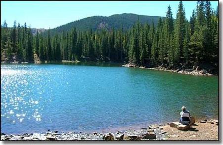
Bear Lake Campground is located in the beautiful San Isabel National Forest at an elevation of 10,480 ft. Views of the nearby Culebra Range Mountains with aspen and spruce forests offer campers a genuine Colorado experience.

Recreation

Indian Trail #1300 begins at the north end of the campground providing direct access to a 23 mile multi-user trail system available for all-terrain vehicle, motorcycle, bicycle, foot and horse. A quieter well marked trail system between Bear Lake and Blue Lake is open to foot and horse traffic.

Facilities

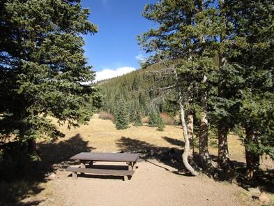
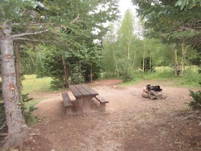
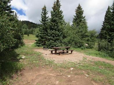
This rustic campground has 14 campsites, each with a table and fire ring. Some are shaded; others provide full sunlight. An on-site camp host offers firewood bundles for sale. Vault toilets and drinking water are available. No electric or septic hook-ups are available.

Natural Features

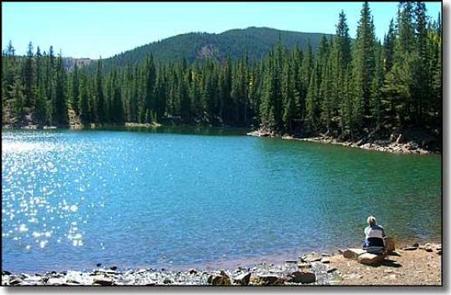
A tributary of the Cuchara River runs through the campground. Bear Lake is 1/8 mile from the campground, and Blue Lake is one mile away. Both of these small lakes are stocked several times during the summer providing for good fishing.

Nearby Attractions

The nearby mountain town of Cuchara offers shopping and visitor information. The town of La Veta offers a grocery store, gas stations, and shops. The Spanish Peaks Wilderness, 15 miles from the campground, is a popular hiking destination.

Reservation

More from CampingHiking.net:

Gold Bar Group Sites, Utah Campground Images, Info & Reservations

Listen Directions From Moab, drive five miles north on Hwy 191 to the intersection with Hwy 279. Turn left/west on Hwy 279 and drive ten miles to the campground entrance road. Phone 435-259-2100 Activities BIKING, BOATING, CLIMBING, CAMPING, HIKING, OFF HIGHWAY VEHICLE, RECREATIONAL VEHICLES, PHOTOGRAPHY, PADDLING, MOUNTAIN BIKING, OFF ROAD

Clear Creek Campground, Washington Campground Images, Info & Reservations

Listen Directions From Seattle, take I-5 north to the Arlington exit. Turn east on Highway 30 to the town of Darrington, then turn south on Mt. Loop Highway and continue 3 miles to Clear Creek Campground. Phone 360-804-1103 Activities BIKING, BOATING, CAMPING, FISHING, HIKING, HUNTING, WATER SPORTS, SWIMMING SITE Keywords

BERLIN FLATS, Idaho Campground Images, Info & Reservations

Listen Directions From Coeur d’Alene, the route is 28 miles east on Interstate 90, then 26 miles north (Kingston exit) on paved Forest Road #9, then 5 miles north from Prichard on paved Forest Road #208, then 9 miles north on Forest Road #412 (paved except 2 miles). Phone 435-245-6521

KIASUTHA, Pennsylvania Campground Images, Info & Reservations

Listen Directions From Kane, Pennsylvania, take State Highway 321 north for 10 miles, then turn onto Longhouse Scenic Drive and continue for a mile to the campground. From Warren, Pennsylvania, take State Highway 59 east for 13 miles, then turn south on Longhouse Scenic Drive and continue for 10 miles.

WILLOW BAY, Pennsylvania Campground Images, Info & Reservations

Listen Directions From Bradford, travel west on PA-346 for 16 miles. Willow Bay is located just south of the Pennsylvania-New York border. Follow signs to the Allegheny Reservoir and the campground. From the south, take PA-321 North to PA-346 and turn left. Continue to the campground on the left. Phone