BIG CREEK LAKES CAMPGROUND, CO Campground Reservation, Info, Images, Map, Directions

BIG CREEK LAKES CAMPGROUND, Colorado Campground Images, Info & Reservations

Directions

From Walden, follow Route 125 north for 9 miles into Cowdrey. Turn left (west) onto CR 6W and travel 18 miles to Pearl. Turn onto Forest Road 600 and drive for 6 miles, following signs to campground.

Phone

970-723-2700

Activities

BOATING, CAMPING, FISHING, HIKING, WILDLIFE VIEWING

Keywords

BIGL,MEDICINE BOW-ROUTT NF-FS

Related Link(s)

Rec Area Info & Images

Colorado State Road Conditions

Colorado State Tourism

Overview

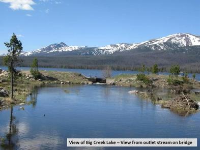
The popular Big Creek Lakes Campground offers a peaceful, scenic setting in the heart of the Rocky Mountains of northern Colorado. The campground is located in Routt National Forest at an elevation of 9,000-ft., and is adjacent to Big Creek Lake, where fishing, boating and hiking are available.

Recreation

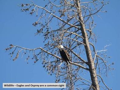
This campground offers boating and fishing on Colorado’s second largest natural lake, hiking in the Mount Zirkel Wilderness and ATV trails nearby. There are also ample opportunities for viewing wildlife, including moose.

Fishing for trout, muskie, grayling and Kokanee salmon is available in the lake. Anglers also have access to a creek. Non-motorized boats are allowed on the upper section of the lake and motorized boats are permitted on the lower section.

Facilities

This facility has a campground and day use area. There are 24 reservable campsites and 30 first-come, first-served campsites, all of which are near Big Creek Lake.

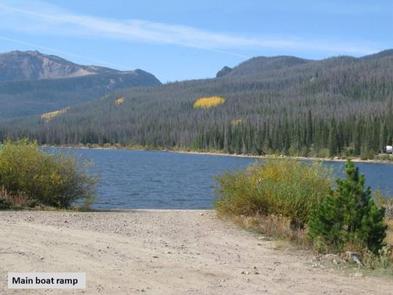
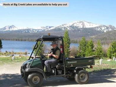
Two boat ramps are provided for the convenience of boaters and anglers. A campground host is on-site for visitor assistance.

Natural Features

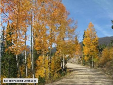
Big Creek lies among Lodgepole pine and fir trees. Some previously forested areas of the campground have been thinned due to pests and now provide more sun. The campground offers beautiful views of the surrounding wilderness.

The wetlands around the lake are prime moose territory. Black bear, bobcat, coyote, elk, mule deer and moose are just some of the many animals that inhabit these rich and diverse lands.

The Medicine Bow-Routt National Forests and Thunder Basin National Grassland, encompass nearly 3 million acres from central and northeastern Wyoming to north-central Colorado.

Nearby Attractions

The closest town is Walden, Colorado, about 35 miles from the campsite. Many more outdoor recreation opportunities exist in the surrounding national forests and grasslands, including hiking, biking, camping, horseback riding, OHV riding, fishing, hunting, sightseeing and winter sports.

Reservation

More from CampingHiking.net:

HIGH VIEW, Texas Campground Images, Info & Reservations

Directions From Ennis, Texas: From Interstate 45, exit onto U.S. Highway 287 Bypass (Exit #247). Travel 4.5 miles and exit at the Bardwell Lake exit sign. Turn left onto Highway 34 and go 2.5 miles southwest. After crossing the Bardwell Lake bridge, take the first left onto High View Park

OVERLOOK PARK, Kansas Campground Images, Info & Reservations

Directions From Lawrence, Kansas, take Clinton Parkway/23rd Street west to the end of the road. Make a right turn followed by the first left turn. Continue approximately one-fourth mile to park. Phone 785-843-7665 Activities BIKING, CAMPING, HIKING Keywords OVLP,CLINTON LAKE,OVERLOOK,OVERLOOK PARK CLINTON LAKE,CLINTON LAKE Related Link(s) Rec Area Info &

EASTSIDE, Idaho Campground Images, Info & Reservations

Directions From Horseshoe Bend, Idaho, take Highway 52 for 9 miles west to the junction with the Sweet/Ola Highway. Turn north and travel 16 miles to Ola, Idaho. Travel north through Ola and follow 10 miles northeast on FS Rd 618, then make a right on FS Rd 626 and

NEWHALEM CAMPGROUND, Washington Campground Images, Info & Reservations

Directions Newhalem Campground is located at mile marker 120 on State Route 20. From Burlington, WA, drive 60 miles east on State Route 20. From Twisp, WA, drive 82 miles west on State Route 20. Phone (360) 854-7200 Activities BIKING, HISTORIC & CULTURAL SITE, CAMPING, INTERPRETIVE PROGRAMS, HIKING Keywords NEWH,North

CRICKET CREEK, Arkansas Campground Images, Info & Reservations

Directions From Branson, Missouri, take US-65 south for nearly 12 miles. Turn right onto HWY 14 South for 1/4 mile which will turn Left, Stay on 14  South it will take you to the campground. Phone 870-426-3331 Activities BIKING, BOATING, CAMPING, FISHING, HIKING, PICNICKING, WATER SPORTS, WILDLIFE VIEWING, DAY USE

DANA PEAK, Texas Campground Images, Info & Reservations

Directions From Interstate 35 in Belton, Texas take Highway 190 west to the Simmons Road exit. Cross under the highway and turn west on Farm-to-Market Road 2410. Turn left (south) on Commanche Gap Road and drive for five miles to reach the park. Phone 254-698-4282 Activities BIKING, CAMPING, FISHING, HORSEBACK