


Directions
From Boise, take State Highway 21 north for 36 miles. Campground access road is located on the east side of the road, between mileposts 36 and 37. Turn right and travel a quarter-mile to the campground.
Phone
208-392-6681
Activities
CAMPING, FISHING, HIKING, HUNTING, VISITOR CENTER, WILDLIFE VIEWING
Keywords
GRA1,GRAYBACK GULCH,BOISE NF – FS
Related Link(s)
Overview
Grayback Campground is located 36 miles northeast of Boise, Idaho, just off scenic Highway 21. Historic Idaho City is just two miles north of the campground. Visitors enjoy fishing in Mores Creek and exploring the Grayback Gulch Trail.
Recreation
Mores Creek can be accessed just below the campground. Anglers fish for whitefish and rainbow trout. Grayback Loop Trail begins within the site, offering a 1-mile footpath for hikers.
Numerous trail opportunities are in the area just north of Idaho City, where hiking, biking, horseback riding and off-road vehicles can be enjoyed. During the winter, the area becomes a playground for back country skiers and snowmobiles.
Facilities
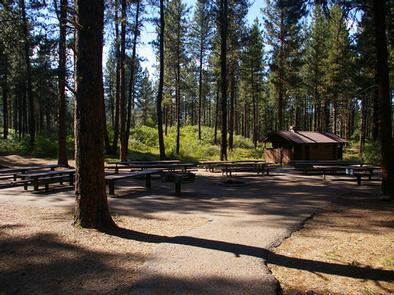
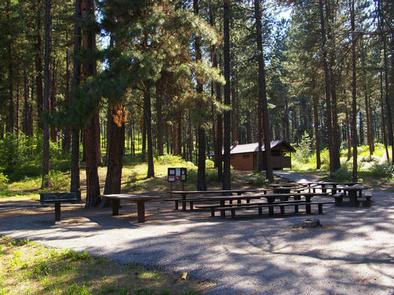
The campground contains two group sites with picnic and serving tables, grills, campfire circles and paved site pads. Site A can accommodate up to 150 people and 20 vehicles, and site B can accommodate up to 100 people and 15 vehicles. Both sites can be reserved at the same time, for even larger groups.
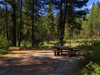
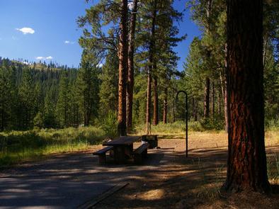
Several single- and double-family campsites are available as well, each equipped with a picnic table, lantern post and campfire ring with grill. Vault toilets, drinking water and trash collection are provided throughout the campground. A campground host is located directly across the road.
Natural Features
The campground is situated on a hillside about a quarter-mile above Highway 21, at an elevation of 4,200 feet. A ponderosa pine forest covers the site, offering partial shade. Wildlife and summer wildflowers are abundant in the area.
Nearby Attractions
Highway 21, also known as the Ponderosa Pine Scenic Byway, snakes along Mores Creek to Mores Creek Summit, Gold Fork and Banner Ridge, offering historic sites, hot springs pools and breathtaking views of the surrounding mountains and forest along the way to the campground.