
Directions
From Seattle, Washington, go north on I-5 to Everett. Take exit 194 onto Highway 2, then turn north at Highway 204 toward Lake Stevens. Turn north on Highway 9 then east on Highway 92 to Granite Falls. The campground is located 13.5 miles east of Granite Falls.
Phone
360-804-1103
Activities
CAMPING, FISHING, DAY USE AREA
Keywords
GOLD,MT. BAKER-SNOQU NF – FS
Related Link(s)
Washington State Road Conditions
Overview
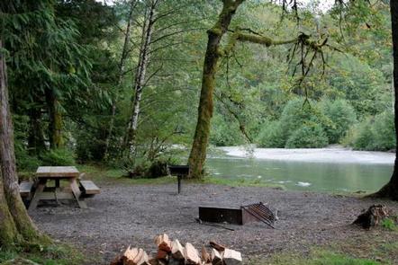
Gold Basin Group Campground sits near the banks of the tranquil South Fork of the Stillaguamish River, close to several wilderness areas and hiking trails, offering visitors opportunities to experience both the serene and wild aspects of the Cascade region.
Gold Basin is the largest campground on the Mountain Loop Highway and offers the most developed and accessible camping experience.
Recreation
In addition to being a prime location for hiking, biking, fishing, picnicking and horseback riding in summer and early fall, Gold Basin offers excellent skiing and snowshoeing in the winter months.
A large, open field offers opportunities for sports and group activities.
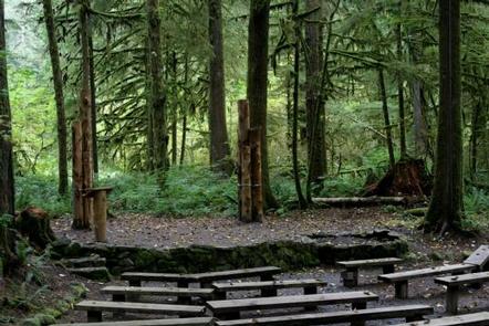
For visitors wanting to learn more about the natural and cultural history of the area, the Gold Basin Mill Pond interpretive trail is located across the street from the campground. This interpretive site includes a short, barrier-free trail that passes by mill relics and ends on a floating viewpoint. Interpretive signs discuss the history of the mill and the wildlife in the area.
Facilities
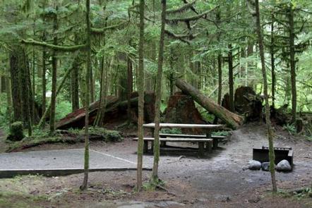
This is a large campground with 99 reservable sites, including one large group site that can accommodate up to 75 guests.
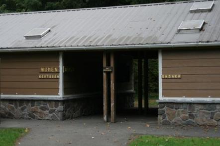
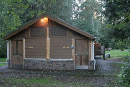
Picnic areas, trails and open spaces, along with the conveniences of firewood, drinking water, showers and flush toilets, give visitors the opportunity to enjoy the outdoors while still having many of the conveniences of home.
Natural Features
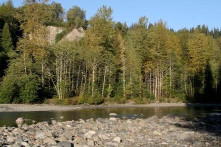
Old-growth forests of cedar, fir and hemlock line the wide, gently-flowing Stillaguamish River and tower over trails winding through moss-covered rocks.
On a clear day visitors can spot Mt. Baker, the most prominent feature of the Mt. Baker Wilderness Area. Rising to an elevation of 10,781 feet, this active volcano is perpetually snow-capped and mantled with an extensive network of creeping glaciers. Mt. Baker’s summit, Grant Peak, is actually a 1,300-foot-deep mound of ice, which hides a massive volcanic crater.
The surrounding undeveloped wilderness, clean streams and diverse forests support an abundance of wildlife. A multitude of mammals, birds, amphibians and reptiles make their homes here, and the area sustains more rare species like lynx, moose, wolves and wolverine.
Nearby Attractions
Visitors enjoy the North Cascades and Mt. Rainer National Parks, where interpretive programs and exhibits offer education about the diverse landscape and history of the area.
The spectacular Pacific Crest Trail (PCT), one of the world’s premier National Scenic Trails, showcases some of North America’s most fantastic scenery, winding its way its way from Mexico to Canada through California, Oregon and Washington, and is accessible near the campground.