
Directions
Take I-70 west of Denver, Colorado, to Glenwood Spring exit 116, Highway 82, south to Carbondale. Take Highway 133 south for 20 miles. Turn left on Gunnison County Road 3 toward Marble. Campground located another 1.5 miles near the river.
Phone
970-927-0107
Activities
BIKING, HISTORIC & CULTURAL SITE, CAMPING, FISHING, HIKING, HORSEBACK RIDING, WILDLIFE VIEWING
Keywords
BOGA,CRYSTAL RIVER,MARBLE,MCCLURE PASS,BOGAN FLATS CAMPGROUND GRP S,WHITE RIVER NF -FS
Related Link(s)
Colorado State Road Conditions
Overview
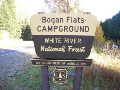
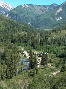
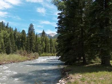
Bogan Flats Campground stretches along the Crystal River in a valley of aspen groves, towering Ponderosa Pine, spruce, and willow. The setting is ideal for larger groups seeking recreation and relaxation in White River National Forest.
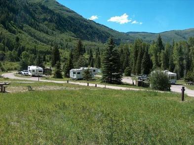
Sites in the campground are widely spaced and offer a nice mixture of open and shaded spots, with several sites at the river’s edge. The group site is located away from the main campground, offering a more private location.
Recreation
Crystal River, a tributary of Roaring Fork River, is renowned for its fly fishing. Rainbow, cutthroat and brown trout are plentiful in this waterway.
A hike up Mt. Sopris offers spectacular panoramic views. This 12,953-foot mountain dominates the surrounding landscape. The hike is 14.8 miles with a 4,600-foot. elevation gain. In summer, wildflowers carpet the trail through aspen groves and mixed conifer forest, climbing up to talus slopes.
Other popular activities in the area include jeep tours, biking, and historic sightseeing.
Facilities
Bogan Flats Campground is able to accommodate tents, trailers and RVs, and has a designated group site.
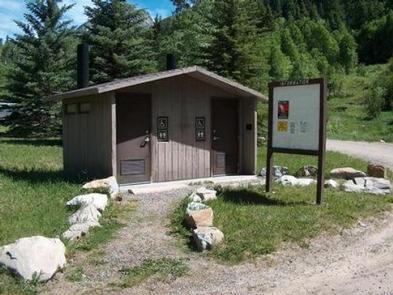
The campground is equipped with picnic tables, campfire rings, vault toilets, and drinking water. Electrical hook-ups are not available.
Firewood is available on-site for a fee.
Natural Features
In the heart of the Rocky Mountains, the 2.3 million acre White River National Forest is a place of serenity and adventure, boasting 8 wilderness areas, 4 defined seasons, and 10 peaks surpassing 14,000 feet in elevation.
The Crystal River flows near the campground and drains the Valley of the Coal Miners, a glacial valley that was once a center of coal mining in southwestern Colorado.
Wildlife in the area abounds. Bighorn sheep navigate rocky ridges and bull elk bugle at dusk. Scenic rivers sustain populations of cutthroat, rainbow, and brown trout. Alpine regions provide habitat for pika and ptarmigan. These species, along with many others, depend on surrounding undeveloped wilderness, clean streams, and diverse forests to live.
Nearby Attractions
The quaint mountain town of Redstone is a hidden gem, located south of Carbondale. In addition to shops, galleries, and restaurants, the town boasts a castle that was built by industrialist John Osgood at the turn of the 20th century.