KYLE CANYON PICNIC AREA DAY USE, NV Campground Reservation, Info, Images, Map, Directions

KYLE CANYON PICNIC AREA DAY USE, Nevada Campground Images, Info & Reservations

Directions

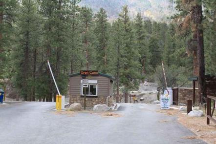
From Las Vegas, Nevada, travel north on Highway 95 to the junction of Highway 157/Kyle Canyon. Turn left and travel approximately 18 miles. The picnic area is on the left side of the highway.

Phone

702-872-5486

Activities

CAMPING, HIKING, WILDLIFE VIEWING

Keywords

KYLE CANYON PICNIC AREA,KYLE CANYON CAMPGROUND,KYLE,MOUNT CHARLESTON,LAS VEGAS,SPRING MNTS NAT REC AREA,HUMBOLDT-TOIYABE NF-FS

Related Link(s)

Rec Area Info & Images

Nevada State Tourism

Nevada State Road Conditions

Overview

Kyle Canyon Picnic Area is set in the beautiful Spring Mountains National Recreation Area, just 23 miles from Las Vegas. Visitors enjoy hiking, horseback riding and scenic driving in this forested desert oasis.

Recreation

The 1.6-mile Fletcher Canyon Trail begins nearby.

Facilities

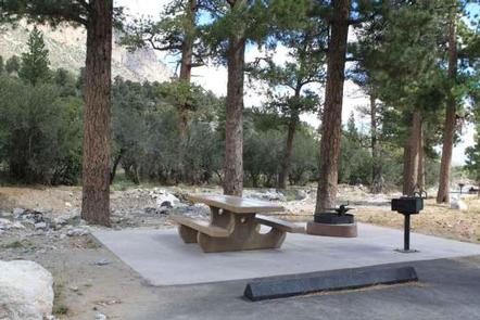
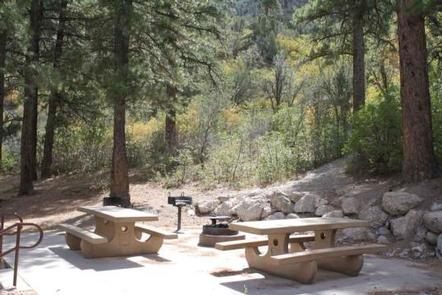
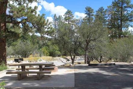
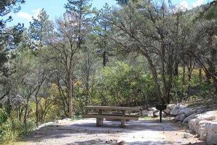
This year-round picnic area contains several single and double sites, four of which are accessible. Sites are equipped with a picnic table, campfire ring and grill. Flush toilets and drinking water are provided. Roads and parking spurs are paved.

Natural Features

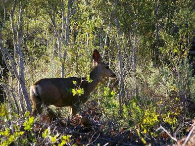
The Spring Mountains National Recreation Area is a beautiful island in the desert, brimming with breathtaking scenery and diverse flora and fauna. The Bristlecone pine, the world’s oldest organism, and the rare Mount Charleston blue butterfly are both found within the Spring Mountains.

More than 100 springs create the namesake for the mountain range, making it an ideal place to escape the heat of the city.

The picnic area is set in an open forest of ponderosa pine, mountain mahogany and Gambel oak, which provides partial shade. Manzanita and wild roses dot the landscape. A seasonal stream and the highway parallels the area. Most sites have views of the surrounding towering canyon walls.

Nearby Attractions

More than 60 miles of hiking and horseback riding trails crisscross the area; two trails allow mountain biking. Rock climbing, picnicking and scenic driving are popular activities.

Reservation

More from CampingHiking.net:

LAVA LAKE CAMPGROUND, Oregon Campground Images, Info & Reservations

Directions From Bend, travel 38.4 miles southwest on Cascade Lakes Hwy (46), then 1.0 miles east on Forest Road 4600 500. Phone 541-323-1746 Activities CAMPING Keywords Related Link(s) Rec Area Info & Images Oregon State Tourism Oregon State Road Conditions Overview Lava Lake Campground is located along the Cascade Lakes

GOLDLEDGE CAMPGROUND, California Campground Images, Info & Reservations

Directions From Bakersfield, take Highway 178 east to Lake Isabella. From Lake Isabella, take Highway 155 around the west side of the lake to the town of Kernville. From Kernville, go 10 miles north on Sierra Way (Mountain 99) to the campground. Phone 760-376-1815 Activities BOATING, CAMPING Keywords GOED,KERN RIVER,UPPER

Miller River Group Camp, Washington Campground Images, Info & Reservations

Directions From I-5 north, take exit 194 to Highway 2. Continue for about 48 miles, then turn south at the Money Creek Campground sign. Continue about 3 miles to the campground. Phone 360-804-1103 Activities BIKING, CAMPING, FISHING, HIKING, WILDLIFE VIEWING Keywords MILR,MT. BAKER-SNOQU NF – FS Related Link(s) Rec Area

ROSE CANYON, Arizona Campground Images, Info & Reservations

Directions From Tucson, Arizona, take Catalina Highway/Arizona Route 39 northeast. The campground is located between mile markers 17 and 18 on the Catalina Highway. Phone 520-576-1477 Activities CAMPING, FISHING, DAY USE AREA Keywords ROSE,ROSE CANYON REC AREA,ROSE CANYON LAKE,ROSE PARK,ROSE CANYON PARK,CORONADO NF – FS Related Link(s) Rec Area Info

THOMAS CANYON, Nevada Campground Images, Info & Reservations

Directions Take I-80 to any Elko exit and head south to Idaho Street. Turn south on 12th Street (from the east) or on 5th Street (from the west), to State Route 227. Travel 25 miles on SR 227 to Forest Road 660 (Lamoille Canyon Scenic Byway). Travel 8 miles on

SOUTH KAWISHIWI RIVER, Minnesota Campground Images, Info & Reservations

Directions From Ely, Minnesota, travel about 10.3 miles south on State Highway 1 toward Lake Superior. Turn left onto the campground road. Phone KAWISHIWI RANGER DISTRICT: 218-365-7600, CONCESSIONAIRE (SUMMER): 218-365-2963 Activities BIKING, BOATING, CAMPING, FISHING, HIKING, HUNTING, WILDLIFE VIEWING, SWIMMING SITE Keywords SOKR,SUPERIOR NATIONAL FOREST,KAWISHIWI FOREST SERVICE CAMP,KAWISHIWI RIVER,KAWISHIWI,KAWISHIWI BEACH,SUPERIOR