KELLY DAHL, CO Campground Reservation, Info, Images, Map, Directions

KELLY DAHL, Colorado Campground Images, Info & Reservations

Directions

From Denver, go north on Interstate 25 to US Highway 36 west to Boulder. Take Colorado Highway 119 (Canyon Boulevard) west for 22 miles to Nederland. Continue south for 4 miles to the campground.

Phone

303-541-2500

Activities

CAMPING, HIKING, HORSEBACK RIDING

Keywords

KELD,KELLY DAHL,ARAPAHO AND ROOSEVELT NF – FS

Related Link(s)

Rec Area Info & Images

Forest Service Concessionaire

Colorado State Tourism

Colorado State Road Conditions

Overview

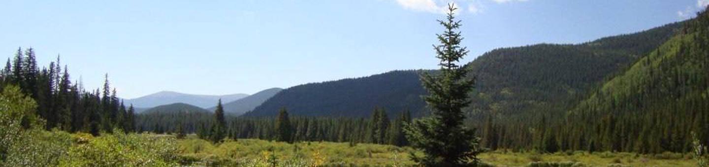
Kelly Dahl Campground is located adjacent to the Peak-to-Peak Scenic Byway, near the historic mining towns of Nederland, Rollinsville, Central City and Black Hawk.

Recreation

Although no formal trails exist in the campground, a few closed roads offer campers the opportunity to explore the surrounding area. West Magnolia and East Portal Trailheads offer trails within a short drive. The Rollins Pass Road (Moffat Road) and other off-road routes can be found in the vicinity.

The lakes across the highway are on private property and access is prohibited.

Facilities

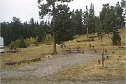
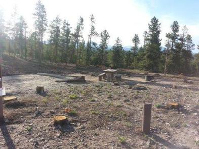
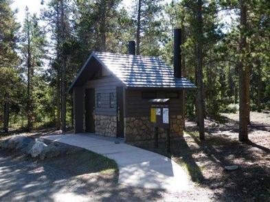
The campground offers 46 single-family sites that will accommodate tents, trailers or RVs. Campsites #1 through #20 are first-come, first-served. Each site is equipped with a picnic table and campfire ring with grill. There is a maximum of eight people per site. Vault toilets, drinking water, and trash collection are provided throughout the campground. Firewood is for sale in campground. The road through the campground is gravel/dirt.

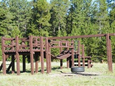
A playground suitable for small children is located within the campground.

Natural Features

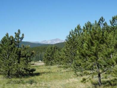
The campground is situated among ponderosa pines, on a gentle slope, at an approximate elevation of 8,600 feet.
Due to the mountain pine beetle infestation and consequent hazardous tree removal, the campground offers little to no shade.

Nearby Attractions

The town of Nederland, which is four miles north of the campground, offers grocery and hardware stores, restaurants, gas, a post office, bank and Barker Reservoir.

Reservation

More from CampingHiking.net:

SARAH TOTTEN CAMPGROUND, California Campground Images, Info & Reservations

Directions From I-5, take exit 786 to Highway 96 (Klamath River Highway). Follow Highway 96 west for about 35 miles. The campground entrance is on the right, about 1 mile east of Hamburg, CA. Phone 530-493-2243 Activities CAMPING, FISHING, SWIMMING, WHITEWATER RAFTING Keywords SATO,KLAMATH NF – FS Related Link(s) Rec

WILLOW FLAT CAMPGROUND, Utah Campground Images, Info & Reservations

Directions From Preston, Idaho, head south on U.S. Highway 91 for approximately 3 miles. Turn east on the Cub River Road (Forest Road 406) and travel 3 miles past the Cache National Forest boundary to the intersection of Forest Road 406 and Forest Road 407. Bear right at the intersection,

PINE POINT, Oregon Campground Images, Info & Reservations

Directions From Sandy, Oregon, travel east on Highway 26 for approximately 40 miles to Skyline Road/Road 42. Turn right on Skyline Road and continue south for about 9 miles. Turn right on Forest Service Road 57 and travel west for 3 miles, then turn right again at the Pine Point

HUMPBACK LAKE CABIN, Alaska Campground Images, Info & Reservations

Directions The cabin is approximately 48 air miles southeast of Ketchikan, east of Mink Bay on the mainland and is accessible by floatplane. This cabin is in a designated Wilderness area, and access by helicopter is illegal. Refer to USGS Ketchikan A-2. In fall, winter and early spring, the cabin

LAKESIDE (TRUCKEE), California Campground Images, Info & Reservations

Directions From Interstate 80 in Truckee take exit 188, Highway 89 north toward Sierraville. In approximately 3.5 miles turn right at the sign for Prosser Recreation Sites. In one mile the campground will be on the left.. Phone (530)587-3558. FOR RESERVATIONS, PLEASE CALL: 1 (877) 444-6777. Activities BOATING, CAMPING, FISHING,

WILSON POINT (Day Use), Oklahoma Campground Images, Info & Reservations

Directions From Sawyer, OK, take Highway 147 north for a mile, then turn left into the day use area. Phone 580-326-0173 Activities BOATING, CAMPING, FISHING, HIKING, HUNTING, WILDLIFE VIEWING, SWIMMING SITE Keywords None Related Link(s) Rec Area Info & Images Oklahoma State Tourism Oklahoma State Road Conditions Overview Wilson Point