


Directions
From Leadville, Colorado, drive west on County Road 4 and follow signs to the Turquoise Lake Recreation Area. Turn right on County Road 9C and follow to the campground entrance on the right.
Phone
719-486-0749 (FOR INFORMATION ONLY, NO RESERVATIONS)
Activities
BOATING, HISTORIC & CULTURAL SITE, CAMPING, FISHING, HIKING, WATER SPORTS, SWIMMING SITE
Keywords
STOM,PIKE AND SAN ISABEL NF- FS
Related Link(s)
Colorado State Road Conditions
Overview
Silver Dollar Campground is situated near the eastern shore of Turquoise Lake in the shade of a lodgepole pine and subalpine fir forest. The family-friendly campground is a popular summer destination for boating, hiking and fishing.
Recreation
Hikers enjoy the 1.2-mile Turquoise Lake Nature Trail. The gentle path meanders through the forest and down to the shoreline of Turquoise Lake, and connects with the 6.4-mile Turquoise Lake Trail that parallels the shoreline from the Sugar Loaf Dam to May Queen Campground. Hikers can pick up a trail guide at the trailhead located near the entrance to Molly Brown Campground to learn about the flora and fauna along the path. On the lake, boating, sailing, canoeing and fishing are favorite activities. Anglers fish for stocked cutthroat, rainbow, brown and lake trout. Matchless Boat Ramp is located nearby.
Facilities
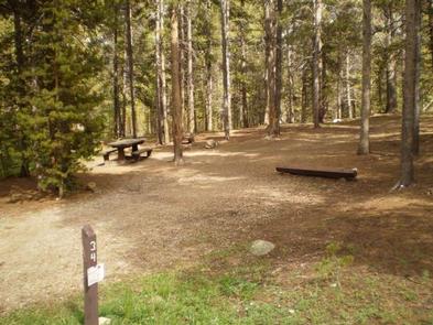
The campground offers single-family sites, each equipped with a picnic table and campfire ring. Some sites also have grills and tent pads. Vault toilets, drinking water, trash collection and recycling services are provided. Firewood is available for purchase from the host. Parking spurs are gravel or dirt.
Natural Features
Campsites are nestled in the forest within walking distance of the scenic lakeshore at 10,000 feet in elevation. The Mount Massive Wilderness Area is nearby. The 30,540-acre expanse encompasses Mount Massive, Colorado’s second highest peak at 14,421 feet. Much of the wilderness is above timberline with many alpine plant communities and permanent snowfields.
Nearby Attractions
Venture to Independence Pass for a scenic drive with breathtaking views of the Rockies and surrounding alpine tundra habitat. At 12,095 feet, it is one of the highest paved mountain passes in the country and marks where the Top of the Rockies National Scenic and Historic Byway crosses the Continental Divide.