THIRTY MILE, CO Campground Reservation, Info, Images, Map, Directions

THIRTY MILE, Colorado Campground Images, Info & Reservations

Directions

From Alamosa, go west on US 160 to South Fork. Turn northwest on State Highway 149 through Creede. Continue on Highway 149 to mile marker 41, turn west (gravel road) on Rio Grande Reservoir Road and continue for 12 miles to Thirty Mile Campground.

Phone

719-658-0829

Activities

CAMPING, FISHING

Keywords

THMI,RIO GRANDE NF- FS

Related Link(s)

Rec Area Info & Images

Colorado State Tourism

Colorado State Road Conditions

Overview

Thirty Mile Campground is nestled on the banks of the Rio Grande River, just a short mile from the Rio Grande Reservoir. The location is perfect for anyone who loves to spend time fishing, canoeing and swimming. In addition, there are two trailheads and regular interpretive programs located at the campground.

Across from the Thirty Mile is the Weminuche Wilderness, the largest wilderness area in Colorado. It’s a famously rugged region with three mountain peaks reaching over 14,000 feet.

Recreation

Anglers and hikers are common campers at Thirty Mile, and the San Juan Mountains provide great fun for backpackers and horse packers.

Two trailheads, Squaw Creek and Weminuche Pass, lead eager hikers into the Weminuche Wilderness and link up to the Continental Divide National Scenic Trail.

Facilities

No electric site hookups are available. Firewood is sold onsite. There is ample parking for day visitors but stock unloading and horse trailers are not permitted. Sites are designed for both tent and trailer camping. Drinking water is available.

Natural Features

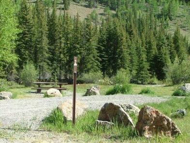
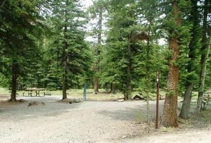
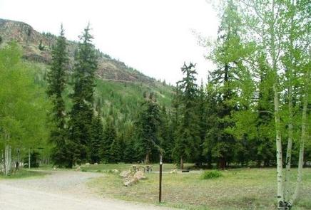
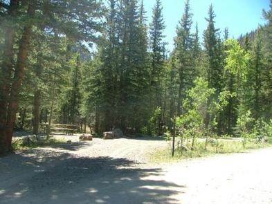
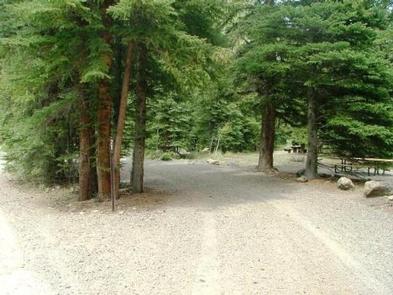
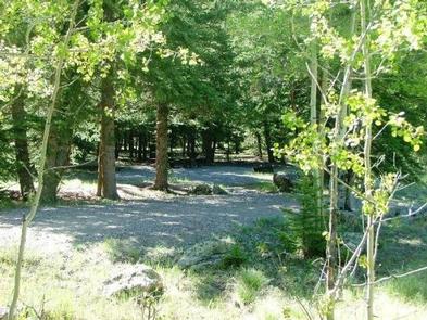
The campground is located in a meadow among mature spruce and aspen trees, just between the Rio Grande River and Squaw Creek. All sites are nicely shaded and some overlook the creek.

The Rio Grande National Forest spans 1.86 million acres in south-central Colorado. The Continental Divide runs for 236 miles along most of the forest’s western border, presenting a myriad of ecosystems from alpine desert to dense wilderness.

Reservation

More from CampingHiking.net:

MEEKS BAY, California Campground Images, Info & Reservations

Directions Meeks Bay Campground is located 10 miles south of Tahoe City, on California Highway 89. Phone 530-525-4733 Activities BIKING, BOATING, CAMPING, INTERPRETIVE PROGRAMS, VISITOR CENTER, SWIMMING SITE Keywords MEEK,WEST SHORE,LAKE TAHOE,RUBICON,WEST SHORE LAKE TAHOE,LAKE TAHOE BASIN – FS Related Link(s) Rec Area Info & Images California State Road Conditions

COUNCIL LAKE DISPERSED CAMPSITE, Michigan Campground Images, Info & Reservations

Directions From Munising, Michigan, take Highway 28 east towards Shingleton. Turn south on Highway 13 at Wetmore. After 10 miles turn right onto Forest Service Road 2261. Continue until the road ends at Council Lake. Phone 906-387-2512 Activities BIKING, CAMPING, SWIMMING SITE Keywords CLDC,COUNCIL LAKE DISPERSED CAMPSITE (MI),Council Lake,Council Lake

COCHITI AREA, New Mexico Campground Images, Info & Reservations

Directions From Albuquerque, New Mexico, take Interstate 25 north to exit 259. Turn west on State Route 22 and proceed through Pena Blanca to the park office and recreation area. Phone 505-465-2557 Activities BIKING, CAMPING, FISHING, HIKING, WILDLIFE VIEWING, DAY USE AREA, SWIMMING SITE, PADDLING Keywords COCA,COCHITI LAKE Related Link(s)

Bumping Lake Campground, Washington Campground Images, Info & Reservations

Directions From Yakima, Washington, travel 25 miles on Highway 12 to the junction with Highway 410. Travel 29 miles on Highway 410 (Chinook Pass Highway) to milepost 88.4. Take Forest Road 18 (Bumping River Road) for 11.7 miles to campground. Phone 541-338-7869 Activities BIKING, BOATING, CAMPING, FISHING, HIKING, WATER SPORTS

VERMILLION, California Campground Images, Info & Reservations

Directions From Clovis, take Highway 168 east to Shaver Lake. Continue through Shaver Lake to Huntington Lake. At the east end of Huntington Lake, turn right on the Kaiser Pass Road (at Eastwood Visitor Center). Travel 17 miles to the Edison Lake Road. Turn left toward Edison Lake and travel

DORABELLE CAMPGROUND, California Campground Images, Info & Reservations

Directions From Clovis: Take Highway 168 north for 49 miles to the town of Shaver Lake. Turn right on Dorabelle Road and go .5 miles to the campground. Campground registration information is at the campground entry station. Phone 559-841-3533 Activities BOATING, CAMPING, FISHING, HIKING, WATER SPORTS, SWIMMING SITE Keywords DORA,DOOR