Directions
Directions: from Mountain Home, drive about 20 miles east on U.S. 20 to Anderson Ranch Dam Road. Additional access around the reservoir is from the Anderson Dam or Fall Creek on improved dirt roads.
Phone
208-587-7961
Activities
BOATING, CAMPING, FISHING, HUNTING, PICNICKING, WINTER SPORTS, RECREATIONAL VEHICLES, WATER SPORTS
Camping Reservations
Reserve your campsite at these camping areas:
Hiking Trails
Looking for nice hiking areas to take a hike? Choose from these scenic hiking trails:
Related Link(s)
Anderson Ranch Reservoir Boat Ramp
Frozen NiagaraOfficial Web Site
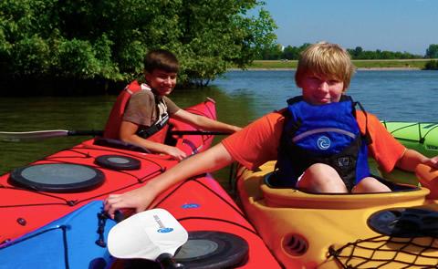
Anderson Ranch Reservoir is formed by Anderson Ranch Dam which is part of the Boise Project. Recreation on this 7.4 square mile (4,730-acre) reservoir is managed by the Boise National Forest, (Boise National Forest map). The reservoir is approximately 14 miles long, a mile wide, with depths to 315 feet, and 50 miles of shoreline. Hiking, boating, waterskiing, and fishing are the major recreation activities at Anderson Ranch Reservoir, located southeast of Boise.Camp Creek Trail is a moderately difficult 6 mile hiking/biking trail in the area. Elevation gain is 1,500 feet. Drive up Fall Creek Road about 3 miles then turn right on to FS Rd. 128 and go about a mile to reach the trailhead. Fish species are kokanee, rainbow trout, smallmouth bass, yellow perch, and bull trout. Season open year-round. Reservoir acre feet and total reservoir capacity and cubic feet/second release rates for rivers below Boise & Payette River Basins reservoirs and select river locations are updated daily and graphically provided. Site offers: vault toilets, boat ramp and dock, Forest Service campgrounds at Deer Creek (30-units), Curlew Creek (25-units), and Fall Creek (20-units), and swimming.

