Directions
Tully Lake is located in north central Massachusetts, about 1.5 hours west of Boston. In Massachusetts, take exit 17 on Route 2, and follow Route 32 north approximately 6 miles through Athol and into Royalston. From New Hampshire, follow Route 32 south about 8 miles from the intersection of Route 119 in Richmond. Route 32 goes over Tully Dam and provides direct access to the lake.
Phone
(978) 249-9150
Activities
BOATING, PICNICKING, WATER SPORTS, WILDLIFE VIEWING, PLAYGROUND PARK SPECIALIZED SPORT SITE
Camping Reservations
Reserve your campsite at these camping areas:
TULLY LAKE RECREATION AREA (MA)
Hiking Trails
Looking for nice hiking areas to take a hike? Choose from these scenic hiking trails:
Related Link(s)
More Massachusetts Recreation Areas
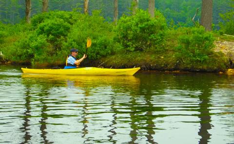
Tully Lake is a 1300-acre flood control project completed in 1949. The reservoir area is rich with natural beauty and outdoor recreation. A tents-only campground with 35 sites lies on the north side of the 200-acre lake. Adjacent to the dam, the Recreation Area offers picnic sites and a boat ramp with a 10-HP maximum. Twenty-three miles of hiking trails extend around the lake, Long Pond, and off-site to nearby waterfalls and scenic vistas. The lake is ideal for canoes and kayaks, which can explore the lake, the Tully River and Long Pond.

