Directions
25 miles south east of Fallon, Nevada on U.S. 50 on the north side of the highway.
Phone
775-885-6000
Activities
HISTORIC & CULTURAL SITE, CAMPING, HIKING, OFF HIGHWAY VEHICLE, PICNICKING, RECREATIONAL VEHICLES
Camping Reservations
Reserve your campsite at these camping areas:
Hiking Trails
Looking for nice hiking areas to take a hike? Choose from these scenic hiking trails:
Related Link(s)
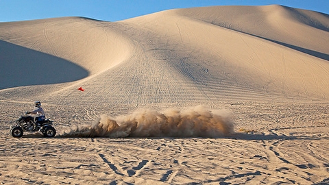
The 4,795 acre Sand Mountain Recreation Area is a designated OHV fee site located in the high desert of west central Nevada twenty-five miles south east of Fallon on U.S. 50 in Churchill County. Created by the migration and deposition of windblown sand as it is stopped by the rising Stillwater Mountains bordering to the north, east and west, the most dominant feature of the dune system is Sand Mountain which is approximately 3.5 miles long, 1 mile wide and 600 feet in height, making it the largest single dune in the Great Basin. The recreation area also includes the Sand Springs Pony Express Station historical site (1860) and the Sand Springs Desert Study Area.
In addition to OHV riding on the open dunes, there are 23 miles of riding available on the designated trail system that was established in 2008 to preserve the Kearny Buckwheat habitat and protect the Sand Mountain Blue Butterfly which is endemic only to the Sand Mountain area.
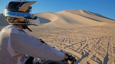
Visitation averages 50,000-70,000 visitors a year with the primary activity comprised of riding ATV’s, motorcycles, sand rails, dune buggies and side by sides. Sand sailing and sand boarding are also practiced by those adventurous enough to brave the OHVs and the climb to the top of the dune. Primitive camping is available at the base of the dunes and facilities are limited to six fault toilets. Water is not available on site.
Sand Mountain Recreation Area is a designated fee site. Fees are set at $40 for 1-7 days and $90 for an annual pass. When riding off open dunes, vehicle travel must remain on designated trail system. Supplementary rules apply to this site.

